
Greg Gagne
Forecaster
Our Week in Review highlights significant snowfall, weather, and avalanche events of the prior week. (Review the archived forecasts for the Salt Lake mountains.)
The danger roses for the Salt Lake mountains from Friday, December 2 through Thursday, December 8:

Summary: The best way to get caught up on early winter weather is by first reading Mark Staple's excellent blog Weather and Snow Summary Fall 2022.
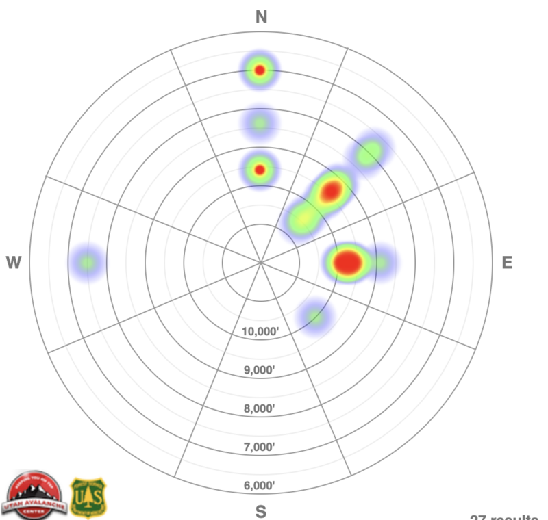
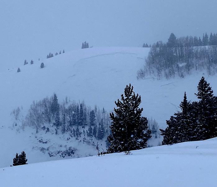
35 avalanches are reported to the UAC over this past week with avalanche activity focusing on aspects facing west through north and east where a buried persistent weak layer (PWL) of faceted snow that formed during the mid-November dry spell is preserved under recent snowfall. A heat map showing the distribution of reported avalanches this past week according to aspect and elevation for the Salt Lake mountains. .
Friday, December 2: The UAC issues its first avalanche warning of the 2022-23 season. With strong winds the prior 24 hours and new snowfall totals of 12", there were several natural and human-triggered avalanches reported a few highlights:
West Willow - Remotely-triggered 2' deep 70' wide 400' vertical
Clayton's - 2' deep 200' wide.
Tuscarora - Remotely-triggered 3' 100' wide (photo)
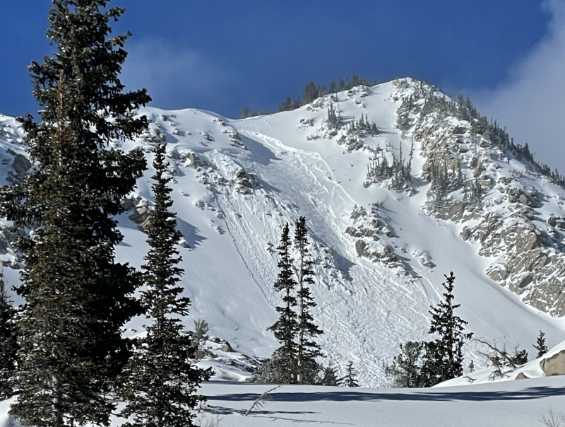
The common ingredient is that these slides failed 2-4' deep in the buried persistent weak layer that formed during the mid-November dry spell.
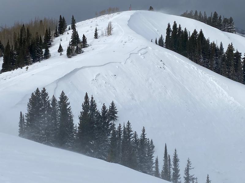
Saturday, December 3: More avalanches reported, including Soldier Fork and along the Park City ridgeline with a crown 2-6' deep that was 300' wide and ran 500' vertical. Photos below
Sunday, December 4: Snowfall begins in the afternoon and continued reports of collapsing and cracking as well as a natural avalanche on Sound of Music along the Park City ridgeline.
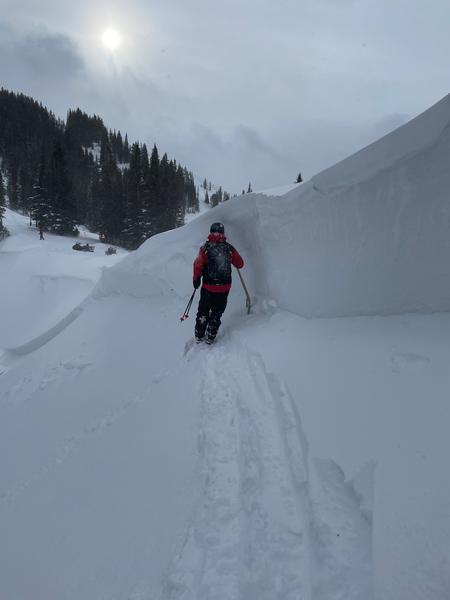
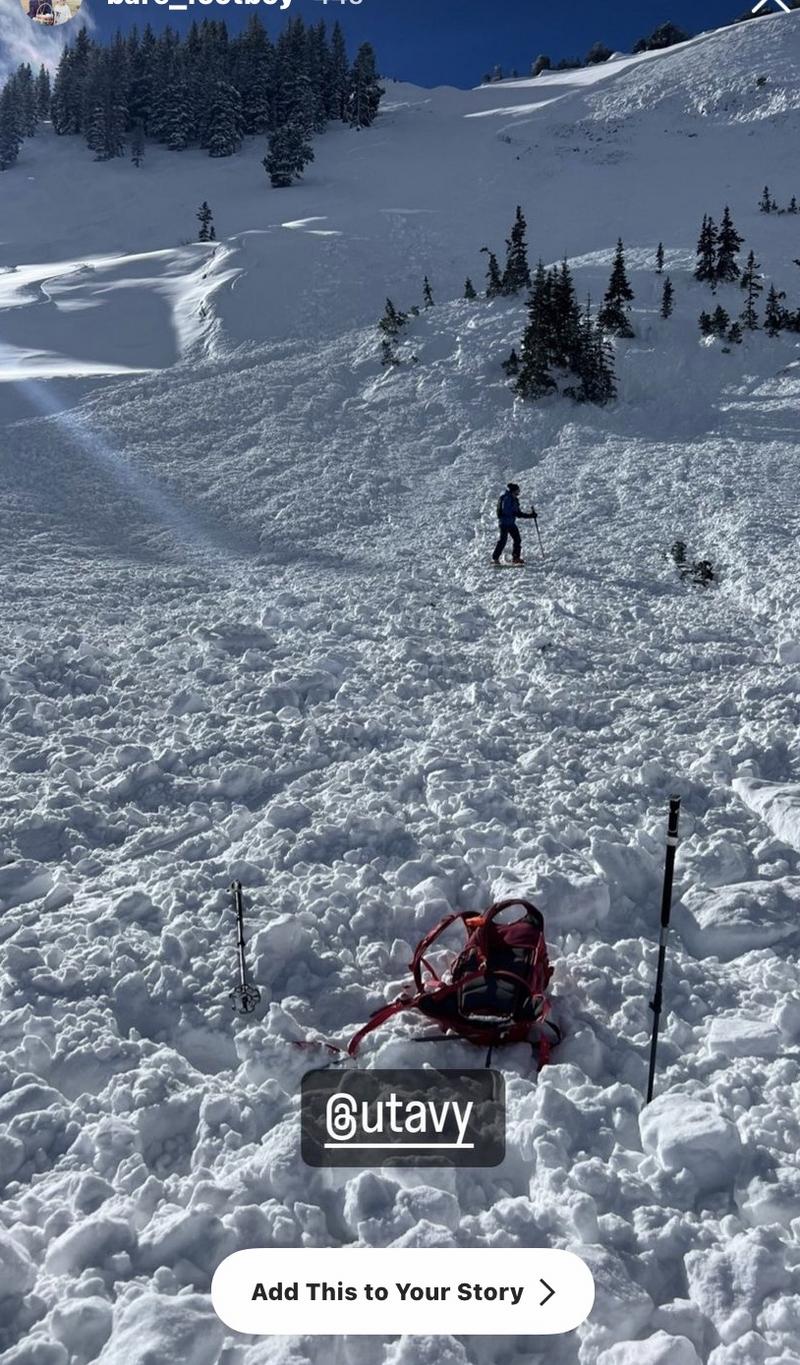
Monday, December 5: Storm totals by the end of the day are 10-16" in the Cottonwoods and along the Park City ridgeline. Two avalanches reported from the Park City ridgeline, including a remotely-triggered slide in No No Name Bowl which was 3' deep, 300' wide and ran 400' vertical. Photo below.
What is interesting about this avalanche is that it initially failed in the November layer of facets (which is about 2-3' deep) and then stepped down to the ground.
Tuesday, December 6: Four human-triggered avalanches reported, including a close call on Dutch Draw along the Park City ridgeline. Photo below.

Wednesday, December 7: 3-4" of very low density snowfall. No backcountry avalanches reported.
Thursday, December 8: Cold and clear with light winds. No backcountry avalanches reported.


