Join us at our 2nd Annual Blizzard Ball

Forecast for the Salt Lake Area Mountains

Drew Hardesty
Issued by Drew Hardesty on
Friday morning, April 8, 2022
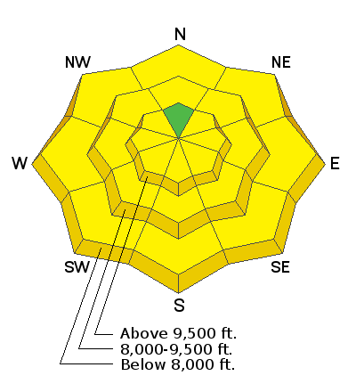
An overall LOW avalanche danger this morning will rise to MODERATE for wet loose avalanches on all but true north aspects today.
Remember that risk is inherent in mountain travel and even a small avalanche can lead to a bad outcome in radical terrain.
Low
Moderate
Considerable
High
Extreme
Learn how to read the forecast here
Special Announcements
Snowbasin Ski Patrol is holding an avalanche dog fundraiser on Saturday, April 9th from 6-10pm at Mountain Luxury Real Estate, 3632 N Wolf Creek Drive in Eden, UT. The event costs $20 and includes dinner and a silent auction. Find more information HERE.
Weather and Snow
Skies are clear.
Mountain temperatures are in the low to mid-30s with cooler temps pooling in the basins and trailheads.
Winds are light from the north.
For today, we'll have sunny skies with high cirrus filtering through overhead by the afternoon. Winds will start to back to the southwest and blow 15mph with gusts to 20. Temperatures will be sweltering by the afternoon and early evening with base temps pushing into the upper 50s as alpine temps reach the mid-40s.
Corn skiing and riding is excellent, although the window will close earlier today than yesterday. One can still find a few inches of high density "powder" on the high northerlies.

A largely dry cold front pushes through in the wee hours overnight, dropping mountain temperatures back into the single digits this weekend. We'll see 25-30mph winds from the southwest tonight into tomorrow before veering to the northwest Saturday night. Ridgetop winds continue to blow 20-25mph on Sunday. The weather models continue to point towards a return to winter next week.
Recent Avalanches
None.

Find all observations HERE.
Ad
Avalanche Problem #1
Wet Snow
Type
Location
Likelihood
Size
Description
All aspects but true north will become damp to wet and unstable with direct sun and scorching temperatures. Wet loose avalanches will be easy to trigger. They will be shallow and slow moving, but problematic in confined terrain. Choose timing and terran carefully. Rollerballs, pinwheels, natural sluffs, and punchy snow are signs to head to a cooler aspect or back to the car. (To be sure, many solar aspects have burned off to dirt, but many have not.)
  • Cornice fall and glide avalanches in the usual places of Stairs, Broads, Mill B South and Porter Fork are always possible this time of year.
General Announcements
Who's up for some free avalanche training? Get a refresher, become better prepared for an upcoming avalanche class, or just boost your skills. Go to https://learn.kbyg.org/ and scroll down to Step 2 for a series of interactive online avalanche courses produced by the UAC.
This information does not apply to developed ski areas or highways where avalanche control is normally done. This forecast is from the U.S.D.A. Forest Service, which is solely responsible for its content. This forecast describes general avalanche conditions and local variations always occur.