
Greg Gagne
Forecaster
Our Week in Review highlights significant snowfall, weather, and avalanche events of the prior week. (Review the archived forecasts for the Salt Lake mountains.)
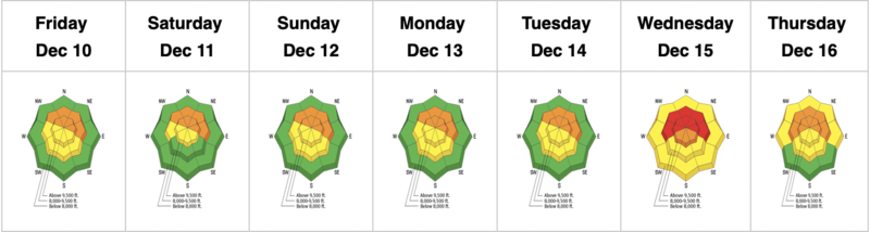
The danger roses for the Salt Lake mountains from Friday, December 10 through Thursday, December 16:
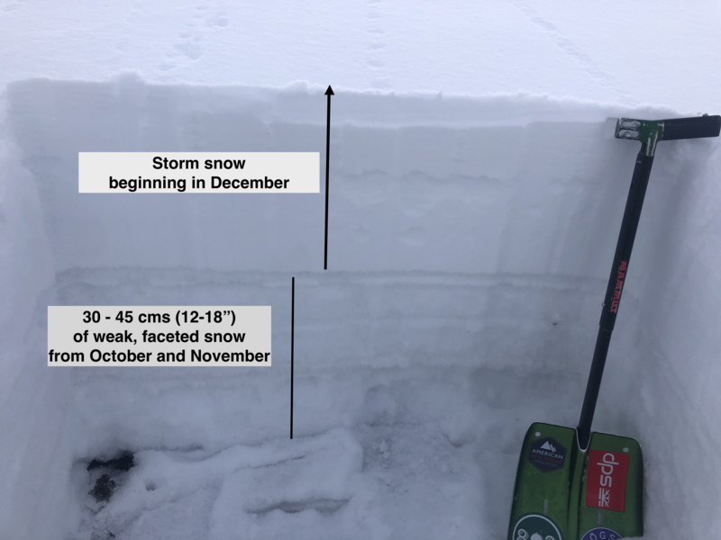
Summary: Early season storms in October and early November gave a promising start to the season, but an extended dry spell of cold, clear weather weakened the snowpack on the shady, northerly aspects at the mid and upper elevations, turning the existing snow surface into weak, sugary facets. A storm system moved into the region on Thursday, December 9, and the weak facets quickly showed their hand with several natural and human-triggered avalanches over this past week. The photo below highlights the current structure of the snowpack with weak snow in the bottom 12-18" of the snowpack on aspects facing northwest through east with a slab of snow from storms that began on December 9. Storms and wind events through December 16 have added to the slab on top of the weak facets.
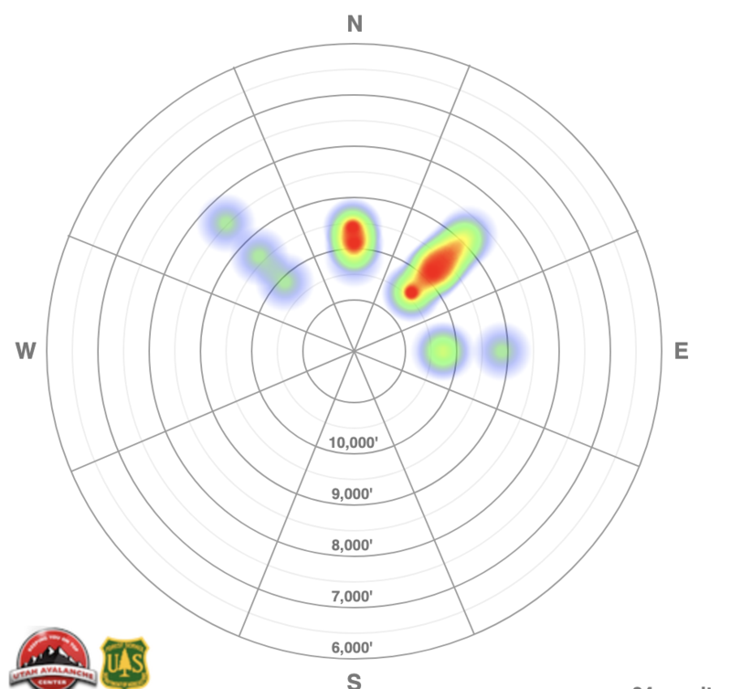
The following heat map shows the distribution of avalanches in the Salt Lake mountains from Thursday, December 9 through Thursday, December 16. This visualizes the primary avalanche problem of a persistent weak layer on mid and upper elevation aspects facing northwest through east.
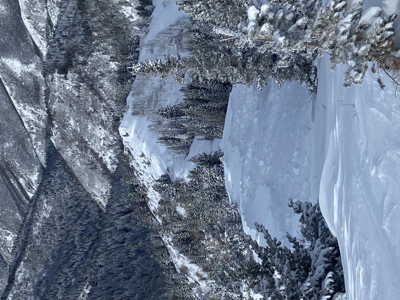
Friday, December 10: Overnight snowfall from Thursday night and throughout the day on Friday totals include 24-30" (containing 2" of water) in the Cottonwoods and 20" (containing 1.5" of water) along the Park City Ridgeline. Several natural and human-triggered avalanches are reported from Friday, with many avalanches triggered remotely (from a distance). In all, 16 avalanches are reported to the UAC from Thursday and Friday. Most avalanches were 1-2' deep and failing in the early-season facets. The largest reported avalanche was West Monitor along the Park City Ridgeline which was up to 1,000' wide and ran 800' vertical:
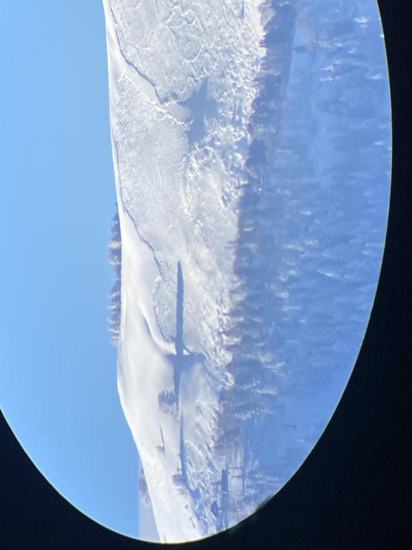
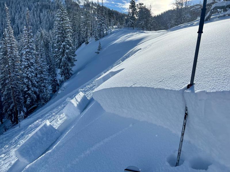
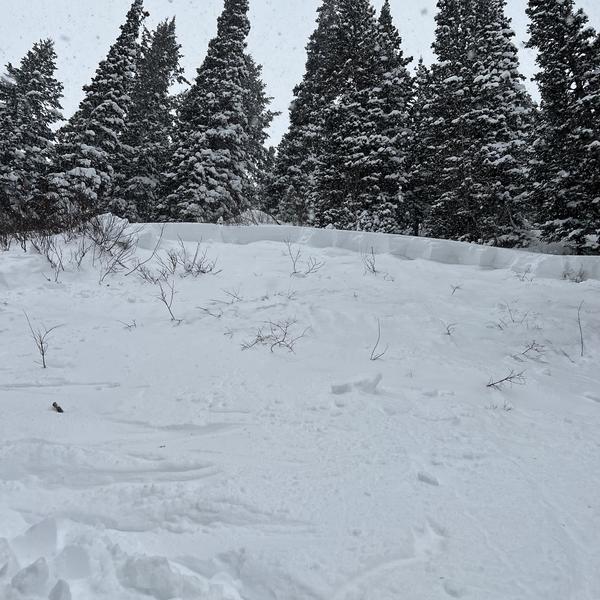
Saturday, December 11: Snowfall ends and with it, natural avalanche activity. However several remotely-triggered avalanches are reported from Saturday, including the avalanche pictured below which was on a steep, north-facing slope along the 10,420' ridgeline in Big Cottonwood Canyon known as Lane's Leap.
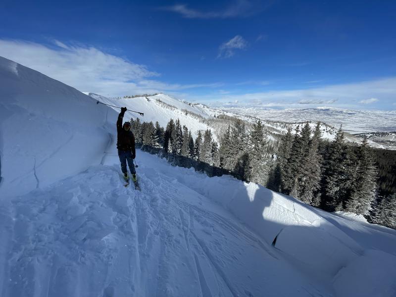
From a safe spot along a flat ridgeline, UAC forecaster Greg Gagne remotely triggered an avalanche along the Park City ridgeline:
UAC forecasters Trent Meisenheimer and Nikki Champion were along the ridgeline between Silver and Days Forks and Trent describes the current setup of a stronger slab of snow on top of weaker faceted snow:
Sunday, December 12: Winds from the southwest increase with averages in the 30's and 40's mph and gusts over 50 mph in the most exposed, upper elevations. Two smaller human-triggered avalanches are reported from the backcountry.
Monday, December 13: Strong southwesterly winds continue with gusts exceeding 100 mph at 11,000' atop Hidden Peak.
Tuesday, December 14: No backcountry avalanches are reported, but strong winds continue, ahead of a vigorous cold front that enters the region in the early evening hours. Snowfall rates during frontal passage are 1-2" per hour.
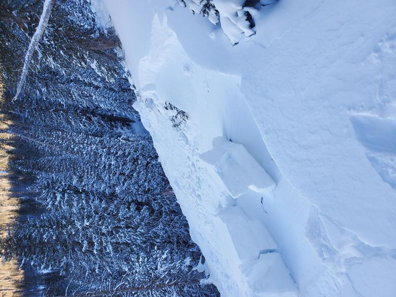
Wednesday, December 15: Storm totals from overnight include 12-20" (containing 1.2 - 1.8" water) in the Cottonwoods with the highest amounts in upper Little Cottonwood, and 12" (containing 1" water) along the Park City ridgeline. Given the new load of snow on top of weak facets, several backcountry avalanches are reported to the UAC including:
what is likely a remotely-triggered avalanche failing down 2.5' in faceted snow on Wills Hill;
Monitors along Park City ridgeline (wind-loaded slope failing on facets with a crown up to 8' in places);
Two Dogs in Days Fork (remotely-triggered failing on facets);
Yellow Jacket Gulch in Millcreek Canyon (facets);
Hidden Canyon in Brighton Backcountry (facets).
Photos from Wednesday, December 15
Monitors
Two Dogs

Yellow Jacket Gulch
Hidden Canyon - Brighton Backcountry
The avalanche in the Hidden Canyon area of the Brighton Backcountry was a near miss where a solo rider was involved in an avalanche that broke 250' wide and 2' deep, running on the Autumn facets. UAC forecaster Drew Hardesty visited the site and describes it in the following video:
Thursday, December 16: A disorganized system delivers 2-6" of storm snow overnight and through the day on Thursday. An avalanche failing on facets is reported from Pink Pine Ridge in Little Cottonwood (photo below) as well as a 2' deep and 150' avalanche in Main Porter Fork.
Thanks that can be a scary area when not skied on frequently
Dan cottam (not verified)
Mon, 12/20/2021


