Check out our Holiday Auction

Forecast for the Salt Lake Area Mountains

Mark Staples
Issued by Mark Staples on
Wednesday morning, October 27, 2021
If there is enough snow to ski or ride, there is more than enough snow to produce an avalanche. The most likely places to trigger a slide will be on slopes loaded by recent winds where a slab of wind drifted snow can avalanche. The real danger isn't so much being buried but having the avalanche sweep you over rocks and stumps that will cause trauma. It's still very early in the season with limited skiing and riding options.
We will update this as conditions warrant. Please submit your observations - thanks!
Low
Moderate
Considerable
High
Extreme
Learn how to read the forecast here
Special Announcements
The 14th Annual Utah Snow and Avalanche Workshop is virtual again this year and will be held Nov 5th (professional session) and Nov 9th, 10th, 11th evenings from 6-9 pm. More info and speaker lineup on our Events page HERE.
Check all the upcoming education HERE.
Weather and Snow
Monday had very strong winds which quickly died down as precipitation began around 5 p.m. on Monday as rain in many places. That rain turned to snowfall Monday evening when the heaviest snowfall occurred. Snowfall continued for most of the day Tuesday with much of that snow falling as graupel. The Alta Ski Patrol reported up to 0.5" of rain at 8500 feet at the onset of the storm although they like to call it "clear snow". Snowfall and water amounts are:
  • Upper Cottonwood Canyons: 8-15" snow (2" water)
  • Park City ridgeline: 4-8" snow (.5-1.5" water)
  • Ogden area mountains: 4-9" snow (.4-1.1" water)
  • Provo area mountains: 3-8" snow (.6-1" water)
Nearly hurricane-force winds eased Monday when precipitation started, and since then at 9000 ft have mostly blown from the west at 10-15 mph gusting 20-30 mph. Wednesday morning they shifted and began blowing a little from the west-northwest.
Today starts out with temperatures mostly in the low 20s F above 9000 ft. Skies will keep some clouds which will be slowly clearing, and temperatures should remain cool. Looking ahead this week, winds look calm and temperatures should warm considerably on Thursday before cooling again late Saturday when a chance for more snowfall returns.
Heads up - Although snow depths at upper elevations are 2-3 feet deep, the risk of hitting rocks or other buried objects remains high.
Recent Avalanches
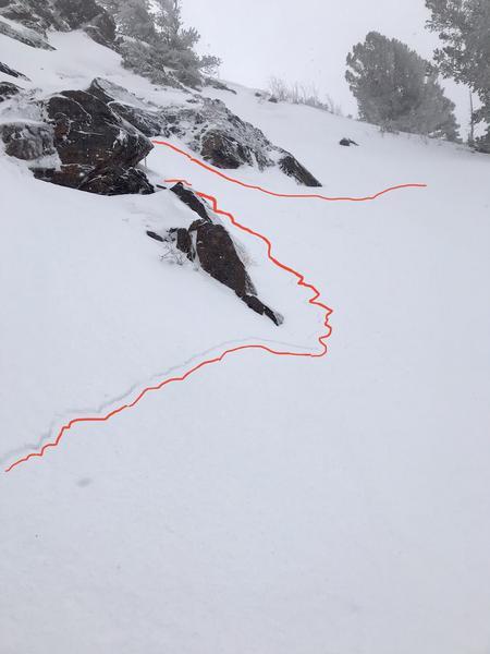
No avalanches were observed or reported yesterday; however, two groups reported long shooting cracks (an obvious sign of instability) on slopes with wind drifted snow. Drew and his partner experienced this in upper Big Cottonwood Canyon and another group experienced it in upper Little Cottonwood Canyon (photo below). Seeing shooting cracks tells us that if you were to get on a steeper slope with similar snow conditions, you would trigger an avalanche.
Ad
Avalanche Problem #1
Wind Drifted Snow
Type
Location
Likelihood
Size
Description
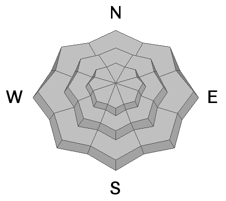
Winds blowing from the west and west-northwest during the last 48 hours have transported snow and formed slabs of wind drifted snow. For today (Wednesday), I would avoid any slope that has been wind loaded. These wind slabs should stabilize in coming days, but will likely remain unstable today.
Remember - triggering any avalanche regardless of it's size can produce serious trauma even if it doesn't bury you because the snowpack is so thin.
Avalanche Problem #2
New Snow
Type
Location
Likelihood
Size
Description
Because the snowpack was very warm and even received rain at the start of the storm on Monday, the new snow has a good bond with the old snow underneath. Greg and his partner were in upper Little Cottonwood canyon yesterday and found the weakest layer was within the new snow. While this layer could fracture and produce a soft slab avalanche of new snow, it has likely bonded as the new snow has settled. The greatest risk remains hitting buried obstacles like rocks and stumps.
General Announcements

This information does not apply to developed ski areas or highways where avalanche control is normally done. This forecast is from the U.S.D.A. Forest Service, which is solely responsible for its content. This forecast describes general avalanche conditions and local variations always occur.