Join us at our 2nd Annual Blizzard Ball

Forecast for the Moab Area Mountains

Eric Trenbeath
Issued by Eric Trenbeath on
Friday morning, April 2, 2021
Heads up, the danger for wet avalanches will increase over the next several days! The danger for loose wet avalanches will quickly rise to MODERATE on all sun-exposed slopes. Signs of instability include rollerballs, pinwheels, and punchy or sloppy unsupportable snow. Get off of and out from under steep slopes as they become wet and sloppy. With very warm temps and no overnight freezes over the next few days, we'll see increasing danger as well as the possibility for wet slab avalanches.
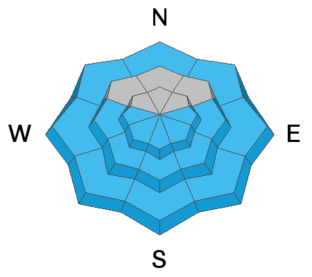
An isolated or MODERATE avalanche danger exists on very steep slopes above treeline that face NW-N-E where stiff slabs overlying weak, faceted snow can still be found. Shallow snowpack areas with steep convexities and rocky, more radical terrain are where you are most likely to trigger an avalanche.
Low
Moderate
Considerable
High
Extreme
Learn how to read the forecast here
Special Announcements
Thanks to everyone who donated to our Spring Awareness Campaign!
The Geyser Pass Road is melted down to the dirt up to the parking lot.
The Lower Utah Nordic Alliance is through grooming for the season.
Weather and Snow
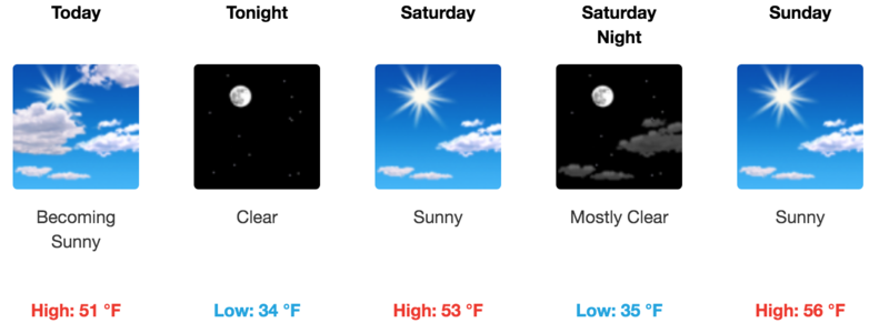
24 Hour Snow 0" 72 Hour Snow 0" Base Depth in Gold Basin 61" Wind S 15 G23 Temp 36F
Wind, temperature, humidity on Pre Laurel Peak (11,700')
SNOTEL site near Geyser Pass Trailhead (9600')
Storm totals at the Gold Basin study plot (10,000')
Snowpack Discussion
Without an overnight freeze, any corn window will be fleeting at best. A very thin, supportable crust The snow will be punchy and unsupportable this morning and will quickly become sloppy today. As the sun warms things up, the danger for loose wet avalanches will quickly rise on all sun-exposed slopes. Unfortunately, this will be the trend over the next several days. With no overnight freezes and increasingly warmer temperatures each day, a more dangerous and harder to predict wet slab avalanche problem may emerge.
Weak, sugary, faceted snow still exists near the ground, especially at higher elevations on NW-E aspects. In shallow snowpack areas, the additional weight of a rider could affect these buried weak layers. Slopes with steep convexities and rocky, more radical terrain are where you are most likely to trigger an avalanche failing on this weak, faceted snow.
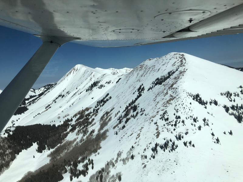
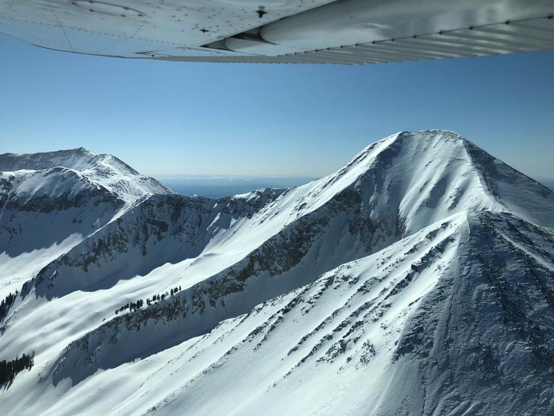
I got to fly around the range with Chris Benson on Wednesday - here are some aerial photos:
Ad
Avalanche Problem #1
Wet Snow
Type
Location
Likelihood
Size
Description
The danger for loose wet avalanches will quickly rise today as a strong sun melts the tenuous crust. Over the next several days the snow will become increasingly wet, sloppy, and more susceptible to avalanching. In addition to loose wet, wet slab avalanches will become possible. It's not going to be a great time to be in the mountains this weekend.
Avalanche Problem #2
Persistent Weak Layer
Type
Location
Likelihood
Size
Description
Weak, sugary, faceted snow still exists near the ground, mostly above treeline on NW-N-E aspects. The most dangerous areas are less than 5' deep and contain wind-drifted snow on top of the deeply-buried persistent weak layer. Slopes with steep convexities and rocky, more radical terrain are where you are most likely to trigger an avalanche failing on weak, faceted snow. Here is a classic example of where this avalanche problem currently exists:
General Announcements
This forecast is from the U.S. Forest Service, which is solely responsible for its content. This forecast describes general avalanche conditions and local variations always occur.