Join us at our 2nd Annual Blizzard Ball

Forecast for the Salt Lake Area Mountains

Greg Gagne
Issued by Greg Gagne on
Friday morning, April 2, 2021
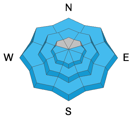
The avalanche danger will quickly rise to MODERATE as the snow becomes wet under the strong sunshine and very warm temperatures. Wet avalanches may be both natural and human-triggered and occur on east, south, and west aspects, as well as northerly aspects, especially at the low and mid-elevations.
Timing is everything - move off of and out from underneath steep slopes once the snow surface becomes wet and unconsolidated.
Low
Moderate
Considerable
High
Extreme
Learn how to read the forecast here
Special Announcements
Thank you to everyone who helped make our Spring Campaign a huge success. We are grateful for your support and look forward to continuing to serve you with forecasting, education, and awareness programs in new and exciting ways.
Weather and Snow
Currently: Skies are clear and temperatures are above freezing - in the low to mid 30's F. - which is about 5 degrees warmer than they were on Thursday morning. Winds are from the south/southwest and were mostly light on Thursday, but increased overnight and are currently averaging in the teens with gusts in the 20's at the mid elevations, with gusts in the 30's mph at 11,000'
Despite the above-freezing temperatures overnight, the snow surface should be refrozen this morning due to clear skies.
Today will be warm and sunny yet again, with temperatures rising into the 40's and 50's. F. Winds will be from the southwest and will average in the teens with gusts in the 20's at mid-elevations, and averaging in the 20's with gusts in the 30's mph at the upper elevations.
Looking ahead, very warm and sunny over this weekend, possibly setting temperature records in the valleys and mountains.

Wondering what are the current mountain temperatures? The Salt Lake office of the National Weather Service has created this excellent site with links to automated weather stations as well as the Cottonwood Canyon forecast.
Recent Avalanches
Small wet-loose avalanches were reported from Thursday.

Our Week in Review which highlights significant snow and avalanche events from the past week has been published.
Ad
Avalanche Problem #1
Wet Snow
Type
Location
Likelihood
Size
Description
Strong sunshine and warm temperatures will produce wet, loose avalanches today once the snow surface begins to take on heat. Fortunately, this is generally a predictable avalanche problem where you can expect avalanching in the wet snow once it begins to soften. The main concern is having a naturally triggered slide come down onto you, especially if you are in a gully, couloir or other confined terrain where avalanche debris can pile up deeper and you have no route for escape. We may also see wet avalanche activity beginning today on northerly aspects where this colder and drier snow warms up from the strong sunshine.
Timing is everything - once the snow surface becomes wet and unconsolidated it is time to move off of and out from underneath any steep slopes.
A couple of videos that describe the current snowpack setup and possible wet avalanche activity. In this first video, Mark Staples discusses how wet avalanches are likely to occur near the snow surface as well as how the cold/dry snow underneath the surface may also begin to produce avalanching:
In this second video, Dave Richards - director of the avalanche program at Alta - describes a collapse of a wet slab on top of dry snow underneath. This occurred in the backcountry on Thursday on a southeast aspect just below 10,000', indicating the potential for larger and more dangerous wet slabs.
Avalanche Problem #2
Gliding Snow
Type
Location
Likelihood
Size
Description
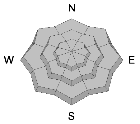
What the heck are glide avalanches and gliding snow? They are avalanches that happen when the entire snowpack starts moving downhill on top of some smooth surface like a rock slab, and then at some point, the snow releases and produces an avalanche.
It is impossible to predict when these slides will happen, BUT we usually know where they will happen because they are almost always preceded by a visible glide crack which is a large crack in the snow that extends to the ground. These glide cracks can exist for minutes, hours or days before producing a glide avalanche. Or they may not produce an avalanche at all.
What to do? With such warm weather expected, I wouldn't be surprised to hear of a few glide cracks opening up and possibly a few glide avalanches. Look for glide cracks in the snow and avoid traveling underneath them. The good news is that glide avalanches only happen in a few specific places like Broads Fork and Stairs Gulch where large slabs of rock exist under the snowpack. There were several glide avalanches that happened in Broads Fork on March 2nd and March 5th. Two people died in a glide avalanche in 2001 on April 28th in Stairs Gulch.
General Announcements
Please visit this website with information about Responsible Winter Recreation by the Utah Office of Outdoor Recreation.

This information does not apply to developed ski areas or highways where avalanche control is normally done. This forecast is from the U.S.D.A. Forest Service, which is solely responsible for its content. This forecast describes general avalanche conditions and local variations always occur.