
Greg Gagne
Forecaster
Our Week in Review highlights significant snowfall, weather, and avalanche events of the previous week. (Review the archived forecasts for the Salt Lake mountains.)
The danger roses for the Salt Lake mountains from Friday, March 5 through Thursday, March 11:

Summary: As evident by the week of all-green roses, for the first time this season, prolonged stability as the persistent weak layer has gone dormant and only minimal wet avalanche activity and sluffing in low-density storm snow.
Friday, March 5: Only minor, wet loose avalanche activity reported.
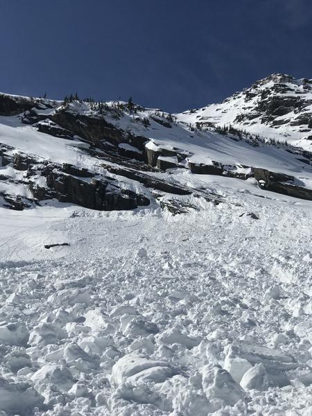
Saturday, March 6: Gusty winds ahead of a weak cold front. A glide avalanche is reported from Broads Fork.
Sunday, March 7 - Tuesday, March 9: Clearing skies and warm temperatures, but only minor, wet-loose avalanche activity is reported.
Wednesday, March 10: A weak storm moves in overnight, with 2-4" of low-density snow. Sluffing in the dry new snow as well as minor wet loose during the afternoon.
Thursday, March 11: Snow showers with 2-8" additional snow, with the highest totals in upper Big Cottonwood and along the Park City ridgeline. The only avalanche activity is sluffing in the low-density storm snow on steeper aspects.


