Join us at our 2nd Annual Blizzard Ball

Forecast for the Salt Lake Area Mountains

Drew Hardesty
Issued by Drew Hardesty on
Saturday morning, April 11, 2020
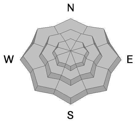
The avalanche danger is LOW, but could possibly rise to MODERATE due to warming of the snowpack.
Travel in avalanche terrain during the springtime can be complicated, and today's concerns include (1) wet avalanches on all aspects as the snow surface warms throughout the day (2) unpredictable large glide avalanches in very specific places and (3) large cornices breaking back farther than expected along the ridgelines.

Pay attention to rapidly-changing springtime conditions.
Low
Moderate
Considerable
High
Extreme
Learn how to read the forecast here
Special Announcements
The Avalanche Research Program at Simon Fraser University is conducting an online survey to examine how people use avalanche safety information. They want to hear from all backcountry users to understand how they process information provided in public avalanche forecasts. Anyone who completes the survey before May 15th will be entered to win cash prizes.
Chapter 7 of the Low Danger Series - The Crossing
Weather and Snow
Skies are partly cloudy.
5am mountain temperatures are in the upper 20s to low 30s.
Winds aloft veered to the west and northwest overnight with most anemometers spinning 10-15mph with gusts to 20. The highest anemometers, ahead of tonight's storm, are indicating wind speeds of 25-30mph with gusts to 40.
Most snow surfaces should have a solid refreeze. A marginal refreeze may be noted, however, in some mid-elevation locations along the periphery of the Tri-Canyons. Some surfaces may have trouble softening today due to the wind and localized cloud cover.

A Return to Winter - A strong cold front is expected to push through overnight that should produce 2-6" of snow, perhaps a touch more in some locations. Grab the down jacket again - ridgetop temps tomorrow will drop to the single digits and low teens. West to northwest winds will be moderate to strong early evening into early tomorrow. Ahead of the cold front, today we'll see increasing clouds, afternoon spring showers, graupel, possibly some lightning. Temperatures will rise to the mid 30s along the ridgelines and the mid to upper 40s down low. Temps remain cool through the week.
Recent Avalanches
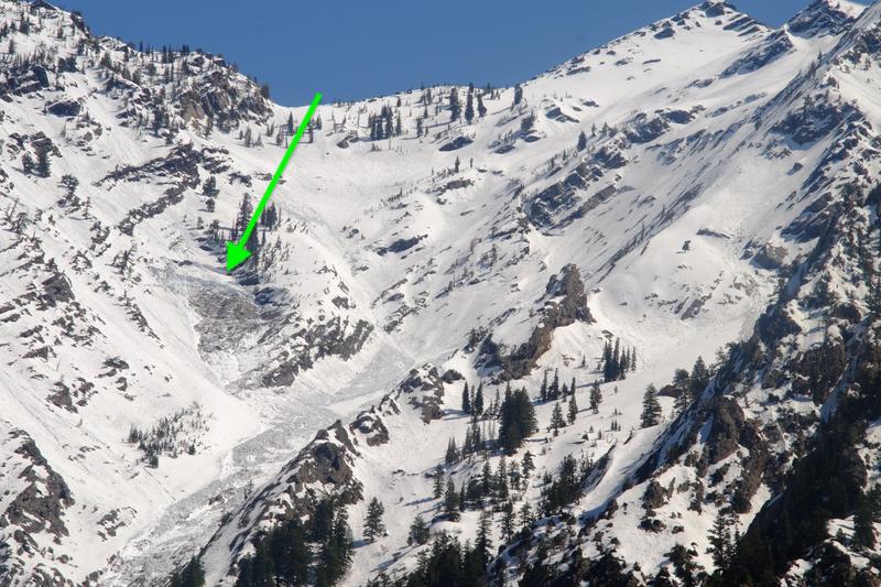
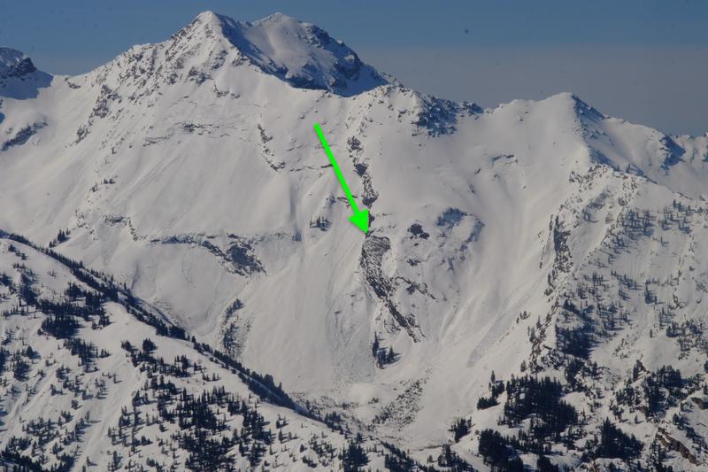
More large and destructive glide avalanches released Thursday night or early Friday morning in Stairs Gulch and Broads Fork of BCC. (photos UDOT BCC/Rogers)
The old Wasatch Tours guidebooks by Hanscom/Kelner relay that, "Knowledgeable agencies wish that Stairs Gulch was absolutely never entered in either winter or spring. The upper part of Stairs is an immense rock slab that frequently sends powerful avalanches into the main gully below. Big Cottwoood Canyon has been buried to depths of 40' or more on several occasions."
Ad
Avalanche Problem #1
Normal Caution
Type
Location
Likelihood
Size
Description
The overall avalanche danger is LOW, possibly rising to MODERATE this afternoon due to warming of the snowpack. In general, wet avalanche activity is managed most effectively by timing - once the snow surface becomes wet and sloppy, it is time to move to a shadier aspect. Watch for signs of wet, loose snow including rollerballs and sluffing in the wet snow.
However, avalanche concerns in the spring can become complicated, and three other concerns to watch for today include:
1. Wet Slabs - Wet slab avalanches occur when meltwater from rain or warm temperatures percolate down through the snowpack and weaken the bonds (strength) of a buried weak layer. These avalanches can be human-triggered, but also occur naturally, including triggering from a small, wet-loose avalanche or cornice fall. (See Thursday's Porter Fork wet slab as Exhibit A.) Colder temperatures should lock up the snowpack this morning, but strong sunshine today could provide enough warming to trigger isolated wet slabs. These could occur on any aspect facing west, south, through east, as well as northerly aspects up to about 10,000'.
2. Glide Avalanches - A separate but related avalanche problem is glide avalanches, and several occurred midweek during a period of warm temperatures. When they happen is mostly unpredictable, however, where they happen is generally predictable because there is often a huge crack in the snowpack. Common places to find glide avalanches are places with rock slabs or a smooth ground surface like Broads Fork, Stairs Gulch, and Mill B South, and upper Raymond Slabs in upper Porter Fork. Simply avoid being under these places or any slope with a visible glide crack.
3. Cornices - Cornices in some places are massive, and they can break off naturally, especially during warm weather when they start bending downhill. Simply avoid being underneath or near the tops of large cornices as they break farther back than expected.
Additional Information
Information on outdoor recreation - The State of Utah created this webpage with information about recreating on both state and federal public lands during the current health crisis.

Skiing and riding at closed ski resorts - Some resorts allow access now, and some do not. Please check HERE for the latest info on ski area access.

New to the backcountry (including riding at closed resorts) - Watch the award-winning, 15 minute Know Before You Go video, or take the 5-part, free online-learning series.
General Announcements
This information does not apply to developed ski areas or highways where avalanche control is normally done. This forecast is from the U.S.D.A. Forest Service, which is solely responsible for its content. This forecast describes general avalanche conditions and local variations always occur.