Forecast for the Skyline Area Mountains

Issued by Brett Kobernik on
Monday morning, January 25, 2016
Monday morning, January 25, 2016
A CONSIDERABLE avalanche danger exists in the mid and upper elevation steep slopes. Conditions are dangerous because not all slopes are going to avalanche and it is very difficult to determine which ones will. Areas that have received the most snow and wind are the most suspect. Avalanches may break into weak layers near the ground. Let the snowpack settle for a few days and adjust to the new load.
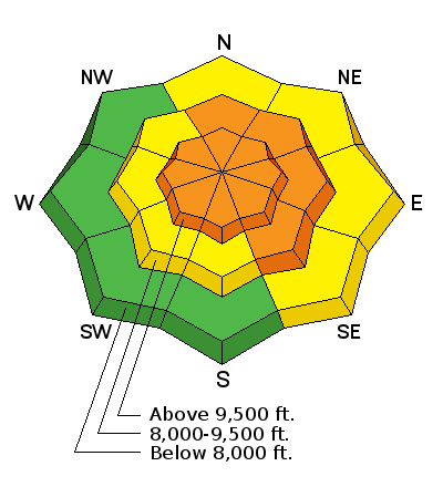
Low
Moderate
Considerable
High
Extreme
Learn how to read the forecast here


