Forecast for the Uintas Area Mountains

Craig Gordon
Issued by Craig Gordon for
Sunday, March 10, 2013

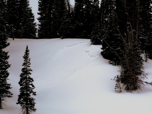
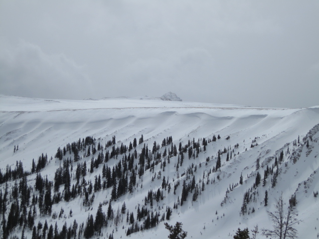
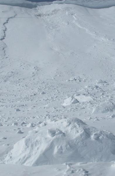
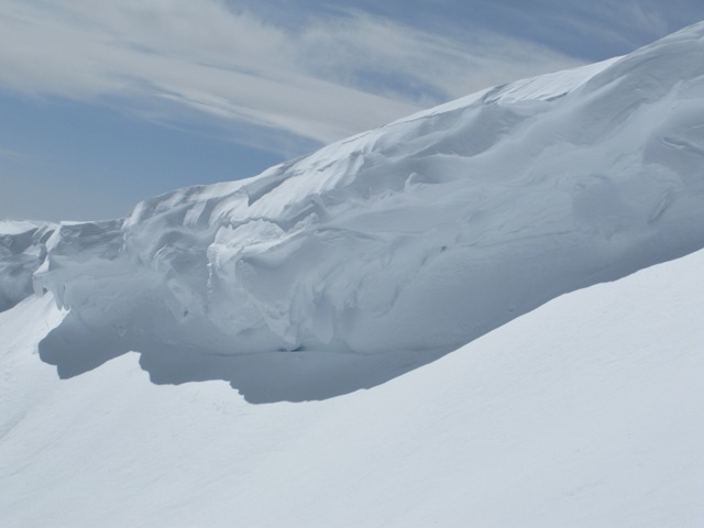
In the wind zone at and above treeline, a CONSIDERABLE avalanche danger exists and human triggered avalanches are likely on steep, leeward, slopes, especially those facing northwest, west, southwest, south, and southeast.

A MODERATE avalanche danger is found at mid elevations and human triggered avalanches are possible on steep wind drifted slopes.

If you're looking for LOW avalanche danger, head to low angle, wind sheltered terrain.

Low
Moderate
Considerable
High
Extreme
Learn how to read the forecast here
Weather and Snow

Skies cleared out late yesterday and temperatures dove into the low teens and single digits overnight. The weekend storm wasn't a huge snow producer for us, but it stacked up 4"-6", helping to put a much needed fresh coat of paint on our mountains. The bigger news actually are the winds. Low pressure sliding east out of Arizona, has kept northeast winds blowing steadily 25-40 mph along the high ridges of the western Uinta's. While most of the above treeline riding is gonna be wind jacked, drop a few hundred feet off the ridges and you'll be treated to cold, creamy, powder in wind sheltered, shady terrain.

Recent observations can be found here.

Our entire Uinta weather station network is up and running. A link to real-time wind, snow, and temperature data can be found here.

This monumental achievement couldn't have happened without the joint efforts from the National Weather Service, The Heber-Kamas and Evanston Ranger Districts, Park City Powder Cats, and all the great work by Ted, Trent, Cody, and Al. Thanks to everyone... this is awesome!

Wondering why last winter was so crazy? Click here to watch the 2011-12 Utah Winter Review... an excellent recap of last years conditions.

Recent Avalanches

On Friday Trent and I found a small, recently triggered pocket breaking to weak January snow on this crossloaded gully in Chalk Creek.

Click here for recent observations from the region.

Ad
Avalanche Problem #1
Persistent Weak Layer
Type
Location
Likelihood
Size
Description

Winds continue blowing from an unusual Northeasterly direction and with fresh snow to work with, they're busy forming drifts on slopes facing the south half of the compass. While easily manageable to start with, once triggered it's gonna be a different story. A fresh drift can break into weak layers of snow buried deeper in the snowpack quickly creating a large and unmanageable avalanche.

In addition to direct loading on south facing slopes, today's wind will also crossload chutes and gullies on shady slopes. So there's more to today's avalanche dragon than meets the eye. Best way to avoid getting tricked is to look for and steer clear of recently wind loaded slopes, especially those that appear fat and rounded.

A perfect example of the kind of terrain that gets crossloaded by winds. One side of the chute might be stripped, while the other harbors a recent deposit of wind drifted snow.

Avalanche Problem #2
New Snow
Type
Location
Likelihood
Size
Description

Usually sunny slopes are very predictable and avalanches break on slick melt freeze crusts formed during the warm days/cold nights. This year however, it's an entirely different snowpack on south and west facing terrain. As a matter of fact, we're seeing very weak sugary snow in the mid portion of the snowpack. And like clockwork, each time it loads with strong northerly winds, avalanches fail on this suspect weak layer, quickly stepping down to weaker snow near the ground.

On the other half of the compass the pack remains suspect in steep, rocky terrain. In either case the best way to combat triggering a deep dangerous slide is with terrain selection. Tone it down a notch or two, match your terrain selection with the avalanche danger, and above all, think about the consequences of triggering a slide.

This slope took a big hit with a huge piece of cornice slamming down on it, triggering a slide that broke to weak January snow.

Avalanche Problem #3
Cornice
Type
Location
Likelihood
Size
Description

Cornices continue to grow in size and unpredictability.

Additional Information

High pressure is building and it'll be a stunning day in the mountains. High temperatures climb into the mid 30's before diving into the mid teens overnight. Northeast winds will be an issue... they'll blow into the 30's and 40's along the high ridges today, switching more west-northwesterly later in the day and decreasing somewhat. A few clouds drift into the region Monday and Tuesday before high pressure becomes firmly established midweek. There are no big storms in sight.

General Announcements

Remember your information can save lives. If you see anything we should know about, please participate in the creation of our own community avalanche advisory by submitting snow and avalanche conditions. You can call me directly at 801-231-2170, email [email protected], or email by clicking HERE

This is a great time of year to schedule a free avalanche awareness presentation for your group or club. You can contact me at 801-231-2170 or email [email protected]

Donate to your favorite non-profit –The Friends of the Utah Avalanche Center. The UAC depends on contributions from users like you to support our work.

The information in this advisory is from the US Forest Service which is solely responsible for its content. This advisory describes general avalanche conditions and local variations always occur.

The information in this advisory expires 24 hours after the date and time posted, but will be updated by 7:00 AM Wednesday March 13th.