March Kicks Off Our Spring Campaign- Donate Now to Support Forecasting

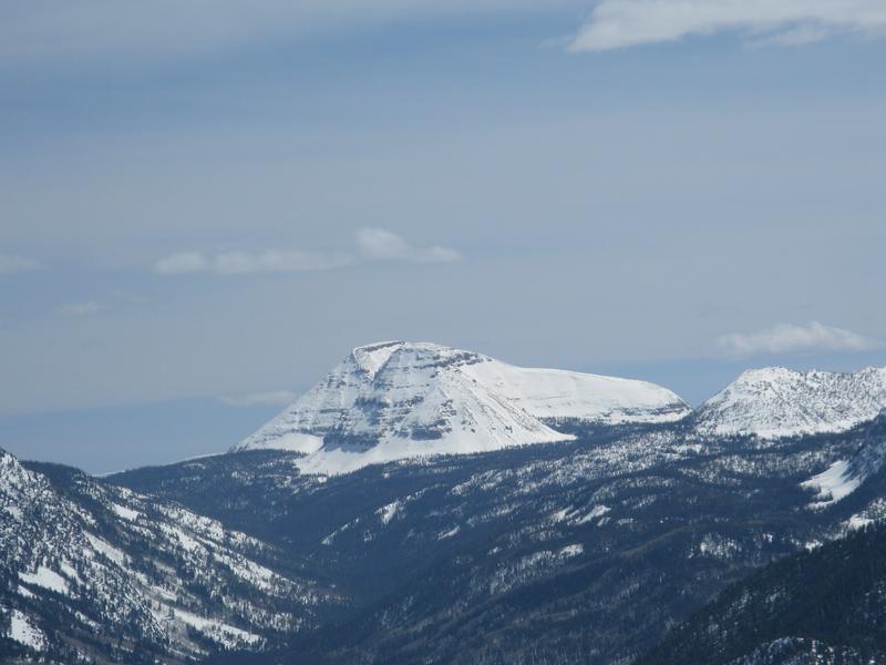
Forecast for the Uintas Area Mountains

Craig Gordon
Issued by Craig Gordon on
Thursday morning, April 9, 2020
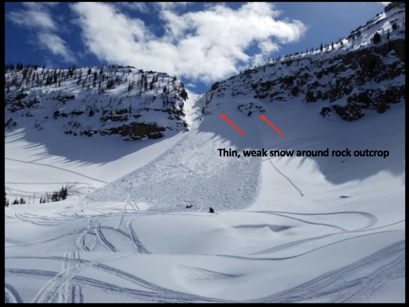
The danger of wet avalanches starts in the LOW category this morning when the snow is hard and frozen and rises to MODERATE danger as the day progresses. As the day heats up, human triggered triggered wet slides and sluffs become possible on steep, sun-baked slopes.
In addition and limited to a small portion of the terrain available to ride in today-
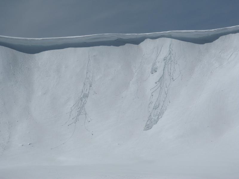
At and above treeline, in the wind zone, pockets of MODERATE avalanche danger exist on wind drifted slopes. Human triggered avalanches breaking deeper and wider than you might expect are POSSIBLE on steep, leeward slopes facing the north half of the compass.
Low
Moderate
Considerable
High
Extreme
Learn how to read the forecast here
Special Announcements
The Avalanche Research Program at Simon Fraser University is conducting an online survey to examine how people use avalanche safety information. They want to hear from all backcountry users to understand how they process information provided in public avalanche forecasts. Anyone who completes the survey before May 15th will be entered to win cash prizes.
Uncertainty, Risk, & Decision Making: before, during, and after COVID-19 - Read this thought-provoking blog post about how we take risks by guest author Tom Diegel.
Weather and Snow
Reid's and Bald Mountain looking rather regal these days.
Currently-
As the Super Pink moon wanes, skies are clear this morning, but temperatures slow to cool off and currently hover right around freezing. East and southeast winds blow just 10-20 mph, even along the high peaks. Riding and turning conditions are aspect and elevation dependent. Upper elevation, wind sheltered, north facing slopes still harbor a few elusive ribbons of cold, chalky snow. However, more reliable and consistently supportable corn surfaces exist on mid elevation terrain facing the south half of the compass. Of course, timing is everything and the harvest reliably starts coming on right around 09:00.
Uinta weather network info is found here. Simply click on the Western Uinta tab.
For today-
The day beings with mostly sunny skies with temperatures climbing into the upper 40's. Winds increase slightly as moisture sliding in from the south brings increasing cloud cover and eventually scattered snow showers this afternoon through early evening. Snow accumulations will be on the light side... perhaps an inch or two.
Futurecast-
Drier weather is on tap for Friday, with a few snow showers possible again by Saturday afternoon.
Recent Avalanches
Other than a few shallow, damp sluffs on sustained steep slopes, I found the snowpack rather well-behaved yesterday. However, all it takes is one rowdy snowball in the mosh pit to get things going.
To view additional trip reports and recent avalanche activity, simply click here.
Ad
Avalanche Problem #1
Wet Snow
Type
Location
Likelihood
Size
Description
Cornices are quite large these days and may break back further than you expect. You definitely want to give these large boxcar pieces of snow a wide berth.
Todays intense sunshine and warm temperatures set their sights on our snowpack, penetrating all aspects and all elevations. The good news is... wet avalanche issues are easy to avoid. If you're feeling like an ant under a magnifying glass, so is the snow. As the day heats up and the snow you're riding becomes damp, manky, or unsupportable, simply switch to a cooler aspect or call it a day and move on to other activities.
Avalanche Problem #2
Wind Drifted Snow
Type
Location
Likelihood
Size
Description
Breaking 3' deep and a football field wide, the avalanche in the image above was triggered Friday on the steep, heavily wind loaded, northwest facing bowl of Notch Mountain. As noted by the rider.... "I was the third snowmobiler to climb the mountain and I triggered the slide. Avalanche airbag kept my head above the snow." More details found here.
Not much has changed on this front. The Uinta's are amazing right now... fat, white and filled in. As a matter of fact, we've got a solid snowpack with a go anywhere base, which enables us to get onto big slopes and tag complex terrain. But, as you know, the Uinta's are a big range. And while the vast majority of our terrain is good to go, if you were looking to trigger an avalanche, I bet you could find one. And, recent avalanches near Bald Mountain Pass and Notch Mountain (above), not only illustrate the type of terrain we love to ride in the spring, it's also the type of terrain where we could trigger a slide today that breaks deeper and wider than we might expect. The most likely places you could trigger a dry snow avalanche are gonna be isolated to the high country... steep, rocky, leeward slopes in the wind zone at and above treeline.
Additional Information
Information on outdoor recreation - The State of Utah created this webpage with information about recreating on both state and federal public lands during the current health crisis.

Skiing and riding at closed ski resorts - Some resorts allow access now, and some do not. Please check HERE for the latest info on ski area access.

New to the backcountry (including riding at closed resorts) - Watch the award-winning, 15 minute Know Before You Go video, or take the 5-part, free online-learning series.
General Announcements
The information in this forecast expires in 24 hours, but will be updated by 7:00 AM Friday Apr. 10th.
This forecast is updated daily by 7:00 AM.
In the mean-time, if you see or trigger an avalanche or just wanna let me know what you're seeing you can reach me directly at 801-231-2170
The information in this forecast is from the US Forest Service which is solely responsible for its content.