Forecast for the Uintas Area Mountains

Issued by Craig Gordon on
Wednesday morning, April 8, 2020
Wednesday morning, April 8, 2020
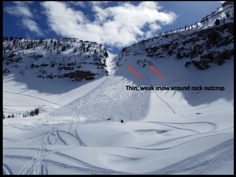
The danger of wet avalanches starts in the LOW category this morning when the snow is hard and frozen and rises to MODERATE danger as the day progresses. As the day heats up, human triggered triggered wet slides and sluffs become possible on steep, sun-baked slopes.
In addition and limited to a small portion of the terrain available to ride in today-
At and above treeline, in the wind zone, pockets of MODERATE avalanche danger exist on wind drifted slopes. Human triggered avalanches are POSSIBLE on steep, leeward slopes facing the north half of the compass, particularly those with an easterly component to its aspect. Any avalanche triggered is gonna pack a punch and could easily ruin your day.

Low
Moderate
Considerable
High
Extreme
Learn how to read the forecast here