Forecast for the Uintas Area Mountains

Craig Gordon
Issued by Craig Gordon for
Sunday, April 7, 2019
The danger of WET slides and sluffs starts as LOW this morning, rising to MODERATE as the day wares on. Human triggered wet avalanches avalanches are POSSIBLE on all steep slopes as the snow surfaces heats up.
Low
Moderate
Considerable
High
Extreme
Learn how to read the forecast here
Special Announcements
The season is winding down and regularly scheduled daily western Uinta avalanche forecasts will be issued through Sunday April 14th.
Wondering what happens when the forecasting ends?
Well the UAC’s work keeps going strong, of course. Summer is a busy time for the UAC. During the summer we are working hard on our fall and winter planning; putting together the Fall Fundraiser and USAW; updating our awareness and education programs; this summer we will be finishing up the website redesign project. Your donation shows you’re invested in this community all year round! You can still be part of the UAC’s success in 2019. Consider making a donation HERE by April 8.
Weather and Snow
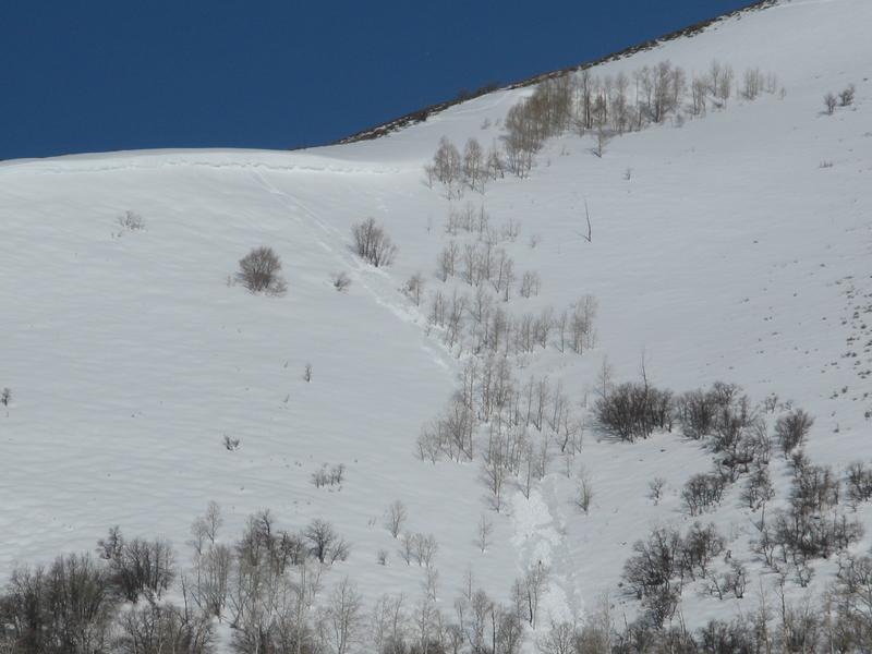
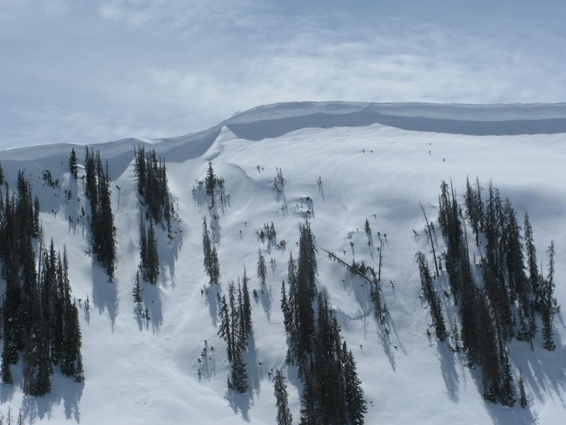
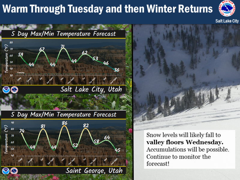
Yesterday's damp, misty weather produced an inch of snow, but skies cleared right around dinnertime allowing temperatures to dip into the teens and low 20's overnight. It'll feel crisp along the ridges where winds blow in the 20's. Soft snow and "hot pow" are done until the next storm cycle, but the corn harvest is going full swing this morning, especially on low and mid elevation sunny slopes.
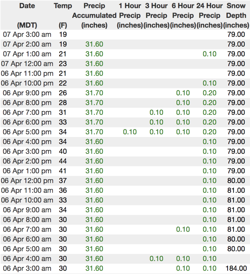
Above is hourly snow data from Trial Lake (9,945')
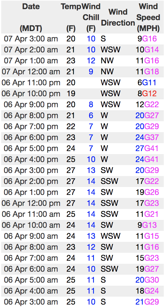
And Windy Peak (10,662')
To view more regional weather stations click here.
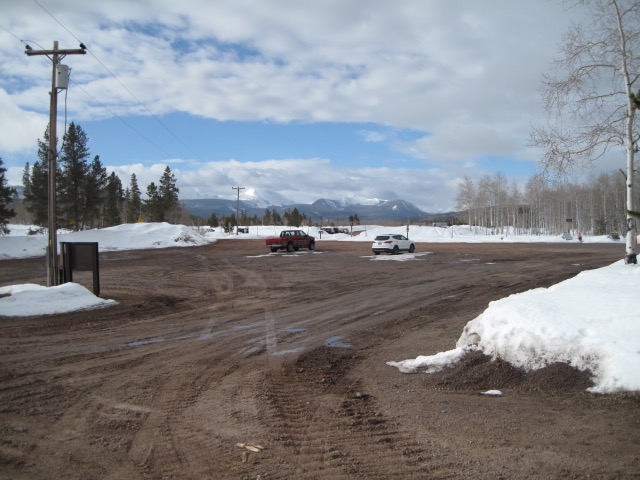
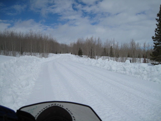
Don't get too discouraged at the trailheads where frozen parking lots in the morning, morph into a slickery, afternoon muddy mess.... Ted Scroggin and his crew are still laying down fresh, smooth roy that'll help get you to the high country.
Recent Avalanches
Ted was able to trigger a shallow fresh drift in the wind zone yesterday and notes... "I did get tripped up with a very shallow fresh wind slab along the higher ridge line. It was only a few inches deep, but the slick crust underneath caught me off guard". More on his thoughts from Whitney Basin are found here
Recent trip reports and avy activity found HERE.
Ad
Avalanche Problem #1
Wet Snow
Type
Location
Likelihood
Size
Description
Cold, overnight temperatures are just what the snow doctor ordered and this mornings snow surface is locked up and tight. However, with temperatures expected to soar into the 40's, wet avalanches become possible on all steep, snow covered slopes as the day heats up. Often starting as a small point release, wet slides and sluffs can fan out and entrain large amounts of damp surface snow as they descend a slope. (like in the image above). No mystery here, this is a pretty-straight-forward avalanche problem to avoid by simply getting off of and out from under steep slopes, especially if the snow surface you're riding feels saturated, manky, or punchy like a trap door. In addition, you'll want to think about your travel plans and remember to avoid terrain traps like gullies and road cuts where cement-like, bone snapping avalanche debris can stack up very deeply.
And remember-
Huuuuge cornices may become more tender and reactive to our additional weight, breaking further back than expected, particularly with warming the next few days. You definitely wanna give these large, unpredictable pieces of snow the respect they deserve and not ruin someones day below by inadvertently knocking a boxcar size piece of snow down on them.
Additional Information
Expect a beautiful day in the mountains with sunny skies and temperatures rising into the mid 40's. Southerly winds are reasonable this morning, blowing in the 20's along the high ridges, but ramp up into the 40's as the day progresses. Overnight lows bottom out near freezing and then the warm up begins Monday ahead of a good looking storm slated for midweek. Looks like snow begins late Tuesday and really gets going Wednesday when cold, moist air arrives. A foot of snow is a good bet by Thursday morning with unsettled weather lingering 'til the end of the work week.
General Announcements
The information in this advisory expires 24 hours after the date and time posted, but will be updated by 7:00 AM Monday April 8th, 2019.
If you're getting out and about, please let me know what you're seeing especially if you see or trigger and avalanche. I can be reached at [email protected] or 801-231-2170
It's also a good time to set up one of our very popular avalanche awareness classes. Reach out to me and I'll make it happen.
This information does not apply to developed ski areas or highways where avalanche control is normally done. This advisory is from the U.S.D.A. Forest Service, which is solely responsible for its content. This advisory describes general avalanche conditions and local variations always occur.