Researchers Ian McCammon and Sara Boilen are developing new tools for managing human factors for backcountry skiers and boarders. This survey asks about personal experiences with human factors and will take 7 - 8 minutes to fill out. Link is HERE.
Nowcast - 0500 AM temperatures are inverted and report in the teens (°F) at 10,000' and closer 25°F near 11,000'. Skies are clear and winds are calm blowing lightly from the south.
Forecast - The warm-up has begun and temperatures will be 10-15 degrees above average by the end of today with a high of 45°F at 10'k. Winds remain calm, blowing from the south around 10 MPH, and should keep consistent throughout the day but not help to cool the snow surface much.
Futurecast - A significant warm-up carries us through today and into tomorrow. An active pattern follows with the potential for more snowfall accumulation later this week.
Travel Conditions - Although yesterday was one of those incredible Uinta days, the sun and warm temperatures certainly took a toll on the snow surface. On the sunnies and mid-elevation slopes, I'd expect a crust on the surface that would hopefully soften by mid-day at the latest. But on the high polars, cold, deep, settled pow remains and provides some of the best quality riding of the season! With all that in mind, remember wherever you're headed across the range watch out for rocks and stump hiding under 1-2' of snow and just waiting for some love from us!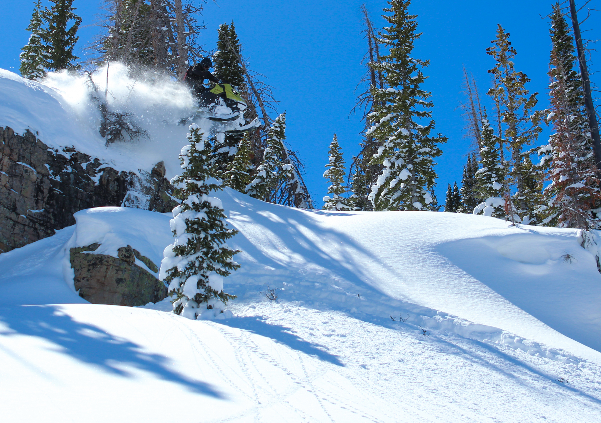 Upper-elevation north facing terrain was the ticket we were trying to book yesterday and it was well worth the price of admission. Kyle C shown above near Ramona Peak getting his final fix of hang-time in before it all melts into the river.
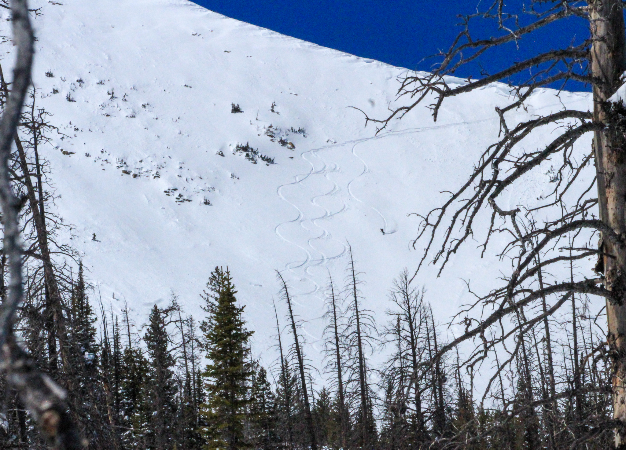 On the sunny side of things, a dialed crew got after the east face of Mt. Watson and found surfy and supportable conditions. They went back for seconds before things got too warm and scored!
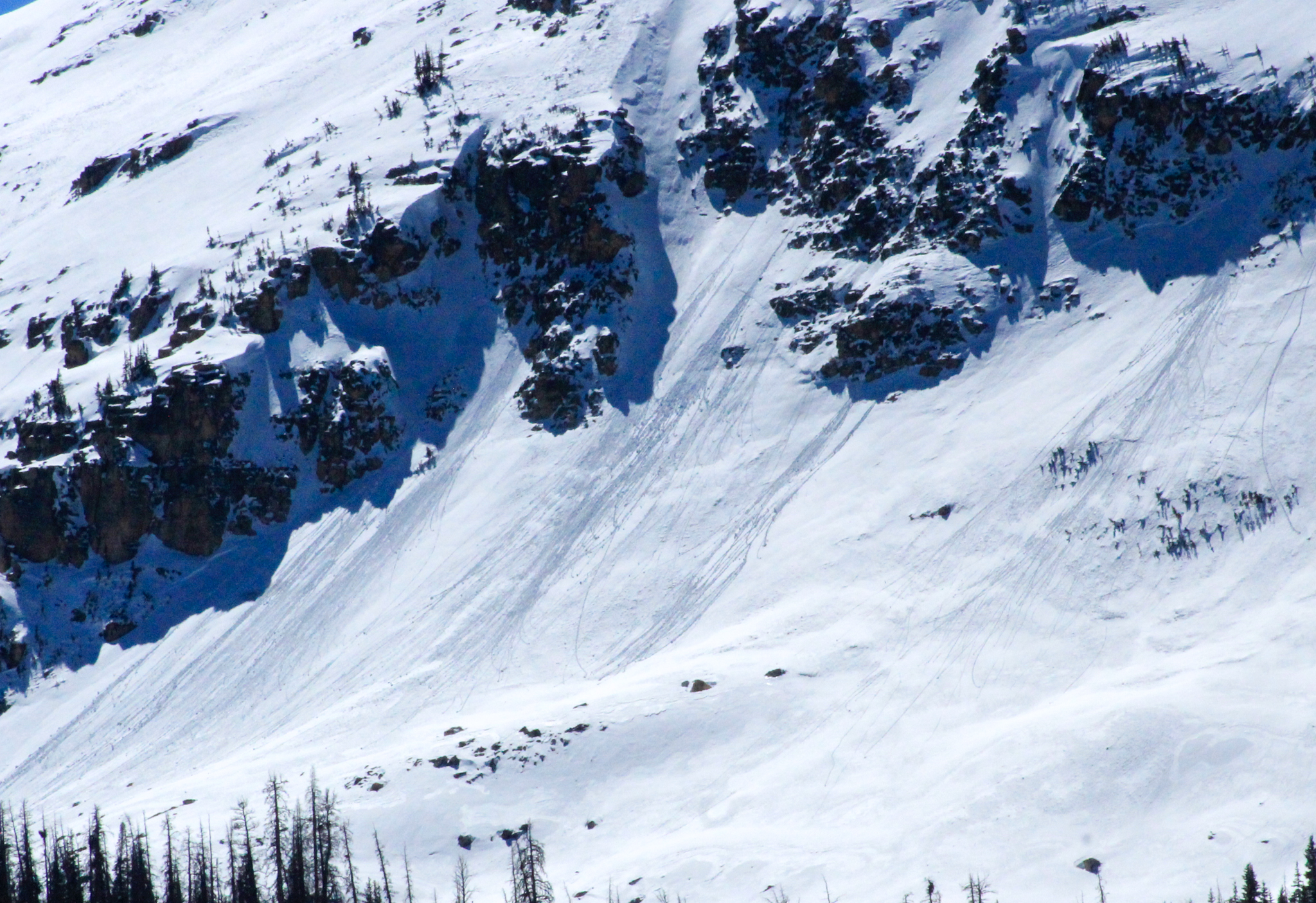
Yesterday, the most significant avalanche observed was during the mid-afternoon warm-up on Haystack, where a natural cornice fall triggered a decent sized slab avalanche in steep and rocky terrain above treeline. 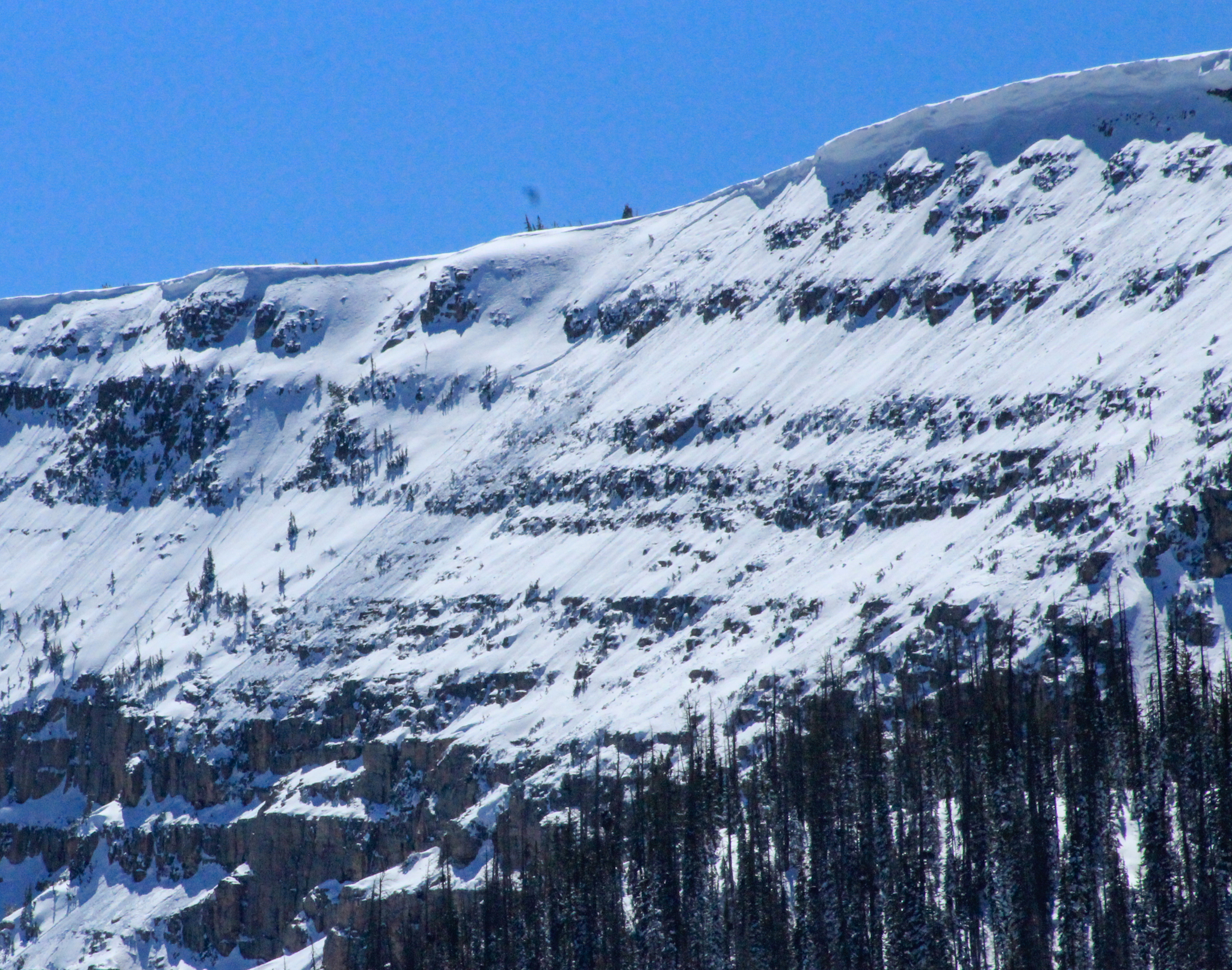 At 11,000' on Haystack mountain, a slab avalanche failed naturally when a cornice broke above it from day-time heating, falling onto the slope below and subsequently triggering the avalanche below.


 Roller balls and pinwheels coming down the apron late in the day in the alpine. No major wet activity was noted, but this is a tell-tale red flag that things are heating up out there -- Watch for more of the same, today.
 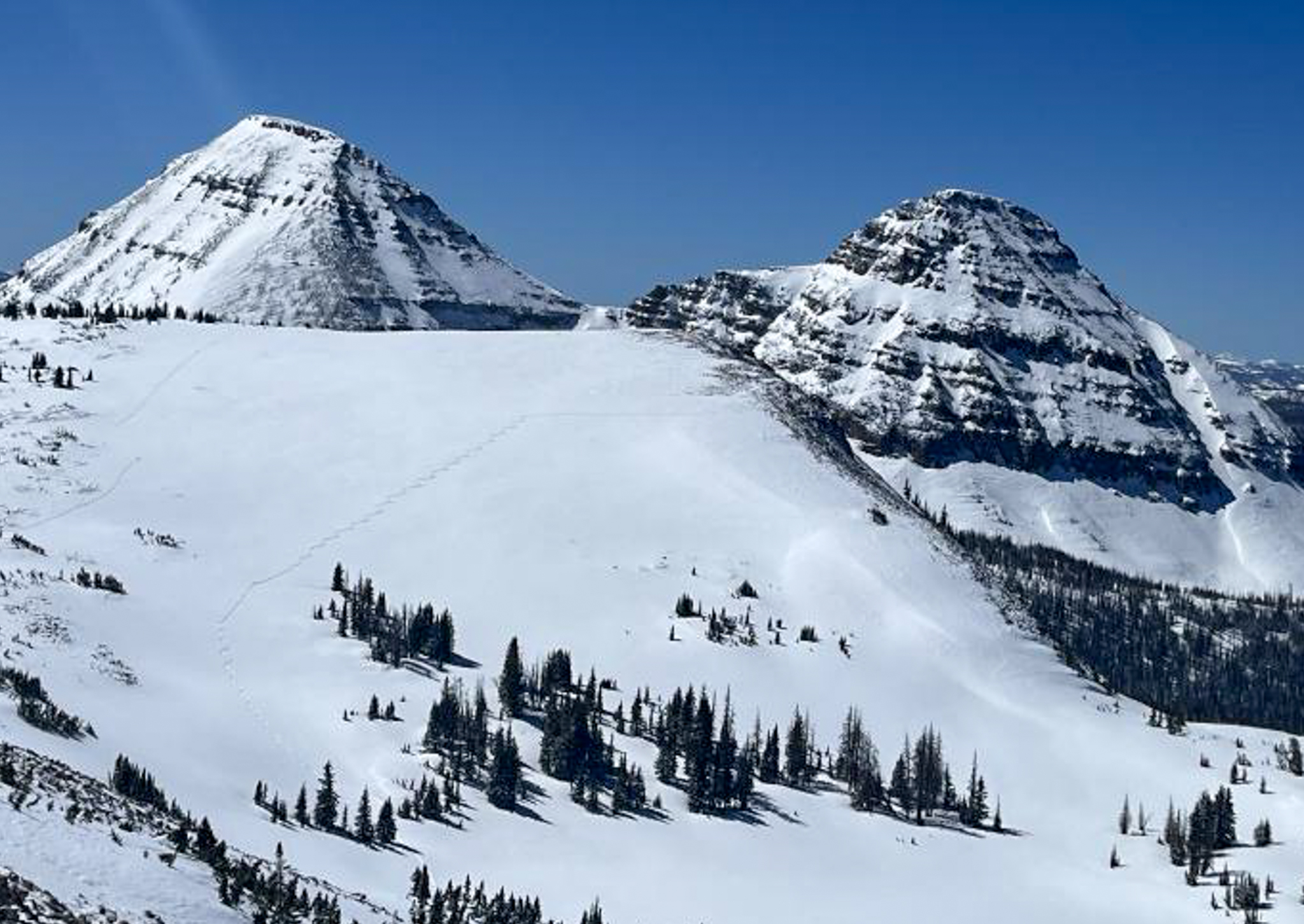 Ted was over near Lofty Peak working a beautiful canvas and noted, " No wet snow issues up high today, the north wind and slightly cool temperatures kept the wet issues in check. With warming temps the new snow should start to get unstable as the spring sunshine beats down."


