Forecast for the Uintas Area Mountains

Craig Gordon
Issued by Craig Gordon for
Thursday, March 28, 2019
The avalanche danger is generally LOW until you climb into the wind zone. While limited to a small percentage of the terrain available to ride in today, at and above treeline you'll find MODERATE avalanche danger. Human triggered DRY SNOW avalanches are POSSIBLE, especially on steep leeward slopes facing the north half of the compass.
Low
Moderate
Considerable
High
Extreme
Learn how to read the forecast here
Special Announcements
We need your help. In an effort to increase awareness and prevent future fatalities we need to reach more people with our daily avalanche forecasts, expand the Know Before You Go program, and increase the number of on-snow avalanche courses. Please consider a donation to the UAC to help us raise $25,000 by April 8. Show your support of the UAC by making a donation HERE
Weather and Snow
Clouds drifted into the region overnight, keeping temperatures relatively mild, dipping into the upper 20's and low 30's. In addition, a stray snow shower or two delivered a thin coat of white paint. The big news however are the southerly winds which crank 50-60 mph along the high ridges. Cold, dry snow is a limited commodity, as all but the highest north facing terrain will be crusty first thing out of the gates this morning.
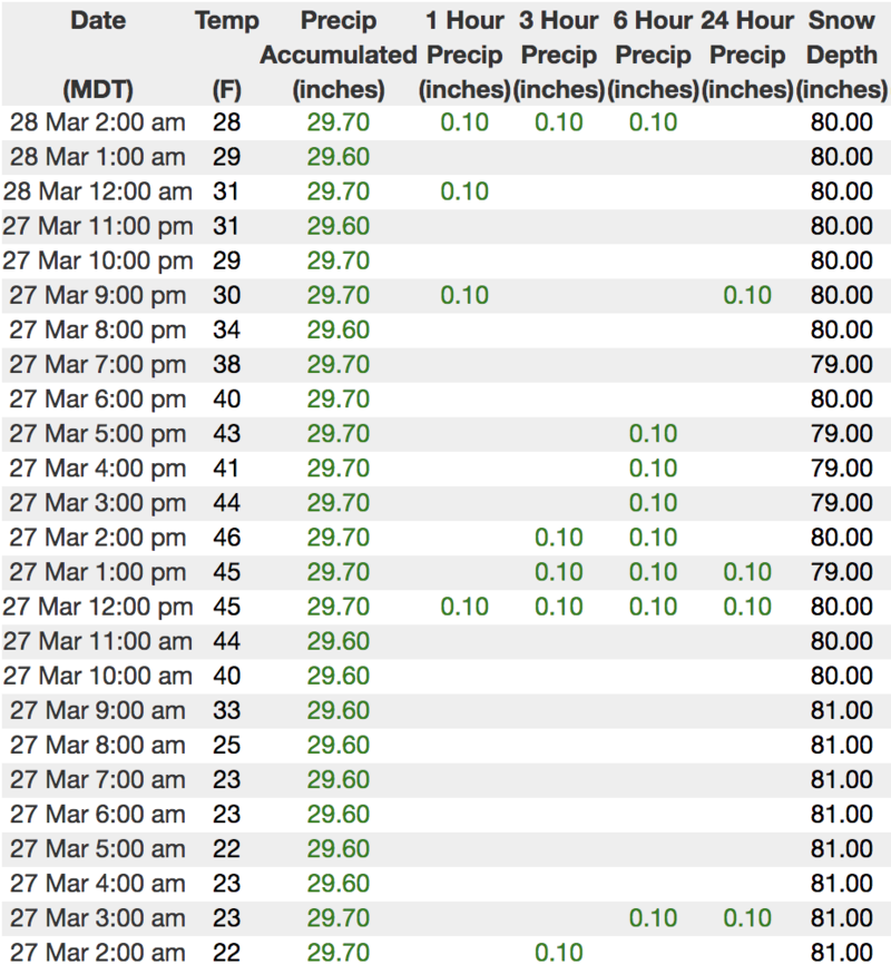
Above is hourly data from Trial Lake (9,945')
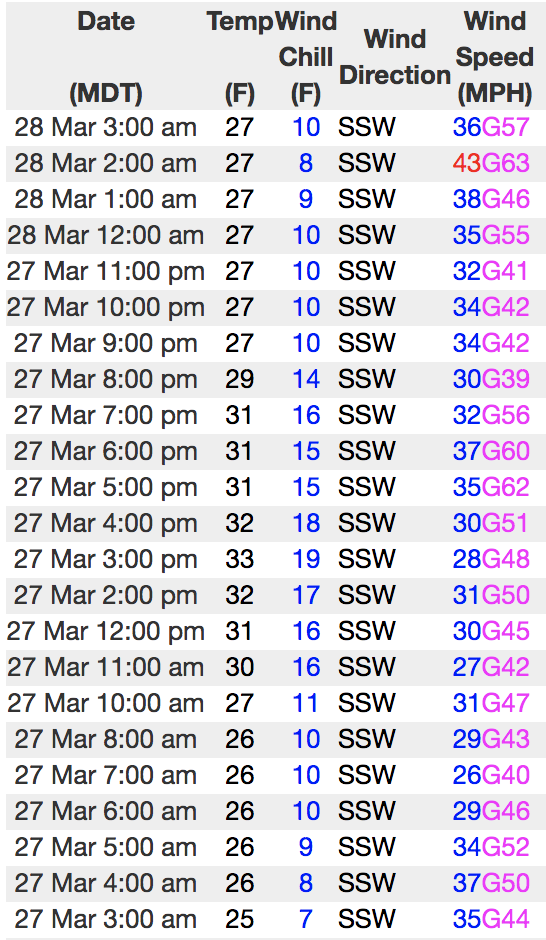
And Lofty Lake Peak (11,186').... which is alive thanks to the hard work of Ted Scroggin, Sean Smith, and Bo Torrey
To view more regional weather stations click here.
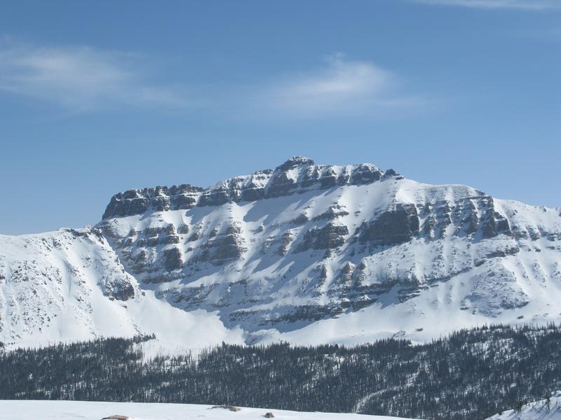
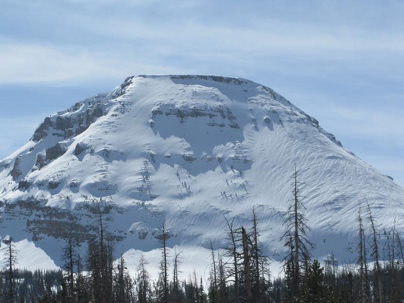
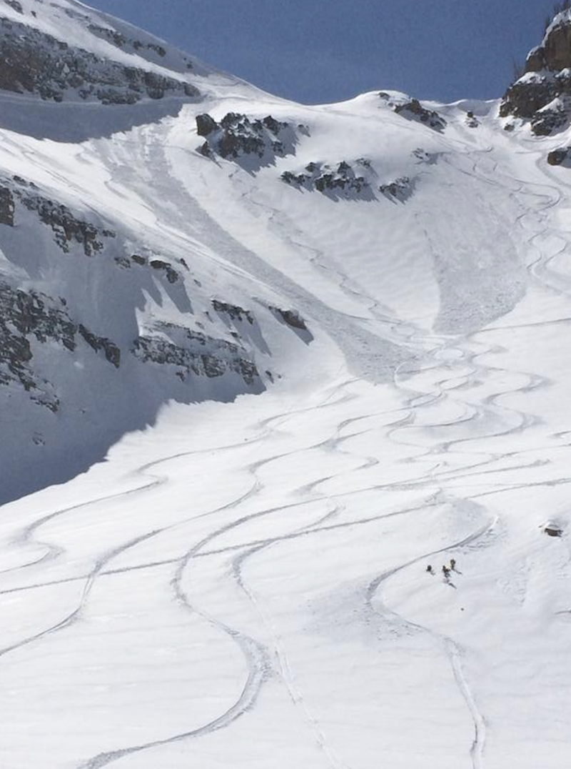
Surreal... the Uinta's are stunningly white. On a go-anywhere-base and a phat Uinta snowpack, overall coverage is about as good as it gets on the eastern front.
Recent Avalanches
No significant avalanche activity to report from Wednesday.
Recent trip reports and avy activity found HERE.
Ad
Avalanche Problem #1
Wind Drifted Snow
Type
Location
Likelihood
Size
Description
The Uinta's are a huge range and while an inch or two of fresh snow might not seem like much, when coupled with strong ridgetop winds, this combo will conspire to form stiff wind slabs sensitive to our additional weight... similar to the image above from Monday. Limited to steep, upper elevation, leeward slopes in the wind zone, today you'll want to continue looking for and avoiding any fat, rounded piece of snow, especially if it sounds hollow like a drum.
And finally don't forget-
Cornices are ginormous and may break back further than you might expect. You definitely wanna give these large, unpredictable pieces of snow a wide berth and not ruin someones day below by inadvertently knocking a boxcar size piece of snow down on them.
Additional Information
Strong southerly winds continue this morning, blowing 40-60 mph along the high peaks, but should relax later this morning. High temperatures climb into the mid 30's with snow showers developing late this afternoon. Overnight, a colder storm moves in bringing strong northwest winds, colder temperatures, and steady snow.
General Announcements
The information in this advisory expires 24 hours after the date and time posted, but will be updated by 7:00 AM Friday March 29th, 2019.
If you're getting out and about, please let me know what you're seeing especially if you see or trigger and avalanche. I can be reached at [email protected] or 801-231-2170
It's also a good time to set up one of our very popular avalanche awareness classes. Reach out to me and I'll make it happen.
This information does not apply to developed ski areas or highways where avalanche control is normally done. This advisory is from the U.S.D.A. Forest Service, which is solely responsible for its content. This advisory describes general avalanche conditions and local variations always occur.