A new version the UAC's mobile app has been released with many new features and performance improvements. Download our app today, available on iPhone and Android. Learn more HERE.
Join Caroline Miller, UAC Executive Director, tonight, March 25th at 6pm in exploring a life-altering accident in the mountains. Broken Neck, Broken Systems is a deeper dive into decision-making in the mountains. Learn more HERE.
Nowcast - Dang... it's warm and I bet the snow supportability is going to deteriorate quickly! Even with clear skies overnight, temperatures only dipped into the mid and upper 40's where they hover at o'dark thirty this morning. Near the high peaks, winds blow in the 30's from the west and southwest.
Forecast - A cool front is headed our way tonight, but until then we can expect strong high pressure to deliver mostly sunny skies with record high temperatures soaring into the mid 60's. Winds blow from the southwest, increasing into the obnoxious category at 30 to 40 mph near the high ridges late this afternoon. Overnight lows dip into the low 40's.
Futurecast - Slightly cooler temps wrap up the work week. Get yer chores done and garage sale items organized while the riding is marginal (hmm... do I really need three leaf rakes... one with a half broken handle ?). There's a suggestion for a potential pattern shift to wetter, cooler weather next week.
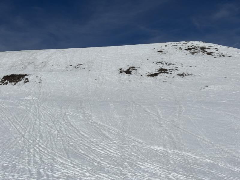
Travel Conditions - It ain't for the faint of heart out there right now! Price of admission is high, but believe it or else, Mill Hollow and Wolf Creek Summit offer the best coverage for contiguous snow access. For the brave, there's some soft snow out there, but timing is everything. Sledders, get on it while the snow is softening to keep your ride cool. Human-powered folk, you may get lucky with some supportable, soft turns by playing the timing game earlier in the day. Either way, you can't beat a day when the suns out, whilst yer guns are out and firin' in the mountains!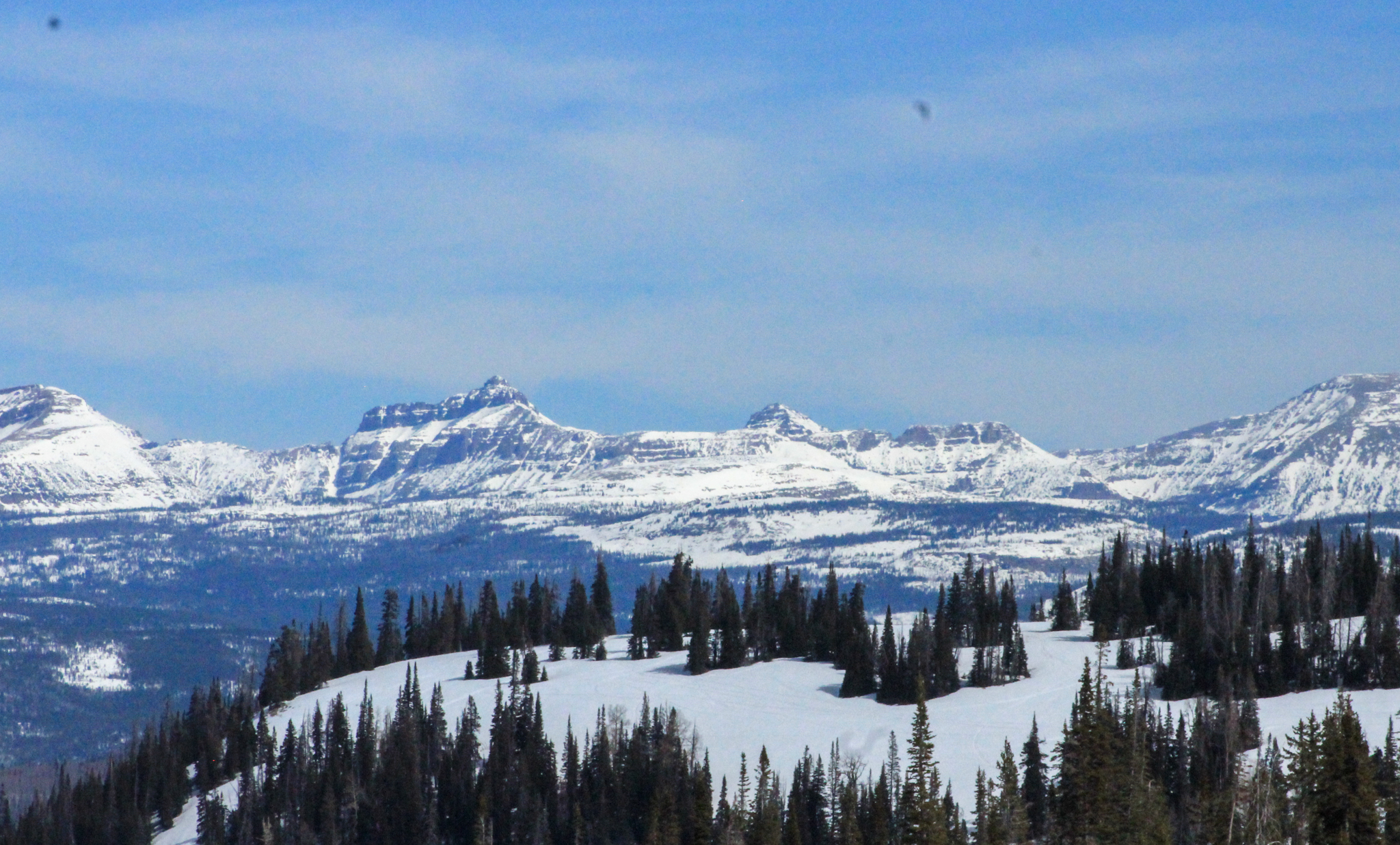
Looking east towards the High Uintas and Central Mountains, there's plenty of snow on polar slopes above 10,000'. Below that... travel, access, and type 2 fun conditions present some serious challenges and oh yeah... lack of coverage.
Traveling around Wolf Creek yesterday I thought to myself... "pretty surreal, this upper elevation, solar slope should be deep and phat with snow. Instead it's starting to look more like June than March."
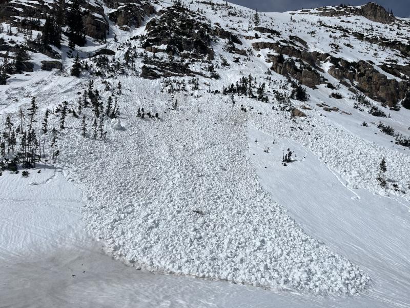
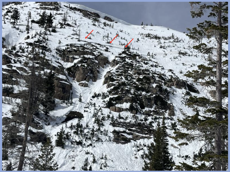
Yesterday, Ted spun a lap around HWY 150 and spotted this couple day old avalanche near Mt. Marsell. Looks like a piece of cornice peeled off the ridge and gouged to weak snow in a shallow, rocky section of the slope.
Recent slides and trip reports from across the range are just a click away... below!