March Kicks Off Our Spring Campaign- Donate Now to Support Forecasting

Forecast for the Uintas Area Mountains

Craig Gordon
Issued by Craig Gordon on
Sunday morning, March 22, 2020
Today's avalanche hazard is pretty straightforward and easily managed with terrain choices, including aspect and elevation-
While the avalanche danger is generally LOW across the range, there are isolated places where you could trigger an old wind drift, especially in steep terrain above treeline in the wind zone. And here's something to consider... if you're getting onto steep, technical slopes, even a small slide can knock you off your ride, potentially slam you into a tree, and throw a curve ball at your day.
In addition, the sun is high in the sky and steep, sunny slopes at all elevations will take on some heat today and become moist. As the day heats up, you'll want to get off steep slopes, especially if the snow feels damp, manky, or unsupportable.
Low
Moderate
Considerable
High
Extreme
Learn how to read the forecast here
Special Announcements
We know there is a lot of uncertainty regarding the Coronavirus, but the Utah Avalanche Center is planning to continue issuing regular avalanche forecasts into April.
Uphill Travel at Ski Areas -
Some resorts will be offering limited uphill access but not all do. Up to date info about uphill access from Ski Utah is posted HERE.
Weather and Snow
Currently-
Under mostly cloudy skies, scattered snow showers are beginning to clear. Yesterday's brief burst of snow added another couple inches to the already cold, deep, and light 12" storm totals. Temperatures are in the teens and southwest winds blow 15-25 mph along the high ridges. On a go-anywhere base, the range is phat and white... riding and turning conditions are about as a good as they get.
Uinta weather network info is found here. Simply click on the Western Uinta tab.
For today-
Since I totally blew yesterday's weather I'll try again... short-lived high pressure begins to build, producing partly cloudy skies, though an afternoon snow shower isn't out of the question. Temperatures rise into the 30's and westerly winds remain reasonable, blowing 15-25 mph along the ridges.
Futurecast-
The next storm system spreads moisture into the area tomorrow afternoon. Unsettled conditions continue through Tuesday before a cold front pushes through the area Tuesday night/Wednesday.
Recent Avalanches
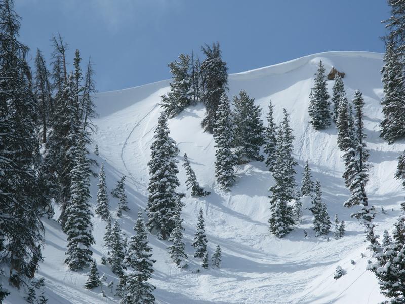
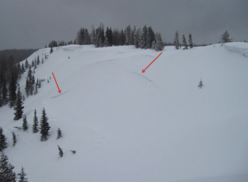
Ted and I found shallow sluffs and a few soft slabs on steep northerly slopes, otherwise no significant avalanche activity to report.
To view additional trip reports and recent avalanche activity, simply click here.
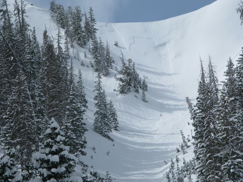
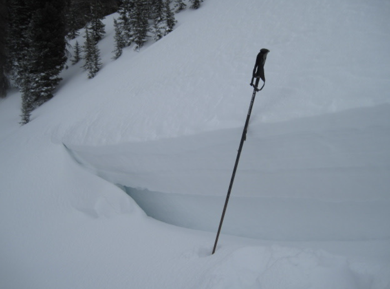
Below is a noteworthy slide from last weekend-
Ted was on the east side of the range yesterday near Elizabeth Pass and discovered the week old slide in the image above. Most likely triggered by cornice fall during the strong winds last weekend and failing on a facet/crust sandwich, Ted noted crown depth ranging from 2'-5' deep and says.... "This is likely a real outlier, but for me it is a good reminder that a buried crust with faceted snow above and below can still be a layer to keep an eye on." Sage advice from a savvy snow pro, key forecaster, and valued member of the UAC team.
Ad
Avalanche Problem #1
Normal Caution
Type
Location
Likelihood
Size
Description
In a sea of manageable avalanche danger here are a few considerations...
Dry snow-
Isolated to steep, leeward terrain in the wind zone, there might be a lingering wind drift or two, or shallow loose snow sluff that'll react to your additional weight. Not particularly widespread, but remember... if you're tagging steep, technical terrain, be aware that even a small slide could surprise you and possibly knock you off your feet and boss you around. So, the ticket to riding safely today is simply look for and avoid any fat, rounded piece of snow, especially if it sounds hollow like a drum.
Damp snow-
If the snow you're riding on becomes damp, manky, and unsupportable, simply change aspect and elevation and set your sights on colder snow.
Additional Information
After my field day in Weber Canyon, I rallied over to Nobletts to buff out the Are You Beeping checkpoint and Beacon Basin. Looking over what was an obviously packed parking lot, it was sorta like showing up after a multi-day music festival. The main event played it's last song and only a few die hards are left to possibly get their tour t-shirts autographed... yup, a great couple of days had by all and we're looking forward to a new setlist :)
General Announcements
The information in this forecast expires in 24 hours, but will be updated by 7:00 AM Monday Mar. 23rd.
This forecast is updated daily by 7:00 AM.
In the mean-time, if you see or trigger an avalanche or just wanna let me know what you're seeing you can reach me directly at 801-231-2170
The information in this forecast is from the US Forest Service which is solely responsible for its content.