March Kicks Off Our Spring Campaign- Donate Now to Support Forecasting

Forecast for the Uintas Area Mountains

Craig Gordon
Issued by Craig Gordon on
Monday morning, March 23, 2020
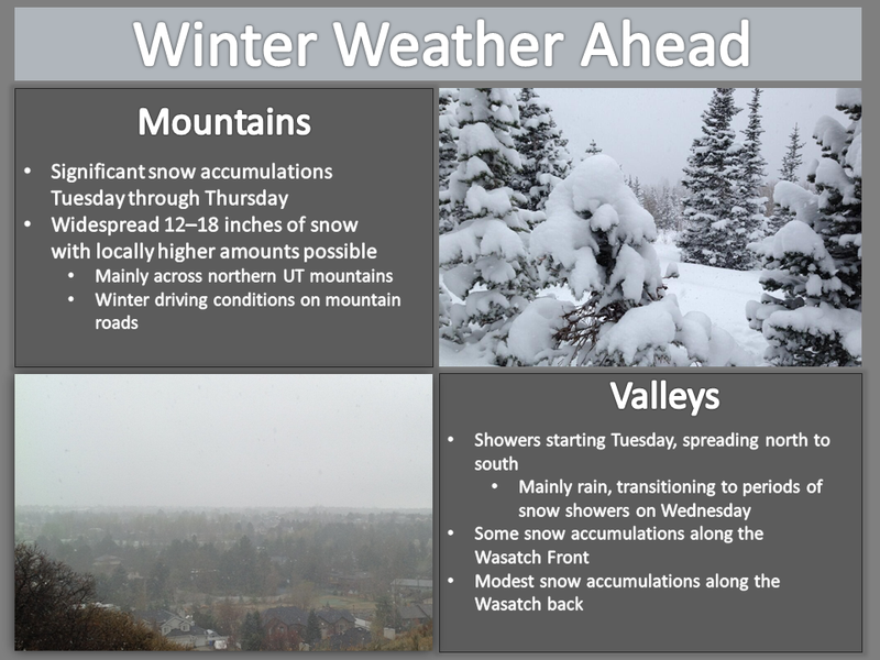
Heads up... avalanche danger ramped up overnight and will continue evolving as winter returns from its hiatus-
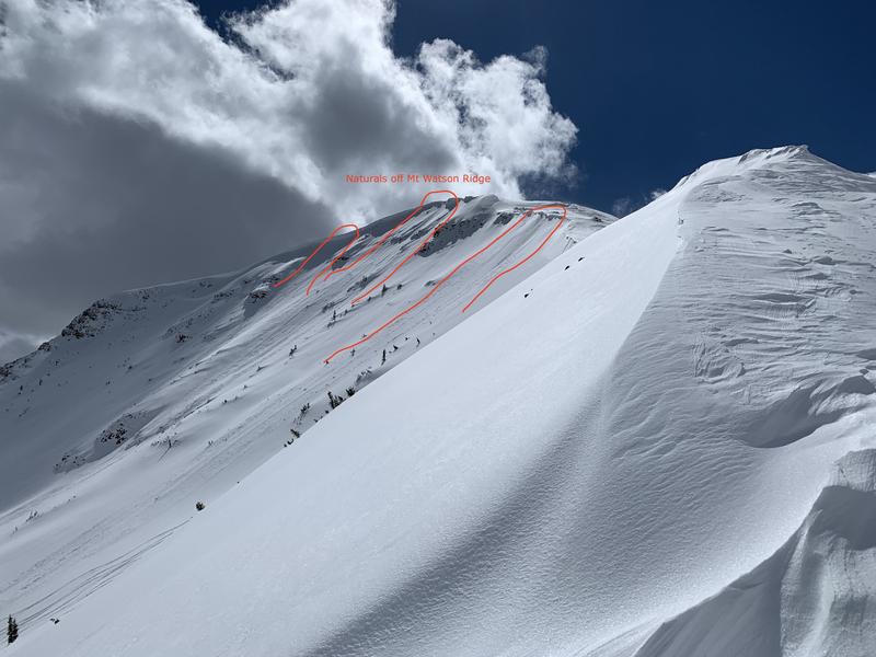
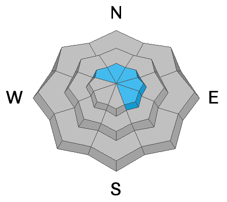
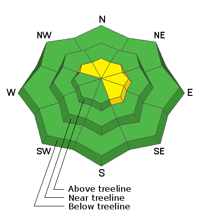
In the wind zone, at and above treeline, MODERATE avalanche danger exists in wind drifted terrain facing the north half of the compass. Human triggered avalanches are possible, especially on steep leeward slopes, particularly those with an easterly component to its aspect.
Lose some elevation, you lose the problem, and still have a great day of riding. Wind sheltered mid and low elevation terrain offers generally LOW avalanche danger.
Low
Moderate
Considerable
High
Extreme
Learn how to read the forecast here
Special Announcements
UAC operating schedule - We will continue issuing regular avalanche forecasts into mid April.
Spring Awareness Campaign - The UAC counts on donations from the backcountry community. We know these are uncertain times and any donation during our awareness campaign will help us continue providing avalanche forecasting and education.
CDC Guidelines - Even in the backcountry and in parking lots, please follow CDC guidelines like limiting group size and keeping a distance of at least 6 feet from other people to protect yourself and others. Read the guidelines HERE.
Taking risks - Be extra conservative to avoid the risk of accidents which can stress the capacity of our medical system.
Skiing and riding at closed ski resorts - Some resorts allow access now and some do not. Please check HERE for the latest info on ski area access.
New to the backcountry (including riding at closed resorts) - Watch the award-winning, 15 minute Know Before You Go video, or take the 5-part, free online-learning series.
Weather and Snow
Currently-
Another couple inches of light density snow fell yesterday and storm totals since last Thursday are generally in the 12"-16" range. The remnants of that multi-day storm system are winding down and exiting the state, producing partly cloudy skies with temperatures in the teens and low 20's. Our recent stretch of light winds changed right around midnight, and southerly winds ramped into the 20's and 30's along the high peaks. On a go-anywhere base, the range is phat and white... riding and turning conditions are about as a good as they get.
Uinta weather network info is found here. Simply click on the Western Uinta tab.
For today-
While the bulk of today's storm is to the south of our zone, we should still increasing clouds with light snow developing this afternoon. A few inches stack up late in the day into early Tuesday morning. High temperatures climb into the upper 20's and southwesterly winds blow in the 30's along the high ridges.
Futurecast-
The main event arrives late tomorrow and lingers into Thursday, producing a good shot of snow.
Recent Avalanches
Chad stomped around Mount Watson yesterday and found a few shallow soft slabs which ran naturally Saturday night, along with recent wind drifts reactive to his additional weight.
To view additional trip reports and recent avalanche activity, simply click here.
Ad
Avalanche Problem #1
Wind Drifted Snow
Type
Location
Likelihood
Size
Description
Follow the wind and you find the avalanche problem. The image above, a 24 hour data dump from Lofty Lake Peak (11,186'), clearly illustrates southerly winds ramping up since midnight.
Here's the setup-
Last weeks cold storm, slowly stacked up 12"-16" of light density snow in the Uinta high country, winds were generally light and reasonable, and the range remained cold through the weekend. Of course, this trifecta made for epic late March riding conditions. However, that party is ending... as winds ramp up and with no shortage of snow to blow around, fresh wind drifts form rapidly today, and they'll be sensitive to our additional weight. While not particularly alarming to begin with, today's continued winds form more connected drifts, and by days end, these stiff pieces of snow become more reactive to our additional weight and begin to breaking deeper and wider than we might expect. So, get after it early in the day and look for changing weather conditions as the day progresses. The key to riding safely is... be flexible with your travels plans and adjust objectives if you're starting to see or feel obvious clues to unstable snow like shooting cracks, sudden collapses, or the biggest clue to avalanches.... and of course that's avalanches!
General Announcements
The information in this forecast expires in 24 hours, but will be updated by 7:00 AM Tuesday Mar. 24th.
This forecast is updated daily by 7:00 AM.
In the mean-time, if you see or trigger an avalanche or just wanna let me know what you're seeing you can reach me directly at 801-231-2170
The information in this forecast is from the US Forest Service which is solely responsible for its content.