Forecast for the Uintas Area Mountains

Issued by Craig Gordon on
Sunday morning, March 21, 2021
Sunday morning, March 21, 2021
Heads up... if the sun comes out for any length of time, expect the danger of wet avalanche activity to instantly spike on steep sun-exposed slopes.
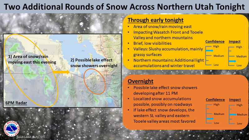
In the wind zone, at and above treeline you'll find CONSIDERABLE avalanche danger and human triggered avalanches are LIKELY, especially on steep, wind drifted, leeward slopes facing the north half of the compass.
And here's something to consider... if you're getting into steep, technical terrain, even a small slide can knock you off your ride, potentially slam you into a tree, and throw a curve ball at your day.
Lose some elevation and the avalanche danger is more straight-forward. Mid elevation leeward terrain offers MODERATE avalanche danger and human triggered slides are POSSIBLE on steep wind drifted slopes.
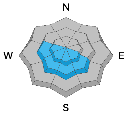
Low elevation wind sheltered terrain offers generally LOW avalanche danger.

Low
Moderate
Considerable
High
Extreme
Learn how to read the forecast here