We know there is a lot of uncertainty regarding the Coronavirus, but the Utah Avalanche Center is planning to continue issuing regular avalanche forecasts into April.
Uphill Travel at Ski Areas -
Some resorts will be offering limited uphill access but not all do. Up to date info about uphill access from Ski Utah is posted HERE. Currently-
Skies cleared overnight, yet temperatures remained on the mild side, currently registering in upper 20's and low 30's. Southerly winds have mellowed somewhat, but are still pretty obnoxious, blowing 30-50 mph along the high ridges.
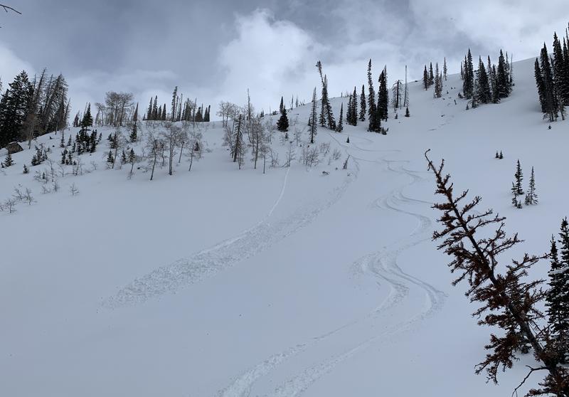
The good news is... recent storms vastly improved riding conditions. Wind sheltered, upper elevation terrain offers soft, settled, cold snow and depending on elevation, sunny slopes deliver supportable corn for a couple hours in the morning.
Uinta weather network info is found here. Simply click on the Western Uinta tab.
For today-
Look for mostly sunny skies for most of the day and continued mild temperatures with highs climbing into the mid 40's. Southwest winds blow in the 30's and 40's, gusting into the 50's along the high peaks. Clouds increase late in the day with a slight chance of scattered snow showers.
Futurecast-
A weakening storm crosses the region mid week, with a better chance for widespread precip. along with cooler temperatures sliding through our zone late Thursday into Friday.
From Saturday-
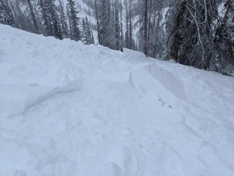
Michael J intentionally triggered this well connected soft slab along the leeward side of a steep wind drifted slope near Hoyt Peak... definitely big enough to let you know who's Boss (and I ain't talkin' Springsteen... yo :)
Mike's insight and great trip report from yesterday is found
here.To view additional trip reports and recent avalanche activity, simply click
here.