Forecast for the Uintas Area Mountains

Craig Gordon
Issued by Craig Gordon for
Tuesday, March 14, 2023
Expect rising avalanche danger later today and overnight, ramping up and becoming dangerously sketchy on Wednesday-
For this morning, pockets of CONSIDERABLE avalanche danger exist on steep, upper elevation leeward slopes, especially those in the wind zone facing the north half of the compass. Both new and older wind drifted slopes are suspect and human triggered avalanches LIKELY, particularly on slopes with an easterly component to their aspect. MODERATE avalanche danger is found on mid elevation, shady slopes, where strong wind whips up fresh drifts sensitive to our additional weight and human triggered avalanches are POSSIBLE. You'll find LOW avalanche danger on most lower elevation terrain and slopes facing the south half of the compass where human triggered avalanches are UNLIKELY.

Low
Moderate
Considerable
High
Extreme
Learn how to read the forecast here
Special Announcements
I am currently working with the operation involved in the March 9th avalanche accident in Weber Canyon and preparing a report. Please be patient as I sort out the details of this complicated incident. A preliminary report is available HERE.
Weather and Snow
Nowcast- Clouds slide into the northwest corner of the state early this morning and temperatures finish up the swing shift registering in the teens and mid 20's. West and southwest winds blow 15-25 mph along the high ridges. I know you're searching for quality riding conditions and it's all about aspect this time of year... solars have taken on heat and are crusty, but polars offer cold, settled snow on mid and upper elevation shady slopes.
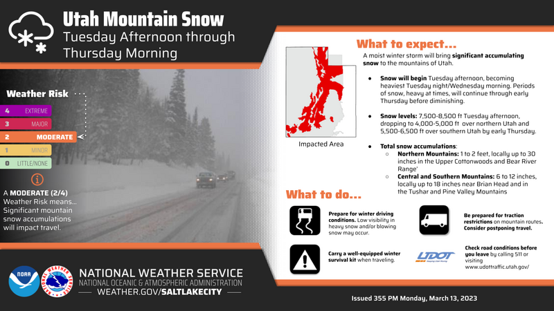
Forecast- Hang on to your hats... if you wear 'em :) A warm, wet, windy storm is on the doorstep. Clouds thicken throughout the day, temperatures climb into the upper 30's, and southwest winds crank into the 50's along the ridges with higher gusts near the peaks by dinnertime. Snow develops late tonight and continues into Wednesday.
Futurecast- The party gets going Wednesday as a very robust AR slams into the sate. Expect dense, heavy snow, ripping winds, and warm temperatures. As cold air filters into the region late in the day, snow densities decrease overnight and we'll see scattered snow showers linger into Thursday. Storm totals in the 18"-24" range with nearly 2" of H2O seem reasonable.
Robert Zimmerman might not need a weatherman to know which way the wind blows, but it sure is nice to have our partners at the NWS help determine how much snow and water is gonna stack up. We are grateful for this decades-long relationship and the graphic above helps all of us determine a better timeline for the upcoming storm.
Detailed trip reports and recent obs are found HERE.
Recent Avalanches
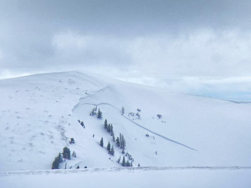
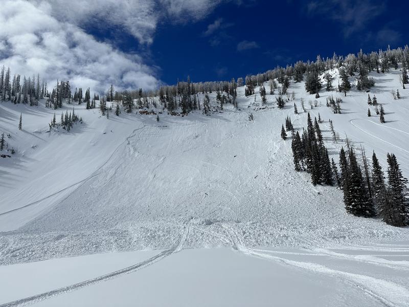
We're still taking inventory of all the recent natural avalanche activity that was driven by Friday's storm, but a common theme is... steep, wind drifted, terrain with an east aspect to its orientation around the range came to life with many large avalanches breaking deep and wide. (like this slide in Upper Chalk Creek)
But wait, there's more... plenty of avy activity to peruse if ya wanna geek out. Click HERE to track this years slide activity throughout the range.
Ad
Avalanche Problem #1
Wind Drifted Snow
Type
Location
Likelihood
Size
Description
Yeah they're getting harder to trigger, but once you pull the legs out from underneath like this piece of snow in the image above near Hoyt Peak on Saturday, any slide triggered today will pack a powerful punch.
Wind drifted slopes were quite reactive on Saturday, less so Sunday and Monday, and I think today they're even more stubborn and harder to trigger, but still have the potential to break deeper and wider than you might expect. In other words... there's enough volume to easily knock you off your feet and take you for an unexpected ride. If your objective is tagging sustained steep terrain, please consider the consequences of triggering a slide and have an exit strategy in place. No mystery here as this avalanche dragon is straight-forward and easy to avoid. Lose the wind and you lose the problem.

Additional Information
Weather stations-
And... rime events from January's atmospheric rivers severely crippled the Uinta weather station network. I'm working to get it back up and running, but a few stations are found HERE (click weather stations, and then on the Western Uinta tab)
Observations-
Your observations are important, so please let me know what you're seeing... click HERE and contribute to this amazing community-based program
General Announcements
Issued at 03:37 on Tuesday March 14th this forecast expires 24 hours after the date and time posted, but will be updated by 07:00 Wednesday March 15th 2023.
Before it gets too crazy, now is the time to book an avalanche awareness presentation for your group, club, or posse. You can reach Craig directly at 801-231-2170 or [email protected].

This forecast is from the U.S.D.A. Forest Service, which is solely responsible for its content. This forecast describes general avalanche conditions and local variations always occur.