I am currently working with the operation involved in the March 9th avalanche accident in Weber Canyon and preparing a report. Please be patient as I sort out the details of this complicated incident. A preliminary report is available
HERE.Nowcast- Yesterday's hit or miss snow showers delivered a nice coat of white paint adding up to 6" of spongy, white goodness. A brief overnight clearing gives way to high, thin clouds drifting into the region early this morning, as another weak weather system brushes the north half of the state. Temperatures register in the teens and low 20's, while light westerly winds barely spin ridge top anemometers, blowing just 5-15 mph. I know you're searching for quality riding conditions and it's all about aspect this time of year... solars have taken on heat and are crusty, but polars offer cold, settled snow on mid and upper elevation shady slopes.
Forecast- Look for a relatively warm, spring-like day with scattered snow showers developing as the day wares on. Temperatures climb into the mid and upper 30's while westerly winds remain rather well-behaved in the morning, bumping into the 30's along the high ridges late this afternoon.
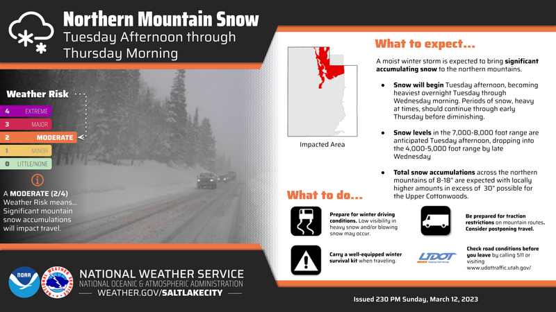
Futurecast- A warm, wet, windy storm develops late Tuesday as an Atmospheric River (AR) has its sights set on the state. Winds begin cranking late in the day, coupled with dense, heavy snow overnight. The party really gets going Wednesday as a solid shot of moistures sweeps through the Uinta's. Colder air is slated to arrive late Wednesday night, winds shift to the northwest and scattered snow showers linger into Thursday. AR's can be fickle and tough to forecast for, but I think 18"-24" of snow with a couple inches of water is a good bet by Thursday morning.
Above is a timeline for the next couple days, crafted by our good friends at the NWS located right here in the City of Salt.
Detailed trip reports and recent obs are found
HERE.
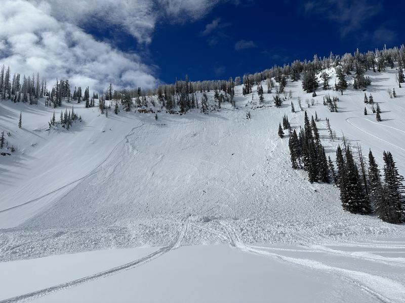
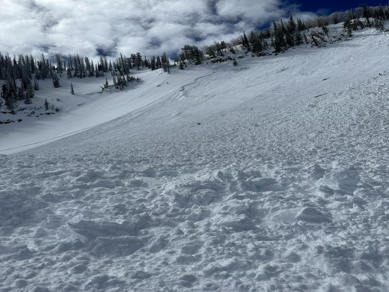
From Saturday near
Hoyt Peak, Max reported this well connected, sled triggered, storm slab avalanche on a steep, east facing, wind drifted slope.
But wait, there's more... plenty of avy activity to peruse if ya wanna geek out. Click
HERE to track this years slide activity throughout the range.