Forecast for the Uintas Area Mountains

Craig Gordon
Issued by Craig Gordon for
Thursday, March 14, 2019
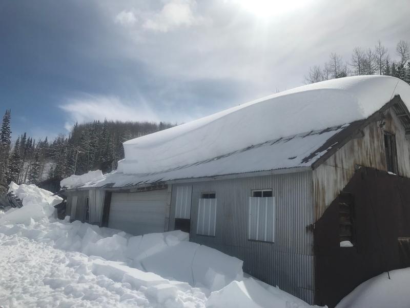
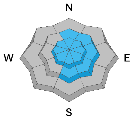
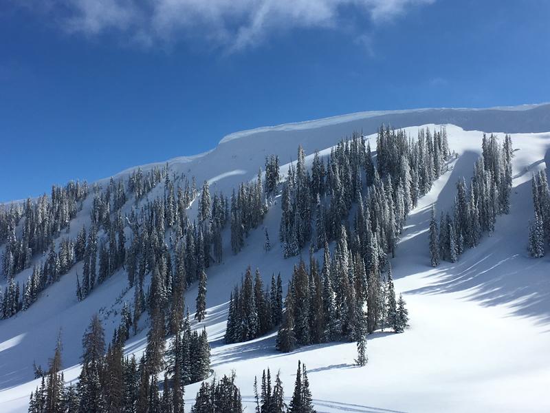
In the wind zone, at and above treeline, you'll find CONSIDERABLE avalanche danger. Human triggered avalanches, breaking a couple feet deep in the new storm snow, are LIKELY on all steep wind drifted slopes, especially those facing northeast, east, southeast and south.
While less widespread, steep slopes at mid elevations offer MODERATE avalanche danger and human triggered avalanches are POSSIBLE on steep wind drifted slopes.
Lose the wind and you lose the problem. Simply steer towards wind sheltered terrain where you'll find LOW avalanche danger.
Low
Moderate
Considerable
High
Extreme
Learn how to read the forecast here
Weather and Snow
WOW.... what a storm! Snow totals are very region specific and the North Slope crushed its nearest competitors clocking in with 18" of uber-light density snow. Terrain on the south half of the range, from Trail Lake to Strawberry, missed the powder party memo and storm totals register in the 6"-8" range. In either case it'll be an epic day, though the further north you travel, the deeper the storm snow. Yep.... over-the-hood and over-the-head :)
Currently, under mostly cloudy skies light snow is falling and temperatures are in the single digits. West and northwest winds blew in the 30's yesterday, adding a bit o' burliness to ridgeline travel, but backed off around 10:00 last night and have been blowing in the teens and 20's overnight.
Above is hourly data from Chalk Creek (9,169') and Windy Peak (10,662'). To view more regional weather stations click here.
Recent Avalanches
Yesterday, reports streamed in of very sensitive, yet shallow new wind drifts along the leeward side of upper elevation ridges, whilst... cabins, sheds, and other structures located in snowbelt mountain communities continue to shed their winter coats.
Recent trip reports and avy activity found HERE.
Ad
Avalanche Problem #1
Wind Drifted Snow
Type
Location
Likelihood
Size
Description
Last night's ultra-light density snow fell straight out of the sky and will sluff easily on steep slopes. However, don't get fooled into thinking that's the only avalanche game in town.... underneath the last gasps of storm snow are yesterday's wind drifts, which are now covered over with fresh snow, making them hard to detect. Sensitive to our additional weight, you'll find today's drifts limited to steep, leeward, mid and upper elevation terrain.
While manageably breaking at or below our skis, board, or sled today's fresh slabs may break slightly deeper and wider than you might expect. So, the best way to manage this setup is to simply look for and avoid any fat, rounded piece of snow, especially if it sounds hollow like a drum.
And don't forget-
Cornices are ginormous and may break back further than you might expect. You definitely wanna give these large, unpredictable pieces of snow a wide berth and not ruin someones day below by inadvertently knocking a boxcar size piece of snow down on them
Additional Information
Scattered snow showers are on tap for this morning, with clearing skies as the day progresses. It'll be cold with highs only reaching into the upper teens. West and northwest winds remain well-behaved and in the 20's along the ridges. High pressure builds for Friday bringing a warm, dry spell to the region with no storms in sight through midweek.
General Announcements
The information in this advisory expires 24 hours after the date and time posted, but will be updated by 7:00 AM Friday March 15th, 2019.
If you're getting out and about, please let me know what you're seeing especially if you see or trigger and avalanche. I can be reached at [email protected] or 801-231-2170
It's also a good time to set up one of our very popular avalanche awareness classes. Reach out to me and I'll make it happen.
This information does not apply to developed ski areas or highways where avalanche control is normally done. This advisory is from the U.S.D.A. Forest Service, which is solely responsible for its content. This advisory describes general avalanche conditions and local variations always occur.