Forecast for the Uintas Area Mountains

Craig Gordon
Issued by Craig Gordon for
Wednesday, March 13, 2019
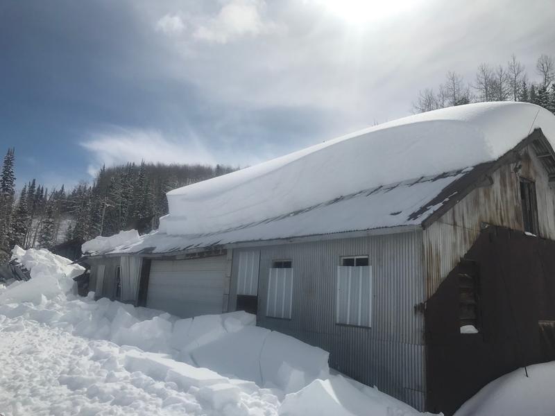
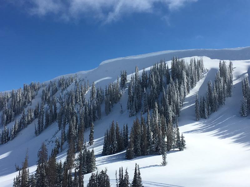
In steep, upper elevation terrain, at and above treeline, you'll find MODERATE avalanche danger. Human triggered avalanches are POSSIBLE on all steep wind drifted slopes, especially those facing northeast, east, southeast and south. While more the exception than the rule, any avalanche that breaks into deeper buried weak layers near the ground will result in a deep, dangerous slide.
Mid and lower elevation, lower angle, wind sheltered terrain offers generally LOW avalanche danger.
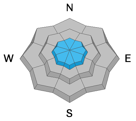
Low
Moderate
Considerable
High
Extreme
Learn how to read the forecast here
Weather and Snow
Overnight, a cold front slid through the region stacking up a couple inches of light density snow and the storm is just getting going. Temperatures have fallen into teens and low 20's and northwest winds began ramping up at o'dark thirty and currently blow 20-35 mph along the high peaks.
Riding and turning conditions are a mixed bag.... strong spring sunshine began baking many south facing slopes Monday, creating a breakable, albeit manageable suncrust and many popular areas are tracked out. However, on a go anywhere base, just switch aspect and swing over to the north half of the compass and you'll be rewarded with miles of untracked, soft, creamy snow.
Above is hourly data from Trial Lake (9,945') and Windy Peak (10,662'). To view more regional weather stations click here.
Recent Avalanches
No significant avalanche activity in the hills, but... cabins, sheds, and other structures located in snowbelt mountain communities continue to shed their winter coats.
Recent trip reports and avy activity found HERE.
Ad
Avalanche Problem #1
Wind Drifted Snow
Type
Location
Likelihood
Size
Description
Winds just started increasing with the arrival of the cold front, and they'll have no problem whipping today's light density storm snow into fresh drifts sensitive to our additional weight. Not widespread and limited to steep, leeward, upper elevation terrain, the best way to manage this setup is to simply look for and avoid any fat, rounded piece of snow, especially if it sounds hollow like a drum.
And don't forget-
Cornices are ginormous and may break back further than you might expect. You definitely wanna give these large, unpredictable pieces of snow a wide berth and not ruin someones day below by inadvertently knocking a boxcar size piece of snow down on them
Additional Information
We can expect a good shot of snow today and I think storm totals should clock in around 8"-12" before snow winds down early Thursday morning. Northwest winds blow in the 30's and 40's along the high ridges and temperatures don't vary much from where we're at this morning. High pressure begins building Thursday and becomes the dominant weather pattern through the middle of next week.
General Announcements
The information in this advisory expires 24 hours after the date and time posted, but will be updated by 7:00 AM Thursday March 14th, 2019.
If you're getting out and about, please let me know what you're seeing especially if you see or trigger and avalanche. I can be reached at [email protected] or 801-231-2170
It's also a good time to set up one of our very popular avalanche awareness classes. Reach out to me and I'll make it happen.
This information does not apply to developed ski areas or highways where avalanche control is normally done. This advisory is from the U.S.D.A. Forest Service, which is solely responsible for its content. This advisory describes general avalanche conditions and local variations always occur.