Nowcast- With mostly cloudy skies overhead, a few light snow showers linger as our storm winds down. Yeah it was a bit of a dud for us, though the North Slope was able to squeak out 8" of low density snow with the south half of the range registering in the 4" range. In either case, it was a much needed refresh and riding conditions remain all-time. Cold air filtering into the area ushered in crisp temperatures which start the work day in the single digits and teens as west-northwest winds blow in the mid 20's along the high ridges.
Forecast- Light snow showers continue through mid morning with a clearing trend slated as the day progresses. It'll feel refreshingly winter-like with high temperatures not varying much from where we're at this morning and overnight lows dipping into the single digits. Northerly winds should stay rather well-behaved, blowing in the 20's near the high peaks.
Futurecast- A beautiful day is on tap for Tuesday with mostly sunny skies, light winds, and temperatures climbing into the 20's. Minor brush-by's Wednesday and Thursday bring cooler temperatures and a flurry or two.
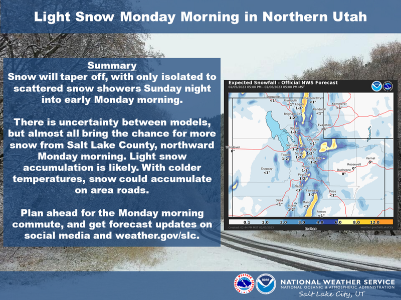
Our good friends and partners in all things weather, the SLC National Weather Service, map out our Monday morning mashup.
Huge thanks for all the great obs streaming in from the eastern front. Detailed trip reports and recent obs are found
HERE.
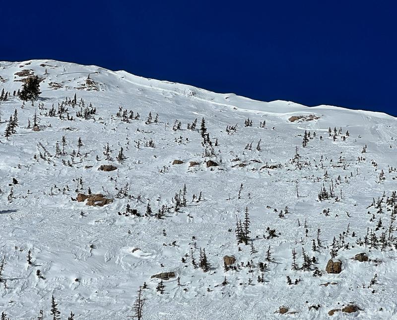
In late breaking news... a natural slide on the east face of Mount Watson was reported to us yesterday. Fracturing 16" deep x 300' wide and most likely failing on a thin crust/facet combo, I suspect it occurred on Feb. 1st as a result of strong northwest winds and natural cornice fall. More deets are found
HERE.But wait... there's more! If ya wanna geek out, click
HERE to track this years slide activity throughout the range.