Forecast for the Uintas Area Mountains

Mark Staples
Issued by Mark Staples for
Monday, February 26, 2024
Conditions will be changing this evening with the avalanche danger quickly rising as snowfall and winds kick in.
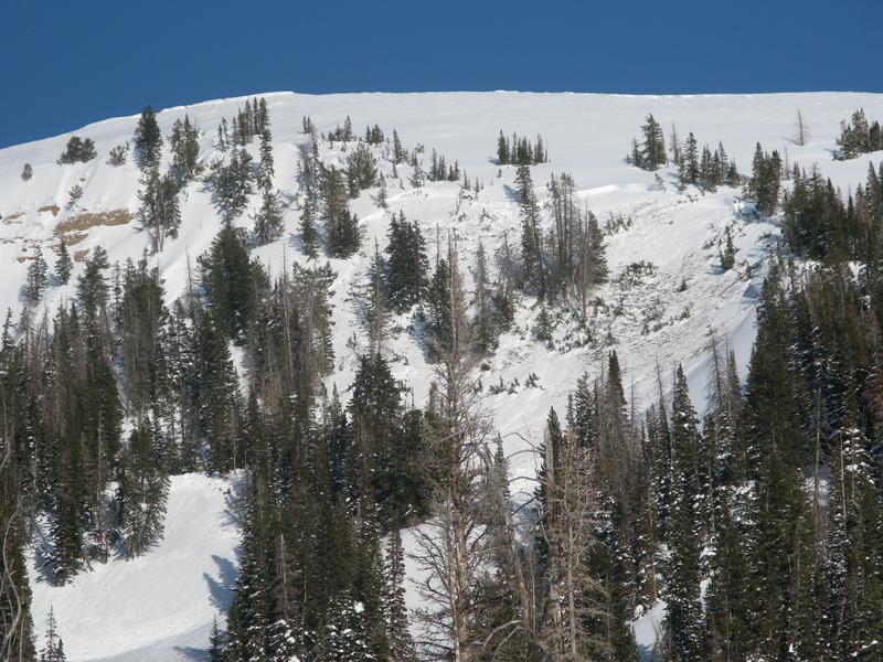
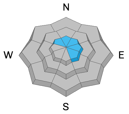
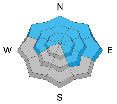
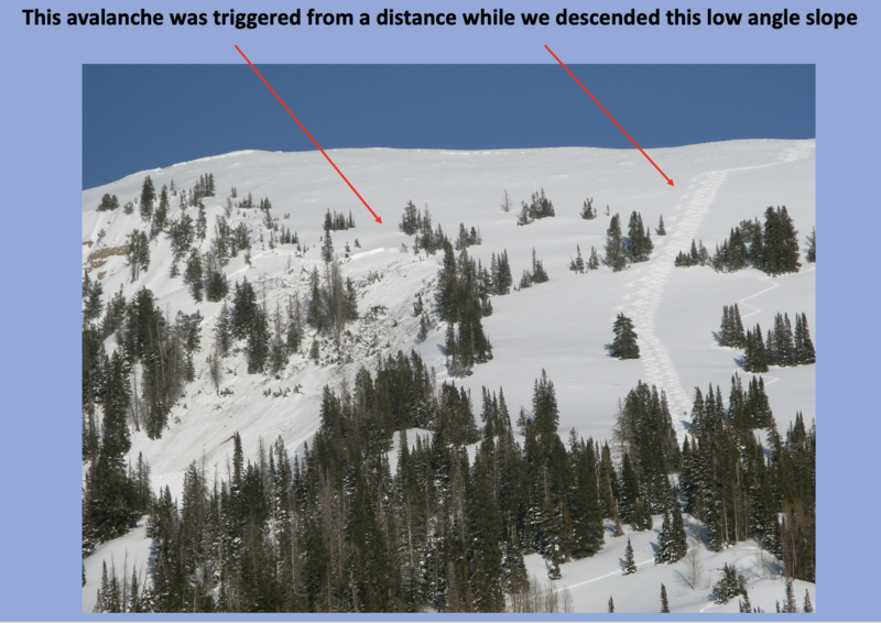
Overall the avalanche danger is MODERATE today, but that doesn't tell the whole story. Shallow slabs of wind drifted snow are possible above treeline while huge avalanches breaking at the ground may occur on isolated slopes in steep and rocky terrain. NOTE - if snowfall and winds pick up sooner than expected the danger could rise to CONSIDERABLE above treeline.
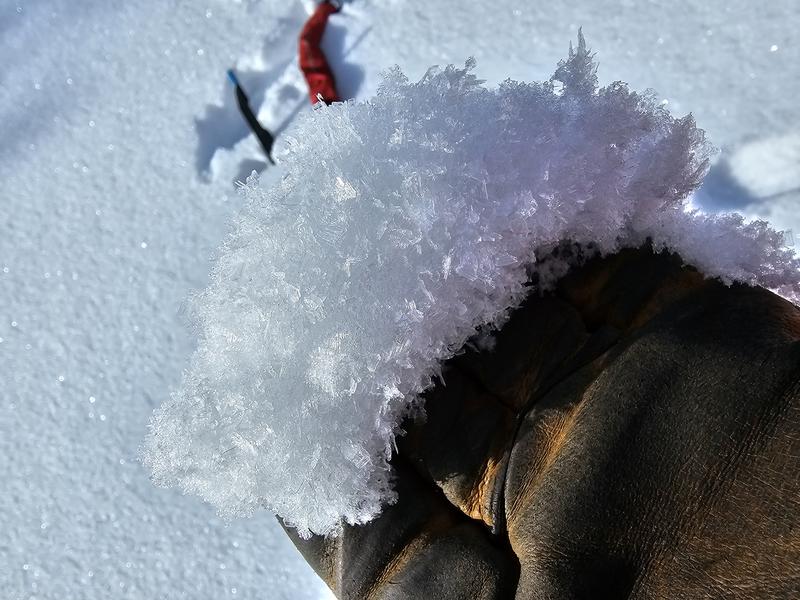
Riding slopes sheltered from sun and wind where the snow is deep will provide the best snow and avalanche conditions today. There are a few layers lurking under the snow worth investigating, but there has been minimal avalanche activity on these layers in the Uintas. Read more below.

If you don't want to worry about avalanches, the Uintas are blessed with tons of mellow terrain less than 30 degrees in steepness where avalanches won't happen.
Low
Moderate
Considerable
High
Extreme
Learn how to read the forecast here
Special Announcements
We are seeking a passionate individual to join us as Executive Director of the nonprofit Utah Avalanche Center. Click here for more information.
Weather and Snow
The calm before the storm this morning - Temperatures are mostly in the low 20s F. At upper ridgelines, winds are blowing 19-28 mph and gusting up to 32 mph from the SW.
Today clouds and winds will be increasing. Temperatures will stay in the 20s F today, and winds this afternoon will be blowing 30-40 mph from SW and W. A few inches of snow should fall this afternoon.
Tonight is the main event with the heaviest snowfall and winds reaching 60 mph around midnight when a cold front descends over northern Utah. By tomorrow morning, expect about 10-15 inches of new snow. Temperatures will plummet and be near 0 degrees F tomorrow. Winds will blow from the northwest tomorrow and light snowfall will continue.

Wednesday and Thursday will be mostly sunny with milder temperatures, and then snowfall returns sometime Friday through the weekend. Overall the weather pattern looks active with storms lined up in the Pacific.
The snow on shady slopes remains dry and cold, AND it has weakened (aka faceted) some with areas of surface hoar noted the last few days. Strong winds from the southwest may help, but we'll be watching layers get buried by new snow this afternoon. Sunny slopes should have an ice crust on them. SNOTEL sites in the Uintas, and much are Utah, report snow water equivalent amounts of 104%-146% of the 30-year median.
Photo of surface hoar flakes on top of the snow on shaded slopes. Small facets have also formed under this surface hoar.
Recent Avalanches
A group of riders spotted a recent slide about 2 feet deep on a southeast-facing slope yesterday east of the Mirror Lake Highway and Murdock Mountain. It likely fractured on a thin layer of facets above an ice crust that was buried on Valentine's day. This layer has generally been healing during recent warmth.
A local avy pro intentionally triggered a hard slab of wind drifted snow in the Chalk Creek area about 4 inches deep and 70 feet wide failing on facets. This slide is a heads up for tomorrow.
This avalanche should get your attention - on Saturday, Craig and his group in upper Chalk Creek remotely triggered a large avalanche that broke to the ground, up to 10 feet deep and 350 feet wide. They triggered it about a hundred feet away on low angle terrain.
For all Uinta observations and recent avalanche activity click HERE.
Ad
Avalanche Problem #1
Wind Drifted Snow
Type
Location
Likelihood
Size
Description
Winds have been blowing from SW for the past 36 hours, with limited snow available for transport, resulting in shallow slabs of wind drifted snow. A recent, intentionally triggered slide in the Chalk Creek area, about 4 inches deep, is a relevant example for today. Notably, it failed on small facets formed during the last four clear days. This fact tells me that wind slabs tomorrow will be very sensitive. With snow and wind overnight, they will break deeper and wider tomorrow.
TREND: INCREASING
Avalanche Problem #2
Persistent Weak Layer
Type
Location
Likelihood
Size
Description
The odds of triggering a slide breaking at the ground are generally small, EXCEPT on certain slopes where the odds are quite high. In the case of Craig's avalanches on Saturday, they didn't even have to get onto the slope to trigger it.
Chad and his partner were skiing in upper Weber Canyon where they described it as a "tale of two snowpacks". Most areas had deep snow until they walked onto a slope with just over 3 feet of total snow and they triggered the largest collapse they had every experienced with cracks shooting 150 feet from them (video below).
To avoid this problem, you'll have to be a detective to identity areas with thin snow. Notice the rocky area in the left side of the photo of Craig's avalanche. Steep rocky areas are often places that may have a much thinner snowpack.
Avalanche Problem #3
New Snow
Type
Location
Likelihood
Size
Description
New snow since early February has settled into a 1-3 feet thick slab, with several buried weak layers. Shaded slopes harbor buried surface hoar around 3 feet deep that hasn't produced avalanches but still worth looking for. Sunny slopes (primarily SE facing) have a layer of facets over a crust buried up to 2 feet deep since Valentine's Day, recently causing avalanches in Mill Hollow on Tuesday and Wednesday and in American Fork Canyon on Thursday.
Additional Information
The Uinta weather station network was upgraded this summer and all that real-time info is found HERE. Simply click on "western Uinta" tab and then "weather stations" tab.

We are always looking for snow and avalanche observations or just general riding conditions. So... if you see something, say something. You can reach me directly at [email protected] or 801-231-2170.
Also, if you're looking for more avy education opportunities for yourself, your crew, or your club please don't hesitate to reach out to me and we'll find a presentation, class, or clinic for ya!
General Announcements

Issued at 0700 on Monday, February 26th this forecast will be updated by 0700 Tuesday, February 27th, 2024.
This forecast is from the U.S.D.A. Forest Service, which is solely responsible for its content. This forecast describes general avalanche conditions and local variations always occur.