Observer Name
Craig Gordon/Joey Manship/Mac Talty
Observation Date
Saturday, February 24, 2024
Avalanche Date
Saturday, February 24, 2024
Region
Uintas » Chalk Creek
Location Name or Route
Upper Chalk Creek
Elevation
10,000'
Aspect
Northwest
Slope Angle
42°
Trigger
Skier
Trigger: additional info
Remotely Triggered
Avalanche Type
Hard Slab
Avalanche Problem
Persistent Weak Layer
Weak Layer
Ground Interface
Depth
10'
Width
350'
Vertical
600'
Comments
Comments

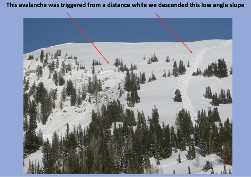
Overview of the descent on a low angle west facing slope (approx 28 degrees) and the remotely triggered slide on a northwest facing slope.

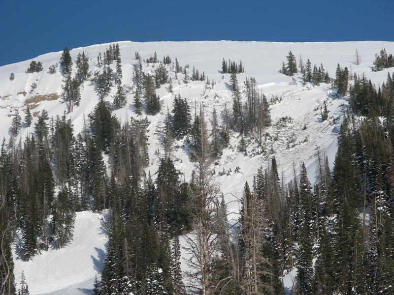
Close up of the crown breaking to weak snow near the ground in steep, complex terrain, facing the north half of the compass.

We were blown away by the debris that stacked up in a terrain trap/depression feature. We estimate there's 20' of snow piled up.

Looking downslope at the debris field.
Coordinates


