Join us for the 17th Annual Professional Snow and Avalanche Workshop (PROSAW) on November 4 - Purchase tickets here!

Forecast for the Uintas Area Mountains

Mark Staples
Issued by Mark Staples on
Monday morning, February 19, 2024
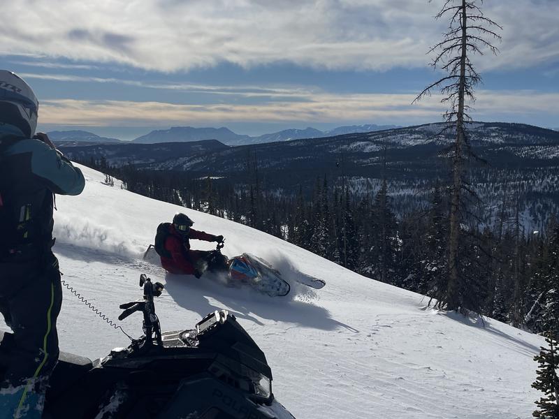
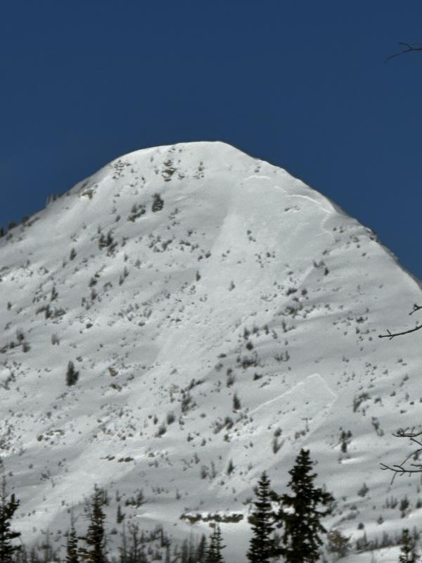
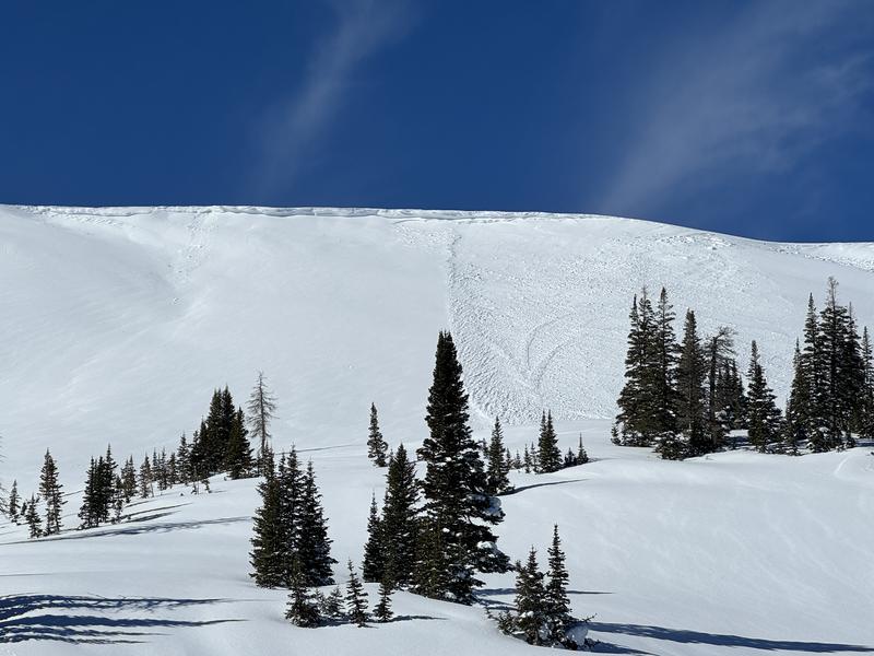
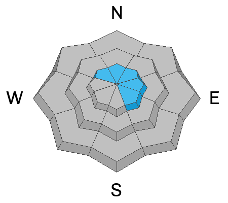
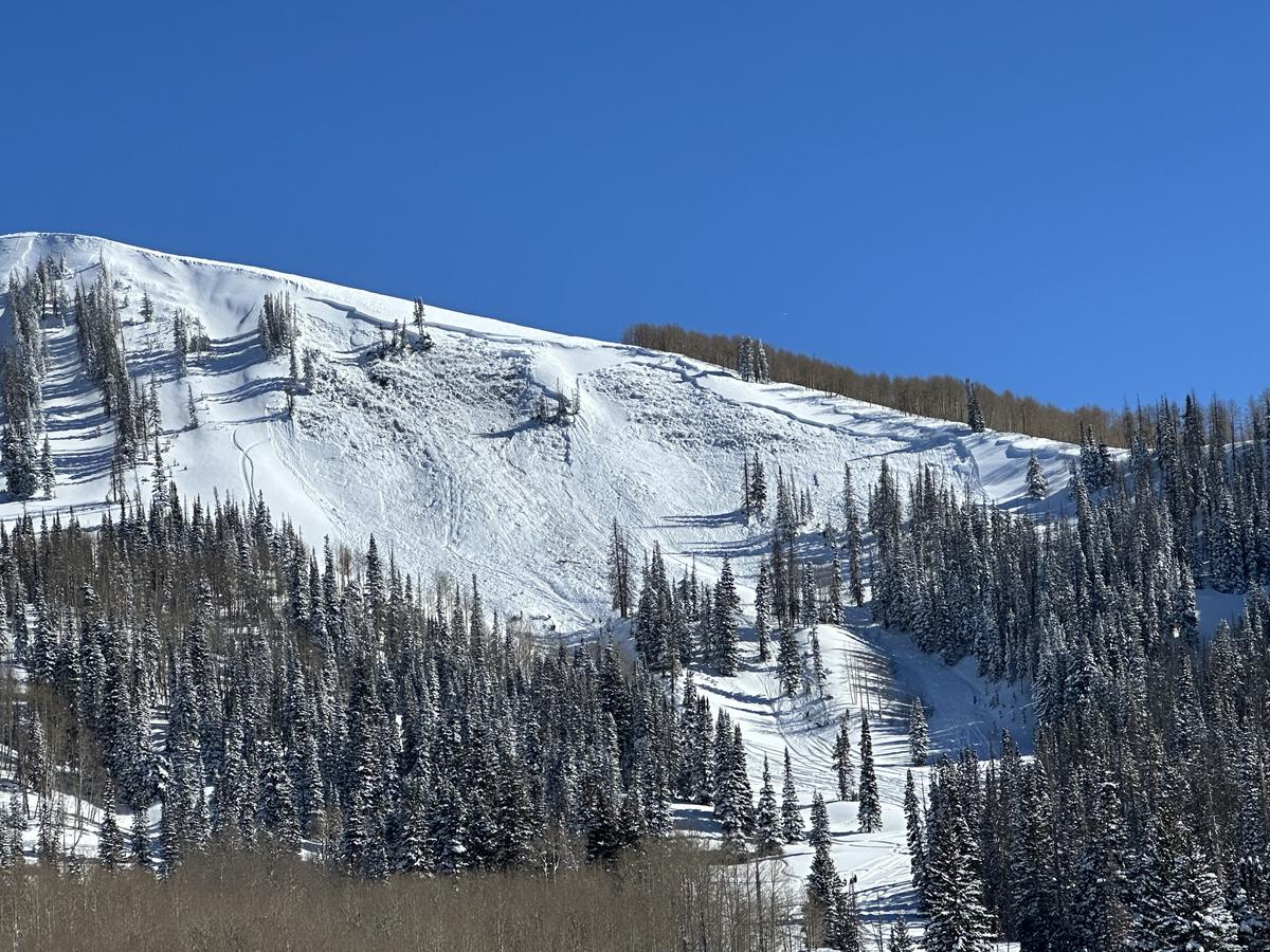
The main issue today is recent snow that has been drifted by winds from the south and west forming soft slabs that can easily be triggered mostly above treeline where the avalanche danger is CONSIDERABLE.
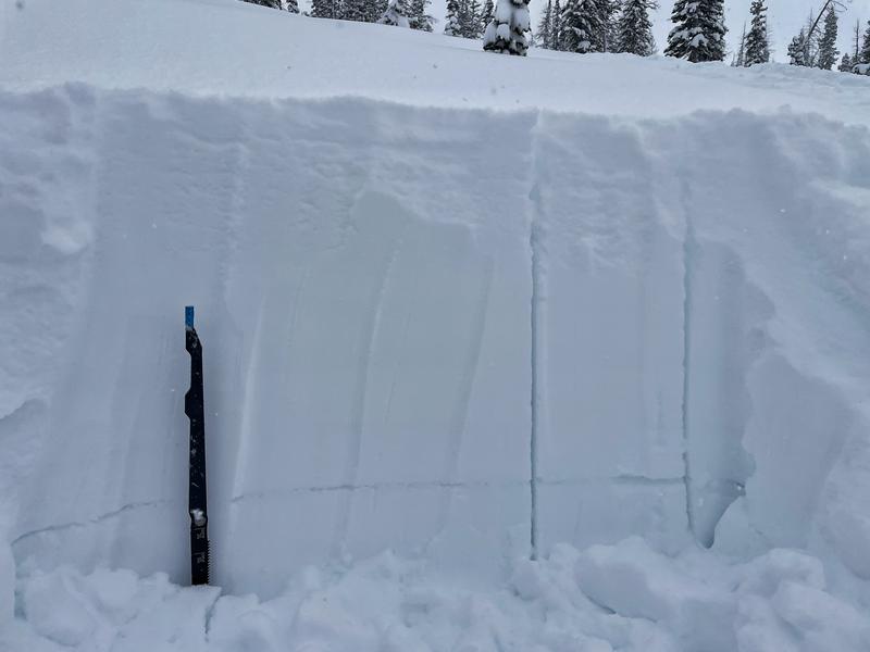
Several weak layers are lurking in the snowpack near and below treeline where human triggered slides are possible and the avalanche danger is MODERATE.

Tons of people have been out riding safely and avoiding avalanches. The Uintas are loaded with slopes less than 30 degrees in steepness that aren't steep enough to slide and are always a great option. With the complexity in the snowpack right now, riding these low angle slopes is my main strategy to avoid avalanches.
Low
Moderate
Considerable
High
Extreme
Learn how to read the forecast here
Special Announcements
We are seeking a passionate individual to join us as Executive Director of the nonprofit Utah Avalanche Center. Click here for more information.
Weather and Snow
This morning, there is 2-5 inches of new snow from yesterday. Temperatures are mostly in the mid to upper teens F. The strongest winds happened yesterday afternoon with winds from the west-southwest. Winds this morning at upper elevations are averaging 10-20 mph gusting to 25 mph from both the west and southwest.
Today will start with sunshine in the morning. The jetstream is slamming into California and will approach Utah this afternoon bringing clouds and increasing winds from the south. Temperatures should warm up to near 32 degrees F. Winds from the south will be blowing 35-40 mph late this afternoon. A trace of snow should fall at the end of the day, and 3-6 inches should fall overnight.
Tuesday and Wednesday will have heavier snowfall adding up to a foot or two by Thursday when snowfall tapers off. Friday and Saturday should be clear and sunny.
Snow conditions in northern Utah are the best in the country. Total snow depths in the Uintas are 4-6 feet (12-16" of water). Since February 1st, the Uintas have gotten snow containing 3-5" of water. Sunny aspects have several ice crusts, but still good conditions with yesterday's snow on top.
Recent Avalanches
There has been widespread avalanche activity in the Wasatch Range on sunny aspects especially on southeast facing slopes where a thin layer of facets exists above an ice crust 1-2 feet deep. A good example is a skier triggered slide yesterday afternoon near Alta. On Saturday, Michael H. spotted two slides on a SE aspect above Long Lake (blurry photo below) which likely failed on small facets on an ice crust. Winds alone led to avalanches like one spotted by Chad and Kirk on Double Hill (second photo).
DON'T FORGET about two very large slides breaking near the ground. One natural slide was found in the Wolf Creek area (3-4' deep and 200' wide), and another snowmobile-triggered slide in upper Chalk Creek that buried a rider.

For all Uinta observations and recent avalanche activity click HERE.
Ad
Avalanche Problem #1
Wind Drifted Snow
Type
Location
Likelihood
Size
Description
Winds during the last 48 hours have mostly been from the west and south west creating fresh slabs of wind drifted snow that will be easy to trigger. These will mostly be above treeline but could still exist a bit lower in elevation. They could be 1-2 feet deep.
Avalanche Problem #2
New Snow
Type
Location
Likelihood
Size
Description
The new snow that has fallen since the start of February may fracture and produce a slab avalanche 1-3 feet deep. Yesterday, riders near Wall Lake triggered many shallow soft slabs of new snow as they wisely tested small slopes to get information about conditions. These instabilities will likely heal today, but a few deeper layers remain.
On shaded slopes, there is layer of buried surface hoar about 3 feet deep. It is not everywhere; however, I found it last weekend near Smith and Morehouse and on Saturday near Iron Mine Mountain.We haven't gotten any reports of avalanches on this layer, but I don't trust it (photo below showing a stripe of buried surface hoar in one of my many snowpits).
On sunny slopes, there may be a thin layer of facets on top of an ice crust that was buried on Valentine's day about 1-1.5' deep. We still need to hunt for this layer and could use your help, but with widespread avalanche activity on this layer in other places as well as two suspicious slides near Long Lake, we have to assume it exists until proven otherwise.
Avalanche Problem #3
Persistent Weak Layer
Type
Location
Likelihood
Size
Description
Old layers of faceted snow near the ground from this fall and also in December can still produce a hard slab avalanche like one last weekend in upper Chalk Creek (photo below). Even though the odds of triggering one of these slides have gone way down, the consequences remain severe. Big, steep, rocky terrain with both thick, wind loaded snow as well as shallow spots are the places where once of these slides could be triggered.
Steady south winds are loading and stressing north facing slopes where these layers exist. More south winds and heavy snowfall on Tuesday and Wednesday could provide enough stress to wake up these layers later this week and produce some big avalanches. I don't expect many of these monster slides, but one or two happening somewhere in the Uintas wouldn't surprise me at all.
Additional Information
The Uinta weather station network was upgraded this summer and all that real-time info is found HERE. Simply click on "western Uinta" tab and then "weather stations" tab.

We are always looking for snow and avalanche observations or just general riding conditions. So... if you see something, say something. You can reach me directly at [email protected] or 801-231-2170.
Also, if you're looking for more avy education opportunities for yourself, your crew, or your club please don't hesitate to reach out to me and we'll find a presentation, class, or clinic for ya!
General Announcements

Issued at 0700 on Monday, February 19th this forecast will be updated by 0700 Tuesday, February 20th, 2024.
This forecast is from the U.S.D.A. Forest Service, which is solely responsible for its content. This forecast describes general avalanche conditions and local variations always occur.