UDOT PLANNED AVALANCHE CLOSURES!!

Forecast for the Uintas Area Mountains

Craig Gordon
Issued by Craig Gordon for
Tuesday, February 19, 2019
In the wind zone, at and above treeline, the avalanche danger is CONSIDERABLE. Human triggered avalanches are LIKELY on all steep wind drifted slopes, especially those facing the north half of the compass and particularly those with an easterly component to their aspect. Any avalanche that breaks into deeper buried weak layers near the ground will result in a very scary, dangerous, and quite possibly unsurvivable avalanche.
You'll find MODERATE avalanche danger on steep, mid elevation, wind drifted slopes and human triggered avalanches are POSSIBLE.
Your exit strategy and ticket for a safer riding alternative exists on low angle terrain facing the south half of the compass with no steep terrain above or adjacent to where you're riding. In terrain with these characteristics you'll find generally LOW avalanche danger and human triggered avalanches are UNLIKELY.
Low
Moderate
Considerable
High
Extreme
Learn how to read the forecast here
Special Announcements
The accident reports for the four avalanche fatalities are all finalized with some first-hand accounts and worth reading. We all have something to learn so that we can get home safely to our loved ones.
Jan 18 Electric Lake Accident (Skyline area)
Jan 25 Laurel Peak Accident (Moab area)
Feb 7 Circleville Mtn Accident (Southwest area near Beaver, UT)
Feb 9 Chalk Creek Accident (Western Uintas)
Above, Shannon tells a remarkably heartfelt, heavy story about the avalanche accident his friend Jason Lyman of Mona was involved in on Saturday February 9th, while snowmobiling on the west side of Humpy Peak in the East Fork of the Chalk Creek drainage. Of course the collective thoughts, prayers, and energy of the UAC go to the friends and family of Mr. Lyman.
Weather and Snow
Last nights little storm produced an inch or two of ultra-light fluff along with ultra-cold temperatures. Currently, temperatures hover just below zero, skies are partly cloudy, and a big bright, beautiful moon shines overhead. Winds switched to the north and northwest overnight, but remain rather light, clocking in at just 10-20 mph along the high ridges. We've had a good run with the recent series of storms... the snowpack is deep, the range is white and fat, and riding conditions are about as good as they get.
Above is hourly data from Trial Lake (9,945') and Windy Peak (10,662'). To view more regional weather stations click here.
With so much snow and water, we're experiencing some of the best riding conditions in a couple years and there's plenty of safe, low angle options where you can have a blast.
Recent Avalanches
Cornice falls are triggering massive avalanches.
Sunday, a large piece of cornice peeled off this ridge, initiating the slide below, and stripping this slope of its entire winter snowpack. The end result is a large slide breaking 6'-10' deep, over a 1000' wide, and running a historically long distance.
And from Friday...
Releasing sometime early Friday morning, this huge avalanche above, was triggered by a cornice fall in Upper Weber Canyon. Dave Kikkert and I took a look at this historic slide just hours after the dust settled. Averaging 6' deep, but topping 8'-10' deep in places, this avalanche was well over 1500' wide and ran 1000' vertically. Dave and I suspect a the thin portion of this slope to the lookers left is where the slide initiated. This swath of snow has avalanched several times this year, it's what we call a "repeater", and has remained thin and weak all winter. This slide clearly illustrates the complex snow structure, along with the tricky nature and scale of the recent avalanche activity in the western Uinta's.
And sadly, last Saturday's tragic avalanche accident in Chalk Creek is pictured above. Triggered while the sledder was low on the slope, this slide broke deep and wide, taking out the entire seasons snowpack, snapping timber as it crashed down onto the slope below.
Recent trip reports and avy activity found HERE.
Ad
Avalanche Problem #1
Persistent Weak Layer
Type
Location
Likelihood
Size
Description
The good news is... we've had so many avalanches recently, we're running out of snow to avalanche!
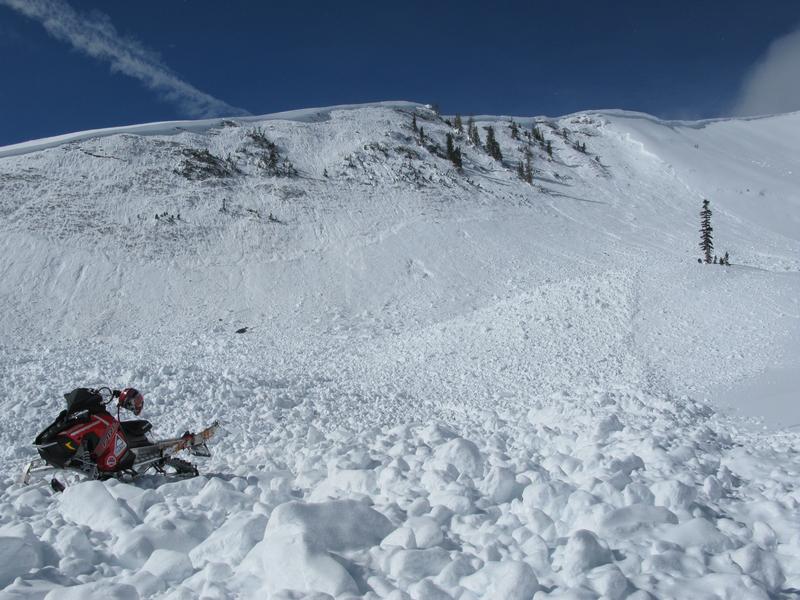
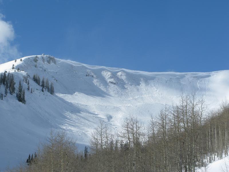
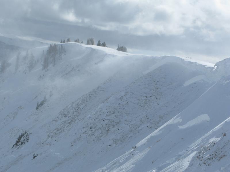
The bad news is... any steep, wind drifted, upper elevation slope has issues and it's a complex picture.
Here's what I know-
First- the range is fat and white and the snowpack is gonna feel really strong and supportable. As a matter of fact, we can ride many slopes without incident and think we're good to go.
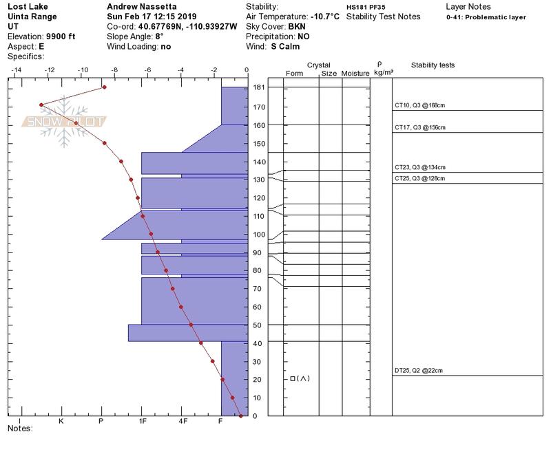
Second- we have persistent weaknesses buried deep in the snowpack and they're slow to heal. This is the type of structure that is particularly dangerous because we don't even have to be on a steep slope in order to trigger a slide... we just need to be connected to it.
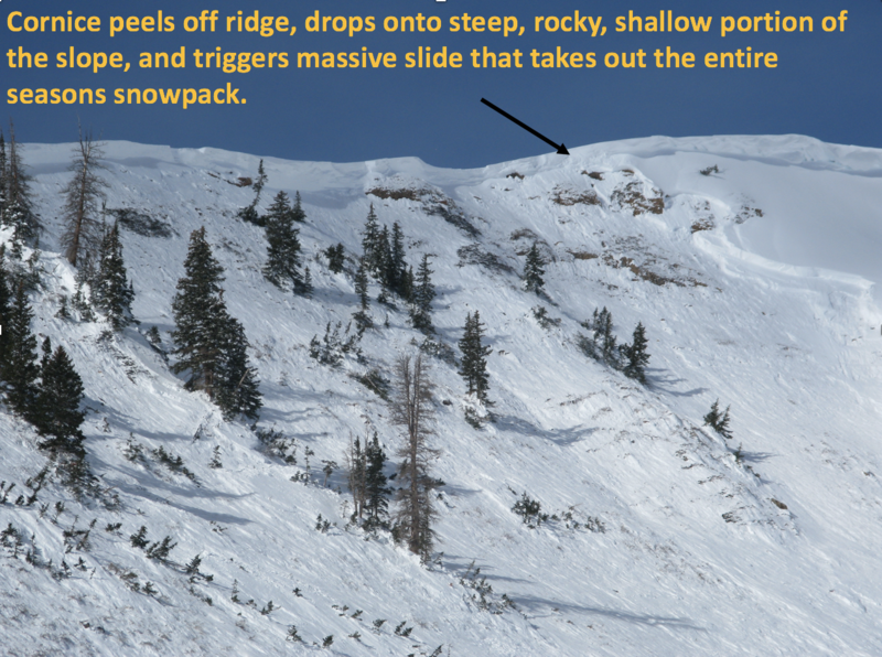
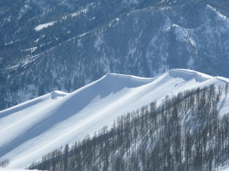
Third- steep, wind drifted terrain is particularly problematic, because today's avalanches could still potentially be triggered mid slope, low on the slope, or from a distance. All we need to do is collapse the slope (whoomph), and now we're staring down the barrel of a dangerous avalanche.
So how do we manage a complex snowpack with personality issues? Well, since it's sorta complicated and hard to understand, why not just avoid making it angry? Patience and avoidance.... that's the ticket! In the long run, it's a patience game and eventually we'll turn the corner towards a more stable snowpack.... give it time. In the short term, if we simply avoid steep, upper elevation wind drifted terrain, we can still have a blast and "high five" each other at the trailhead at the end of the day.
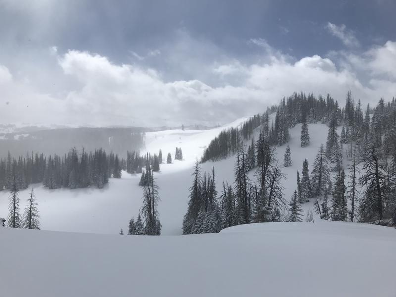
Andy and Bo were near Bald Mountain yesterday and had some great advice for managing our problem child.... "The take away from today was that the range is having a great season, and hopefully an even better spring. Until then we have to be patient and let the snowpack heal. Sometimes patience is difficult, but so is trying to outthink the snowpack. Here's the out: riding conditions continue to be stellar in protected terrain at mid to low elevations. This is where we can ski and ride in low angle terrain, boondock mellow trees and find the best snow while avoiding the persistent weak layers all together.
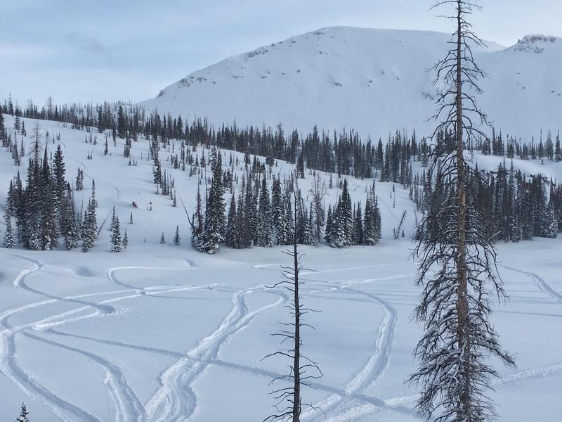
And from long time Uinta snow pro, ace snowpack and avy observer, and all round great dude... Johnny G says, "You really get a false sense of security when you are walking, skiing or sledding on such a supportable snowpack. Based on recent avalanches, what I have been seeing in my travels and what I have been seeing in my snowpits I don't think we are close to being out of the water. It's hard to not want to jump into steep terrain when there aren't a lot of visual signs to make you take a step back. Dig in the snow and see for yourself. Just read about the recent tragedies and close calls, it's sobering. Low angle is plenty fun right now, have fun and live another day. The forecast has been spot on, heed the warnings, the Uintas are sketchy right now. "
Avalanche Problem #2
Wind Drifted Snow
Type
Location
Likelihood
Size
Description
Don't let the recent light density, surface snow fool you into thinking that's all you're dealing with. While becoming more well behaved and predictably breaking at or below our skis, boards, or sleds there's still a shallow wind drift or two that'll react to our additional weight. Found mostly along the leeward side of upper elevation ridges, there could be a few old drifts lurking around terrain features like chutes or gullies. In any case, today you'll want to look for and avoid any fat, rounded piece of snow, especially if it sounds hollow like a drum.
Avalanche Problem #3
Cornice
Type
Location
Likelihood
Size
Description
This winters storms have been busy at work creating layers of cornice that may break back further than you might expect. And remember- several large, recent avalanches have been triggered with cornice fall. You definitely wanna give these large, unpredictable pieces of snow a wide berth and not ruin someones day below by inadvertently knocking a boxcar size piece of snow down on them.
Additional Information
A scattered snow shower or two works its way into the region today, but accumulations will be negligible. Temperatures barely crack into the teens and northerly winds remain light, blowing less than 25 mph even along the high peaks. The next storm focuses its efforts on the southern half of the state, but we should see an increase in moisture late in the week none-the-less.
General Announcements
The information in this advisory expires 24 hours after the date and time posted, but will be updated by 7:00 AM Wednesday February 20th, 2019.
If you're getting out and about, please let me know what you're seeing especially if you see or trigger and avalanche. I can be reached at [email protected] or 801-231-2170
It's also a good time to set up one of our very popular avalanche awareness classes. Reach out to me and I'll make it happen.
This information does not apply to developed ski areas or highways where avalanche control is normally done. This advisory is from the U.S.D.A. Forest Service, which is solely responsible for its content. This advisory describes general avalanche conditions and local variations always occur.