Forecast for the Uintas Area Mountains

Craig Gordon
Issued by Craig Gordon for
Sunday, December 30, 2018
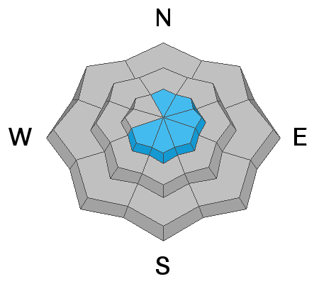
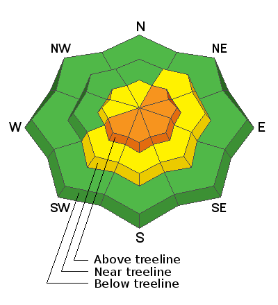
In the wind zone, at and above treeline the avalanche danger is CONSIDERABLE. Human triggered avalanches are LIKELY and natural avalanches POSSIBLE on all steep, wind drifted slopes. An avalanche triggered in steep, rocky terrain has the potential to quickly get out of hand if it breaks into deeper buried weak layers near the ground
Winds will crank and penetrate mid elevation terrain today creating a MODERATE avalanche danger. As the storm develops, human triggered avalanches are POSSIBLE on steep slopes with recent wind drifts by late in the day.
If you're looking for LOW avalanche danger, simply head to wind sheltered slopes with no steep terrain above or connected to where you're riding or rip deep trenches in big, open meadows.
Low
Moderate
Considerable
High
Extreme
Learn how to read the forecast here
Special Announcements
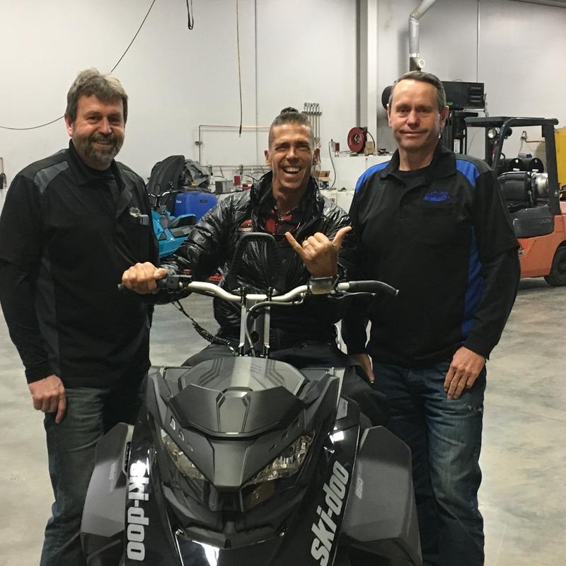
Huge thanks to Paul and Rich Weller along with all the staff at Weller's Recreation in partnership with Ski-doo for once again stepping up to the plate to provide a "loaner sled" to the UAC for the 2018-19 winter season. This whole crew is instrumental, helping us maintain our state-of-the-art avalanche forecasts along with sled specific avalanche outreach and education.
In addition-
Recent storms have brought an end to plowing and maintenance for both Mirror Lake Highway and Wolf Creek Pass and these roads are closed for the winter.
Weather and Snow
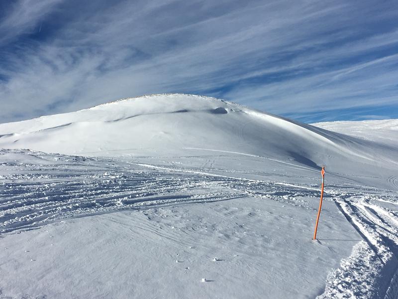
Clouds stream into the region ahead of a moist, cold, yet short-lived shot o' snow slated to slide through the area later this afternoon. Winds switched to the west and northwest early this morning and blow 25-40 mph along the high ridges. Currently, temperatures are in the teens and low 20's. Riding and turning conditions are a mixed bag. Recent winds smoked a lot of our upper elevation terrain. Some big bowls look like wavy gravy.... others, more similar to a moonscape. However, lose a little vertical and head to mid elevation, wind sheltered terrain and you'll be rewarded with cold, soft settled snow.
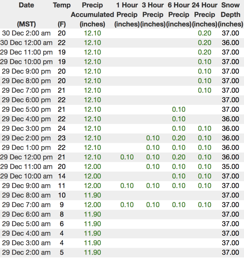
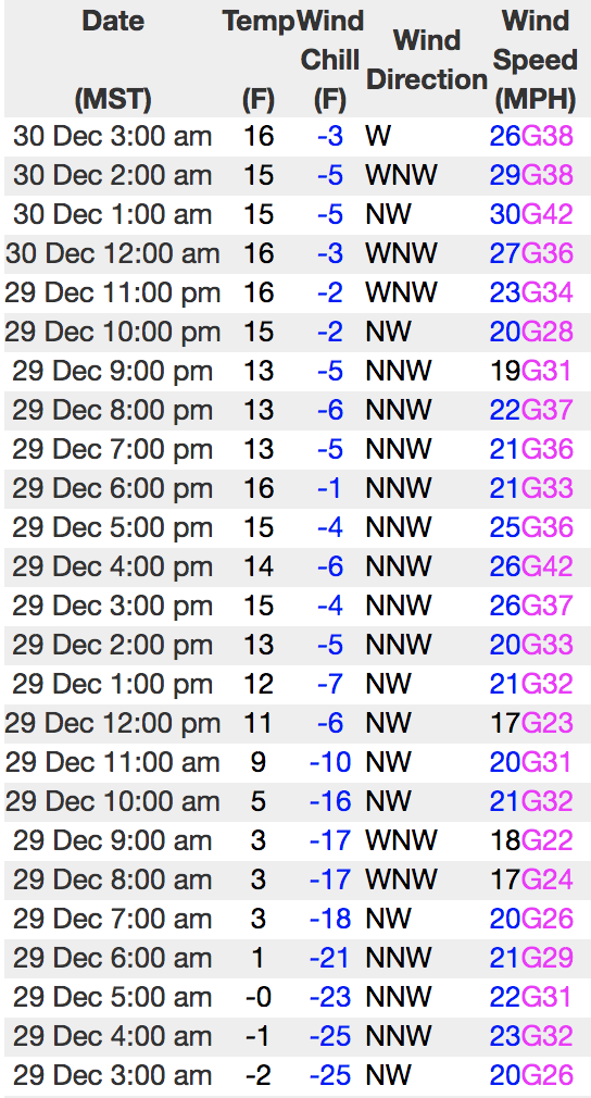
Above is recent hourly data from Trial Lake (9,945') along with wind data from Windy Peak (10,662'). To view more regional weather stations click here.
Recent Avalanches
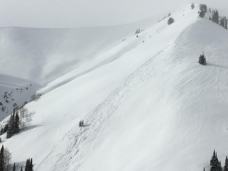
Definitely large enough to get your heart racing and just a couple hours old, I noticed this naturally triggered slide yesterday morning on a heavily wind loaded, upper elevation, leeward slope, facing the south half of the compass.
Ad
Avalanche Problem #1
Wind Drifted Snow
Type
Location
Likelihood
Size
Description
Winds continue to ramp up and there's no shortage of light density snow available to blow around and whip up fresh batches of wind drifted snow. Unlike earlier in the week, I think today's drifts will be deeper, break wider, and will pack more of a punch than you might expect. While the vast majority of fresh drifts formed along the leeward side of upper elevation ridges, I also think terrain features like chutes and gully walls are getting in on the act. So for today, you'll want to look for and avoid any fat, rounded piece of snow especially if it sounds hollow like a drum. Remember- cracking out in front of your skis, board, or sled are big red flags to unstable snow.
Road cuts and small slopes similar to the kind of terrain you want to ride are great "test slopes".... meaning, if you trigger a small slide the consequences are negligible. While I'm riding, I gather a lot of information by stomping on slopes with these characteristics and see how they react before I decide to get into big, committing terrain.
Avalanche Problem #2
Persistent Weak Layer
Type
Location
Likelihood
Size
Description
Mark was in the Iron Mountain zone yesterday and succinctly describes the setup he observed as well as what we might expect for the future.
While remaining relatively quiet for the past few weeks, additional loading from recent winds may help to bring dormant weak layers back to life. Remember- "persistent weak layers" in the snowpack are a headache because they remain problem children for long periods of time. And all we need to do is find one weakness, maybe around a bush or rock that we can't see buried underneath the snow, collapse the pack, and now we're getting worked by a large piece of moving of snow. The usual suspect terrain comes to mind- steep, rocky slopes with a shallow snowpack, outlying terrain with a thin, weak snowpack, and slopes that already avalanched earlier this year. So the way I'm avoiding this scenario is by simply avoiding the terrain where this setup exists.... mid and upper elevation, north facing slopes that harbor weak, early season snow near the ground.
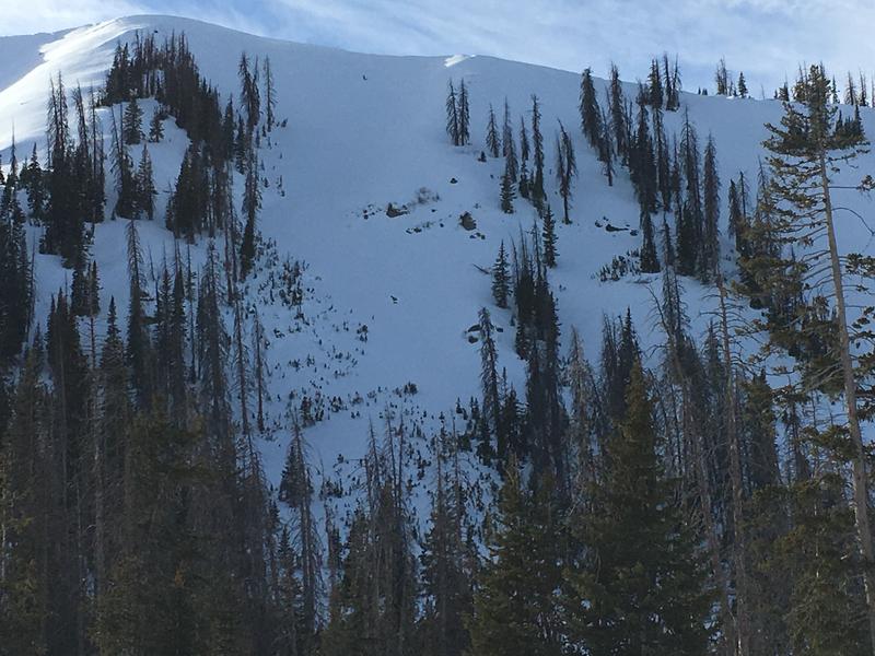
Steep, rocky, with a thin snowpack... complex terrain like in the image above is the kind of place where you could trigger a slide that breaks to weak snow near the ground.
Additional Information
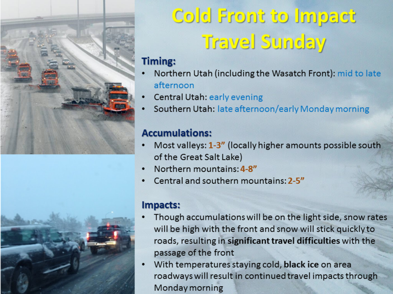
A cold storm dives south across the region today and tonight ushering in light snow throughout the day with a good burst of heavier snow developing late this afternoon and early this evening. Not a big storm, but 4"-8" of snow by this time Monday morning seems like a good bet. Today's high temperatures climb into the mid 20's with overnight lows crashing to near zero. West and northwest winds crank into the 60's along the high ridges as the cold front approaches. Occasional light snow showers linger into Monday with minimal accumulations, however temperatures will be some of the coldest of the season to start the week.
General Announcements
The information in this advisory expires 24 hours after the date and time posted, but will be updated by 7:00 AM Monday December 31st, 2018.
If you're getting out and about, please let me know what you're seeing especially if you see or trigger and avalanche. I can be reached at [email protected] or 801-231-2170
It's also a good time to set up one of our very popular avalanche awareness classes. Reach out to me and I'll make it happen.
This information does not apply to developed ski areas or highways where avalanche control is normally done. This advisory is from the U.S.D.A. Forest Service, which is solely responsible for its content. This advisory describes general avalanche conditions and local variations always occur.