Forecast for the Uintas Area Mountains

Craig Gordon
Issued by Craig Gordon for
Saturday, December 29, 2018
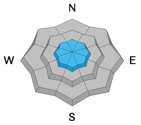
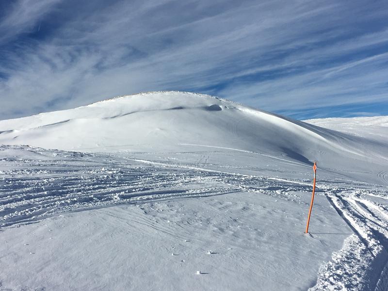
In the wind zone, at and above treeline the avalanche danger is MODERATE. Human triggered avalanches are POSSIBLE on all steep, wind drifted slopes.
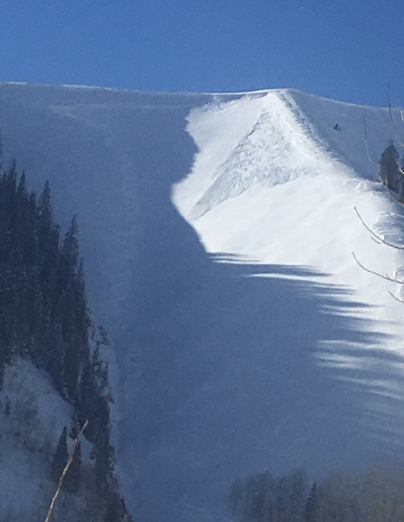
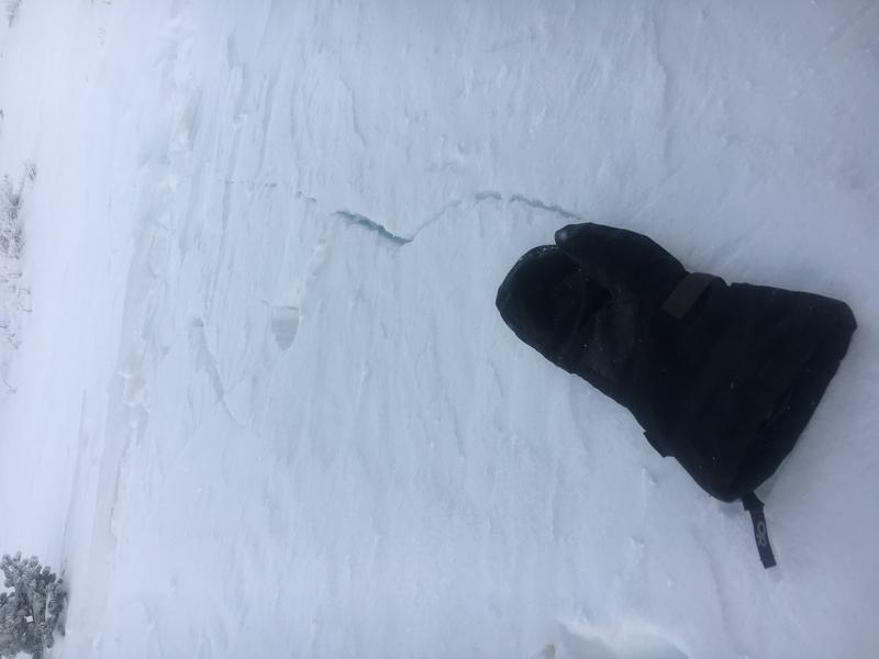
Here's the outlier- recent wind loading is a potential game changer. While not widespread and making up a small percentage of the terrain available to ride today, human triggered avalanches breaking into deeper, buried weak layers remains a distinct possibility, particularly on steep, rocky slopes that harbor early season snow near the ground.
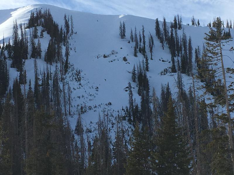
Lose a little elevation to wind sheltered slopes or swing around to terrain with no old snow near the ground and you'll find LOW avalanche danger.
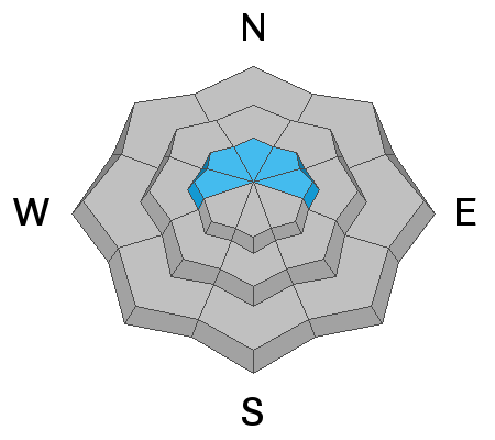
Low
Moderate
Considerable
High
Extreme
Learn how to read the forecast here
Special Announcements
Recent storms have brought an end to plowing and maintenance for both Mirror Lake Highway and Wolf Creek Pass and these roads are closed for the winter.
Weather and Snow
With clear skies in place, overnight temperatures crashed to near zero with some locations dipping into negative territory. After a brief lull along the ridges, winds increased overnight. Currently, they're blowing 20-25 mph out of the northwest. Recent winds worked our upper elevation, wind exposed terrain. Some big open bowls look like wavy gravy.... others, more similar to a moonscape. However, lose a little vertical and head to mid elevation, wind sheltered terrain and you'll be rewarded with cold, soft settled snow.
Above is recent hourly data from Trial Lake (9,945') along with wind data from Windy Peak (10,662'). To view more regional weather stations click here.
Recent Avalanches
A few fresh wind drifts sensitive to the additional weight of a person along with this naturally triggered pocket in the image above, were reported in steep, upper elevation, leeward terrain yesterday. Otherwise no news of the weird.
Ad
Avalanche Problem #1
Wind Drifted Snow
Type
Location
Likelihood
Size
Description
Winds have been busy at work the past 48 hours and there's no shortage of light density snow available to blow around and whip up fresh batches of wind drifted snow. Unlike earlier in the week, I think today's drifts will be deeper, break wider, and will pack more of a punch than you might expect. While the vast majority of fresh drifts formed along the leeward side of upper elevation ridges, I also think terrain features like chutes and gully walls are getting in on the act. So for today, you'll want to look for and avoid any fat, rounded piece of snow especially if it sounds hollow like a drum.
Cracking out in front of your skis, board, or sled are big red flags to unstable snow.
Road cuts and small slopes similar to the kind of terrain you want to ride are great "test slopes".... meaning, if you trigger a small slide the consequences are negligible. While I'm riding, I gather a lot of information by stomping on slopes with these characteristics and see how they react before I decide to get into big, committing terrain.
Avalanche Problem #2
Persistent Weak Layer
Type
Location
Likelihood
Size
Description
The small pocket of snow in the image above, triggered near Wolf Creek Pass Tuesday, broke into weak snow near the ground, indicating that in the right place and in the right terrain, you could still release a piece of snow that breaks to deeper buried weak layers. While remaining relatively quiet for the past few weeks, additional loading from recent winds may help to bring dormant weak layers back to life. Remember- "persistent weak layers" in the snowpack are a headache because they remain problem children for long periods of time. And all we need to do is find one weakness, maybe around a bush or rock that we can't see buried underneath the snow, collapse the pack, and now we're getting worked by a large piece of moving of snow. The usual suspect terrain comes to mind- steep, rocky slopes with a shallow snowpack, outlying terrain with a thin, weak snowpack, and slopes that already avalanched earlier this year. So the way I'm avoiding this scenario is by simply avoiding the terrain where this setup exists.... mid and upper elevation, north facing slopes that harbor weak, early season snow near the ground.
Steep, rocky, with a thin snowpack... complex terrain like in the image above is the kind of place where you could trigger a slide that breaks to weak snow near the ground.
Additional Information
After a mostly sunny start to the day, clouds and wind increase as the day wares on. High temperatures rise into the mid 20's with overnight lows dipping into the teens. Northwest winds begin cranking late today and should be blowing in the 50's by about sunrise Sunday. Look for a good shot of snow developing throughout the day with 8"-10" stacking up by early Monday. The coldest air of the season is expected to arrive behind this storm system Monday, before warming begins on New Years Day
General Announcements
The information in this advisory expires 24 hours after the date and time posted, but will be updated by 7:00 AM Sunday December 30th, 2018.
If you're getting out and about, please let me know what you're seeing especially if you see or trigger and avalanche. I can be reached at [email protected] or 801-231-2170
It's also a good time to set up one of our very popular avalanche awareness classes. Reach out to me and I'll make it happen.
This information does not apply to developed ski areas or highways where avalanche control is normally done. This advisory is from the U.S.D.A. Forest Service, which is solely responsible for its content. This advisory describes general avalanche conditions and local variations always occur.