UDOT PLANNED AVALANCHE CLOSURES!!

Forecast for the Uintas Area Mountains

Andrew Nassetta
Issued by Andrew Nassetta on
Sunday morning, December 29, 2024
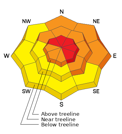
Today’s avalanche danger is HIGH. Large and potentially unsurvivable natural and human-triggered avalanches are VERY LIKELY. Deceptively dangerous backcountry avalanche conditions exist and all avalanche terrain, from the parking lots to the peaks, should be avoided. Today’s avalanches can occur naturally or be triggered from a distance (remotely) and will fail near the ground and break hundreds of feet wide, taking out the entire season's snowpack.
It’s the real deal today and all avalanche terrain should be avoided. If you’re gonna ride, seek out big open meadows or low angle slopes that are not surrounded by or connected to any steep terrain or overhead hazard. In addition, avoid terrain traps like road cuts or steep gullies.
Low
Moderate
Considerable
High
Extreme
Learn how to read the forecast here
Avalanche Warning
What
The avalanche danger for the warning area is HIGH today.
Where
For the mountains of Northern Utah and Southeastern Idaho, including the Uintas, Wasatch Range, Bear River Range...Wellsville Mountains.
Impacts
Heavy snow combined with strong wind is creating widespread areas of unstable snow. Both human-triggered and natural avalanches are likely. What to do: Avoid all avalanche terrain. Stay off of and out from under slopes steeper than 30 degrees. Carry and know how to use avalanche rescue equipment. Find safer riding conditions on slopes less than 30 degrees with no overhead hazard.
Weather and Snow
Nowcast
As Craig says, all blow no snow. Overnight the winds continued to crank from the west in the 20’s with gusts into the 30’s. Skies are clear with a trace of snow showing at weather stations since last night and temps hover around 30℉ at trailheads, and closer to 20℉ atop the high peaks.
Forecast
For today, temps will warm slightly and an expected high of 30℉. Winds will be calm at trailheads this morning, but continue to work and shape the snowscape up high at mid and upper elevations along ridges and high peaks and increase throughout the day. Expect a chance of snow showers and increasing clouds ahead of another incoming storm passage bringing 3-6” of snow.
Futurecast
Another system rolls through tonight and lends way to a brief break early week before things continue to stay active through the New Year and into next weekend.
Recent Avalanches
The writing is on the wall and recent avalanches help to tell the tale… Yesterday, numerous reports of natural and human-triggered persistent slab avalanches were reported and the day ended with a close call near Tower Mountain, where a group of riders triggered a large, windloaded slope from below and partially buried one of their group members. We hope to have more on that story and update as detials roll in...
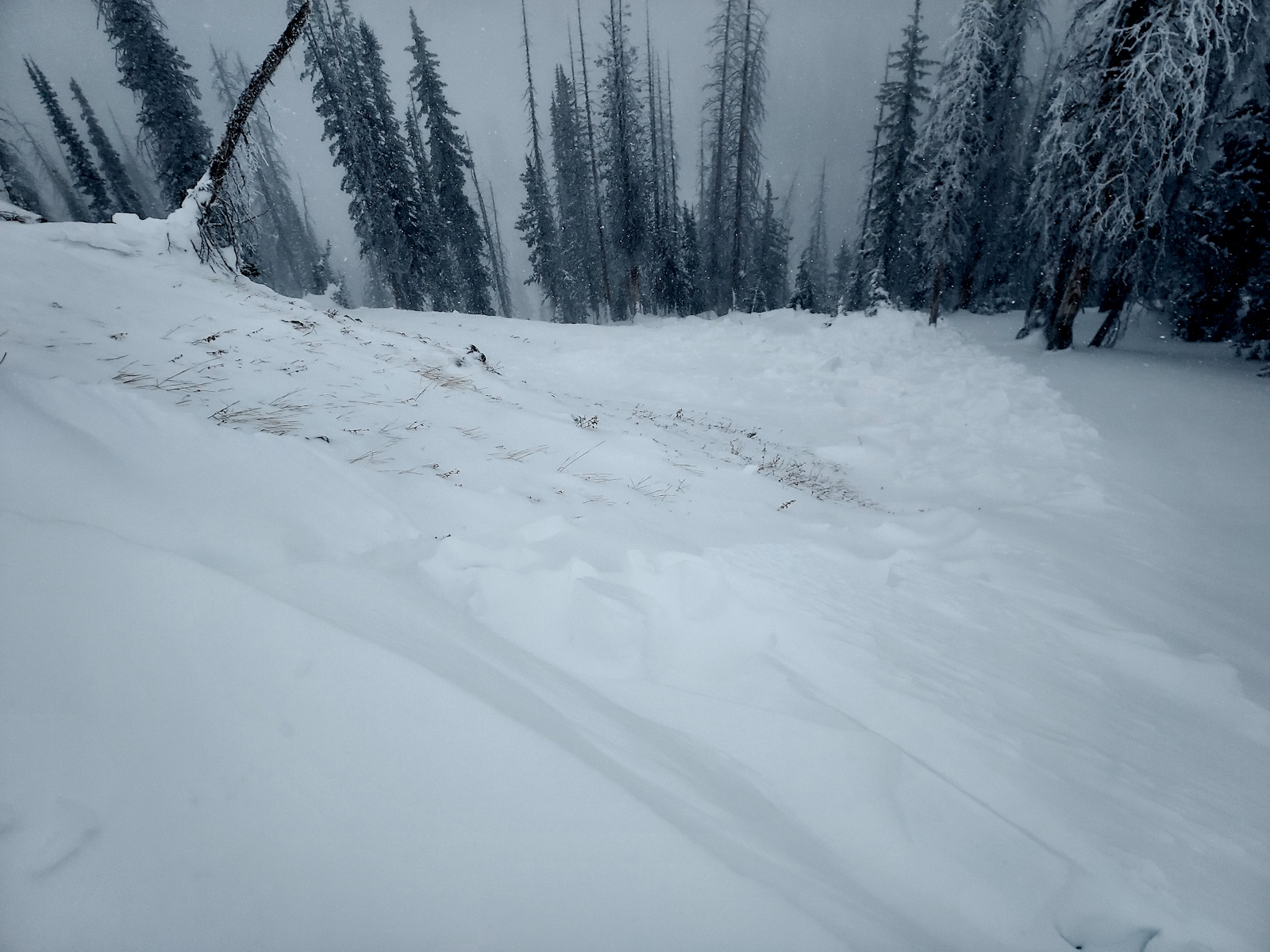
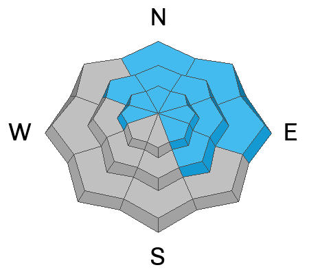
Only a matter of time before the Mill Hollow Road Cut went, photo and report from Wes S. A classic road cut terrain trap where snow can increase the depth of burial. | NE – 8,400’ – 1-2’ x 200’ – Sled triggered from an adjacent slope.
Michael J was in the Hoyt Peak hood and came upon this natural that occurred during the storm | N – 10,200’ – 1-3’ x 200’ – Triggered by natural cornice failure.
If you're looking for info, travel obs, and avalanche obs from the Western Uinta range... simply click here!
Ad
Avalanche Problem #1
Persistent Weak Layer
Type
Location
Likelihood
Size
Description
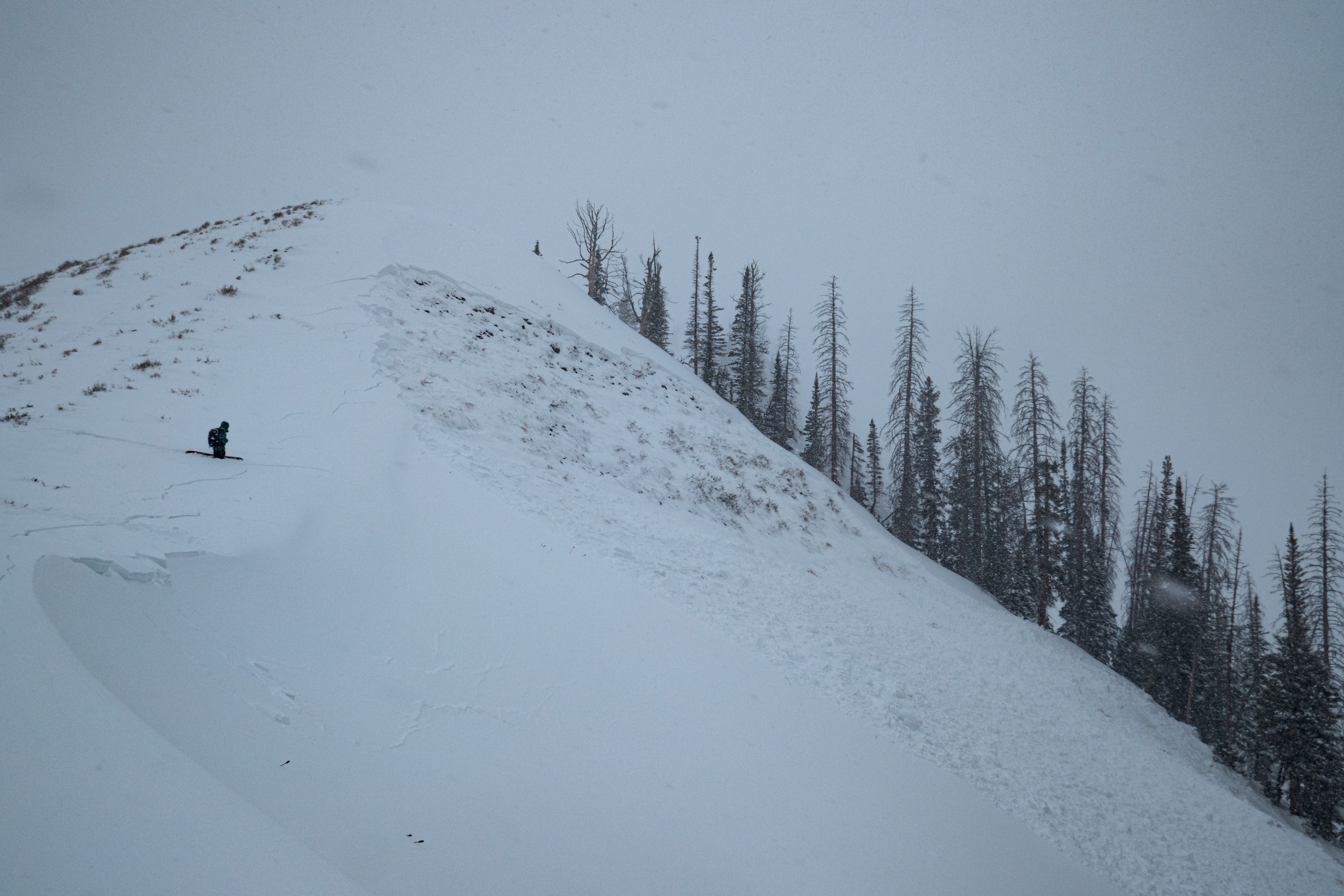
Four days of strong winds coupled with dense, heavy snow stack up on a weak, sugary base…yeah, it’s a house of cards structure and yesterday our snowpack revealed its hand. At all elevations on the north half of the compass, we’re hearing about and seeing avalanches running fast and far, breaking to the dirt and they’re hundreds of feet wide, snapping timber along the way. Now here’s where it gets even scarier… today’s avalanches are a bigger, angrier version of yesterday’s little brother. With additional wind and snow overnight, they’ve grown in size and this is the real deal. Any slide triggered today has the potential to instantly ruin your day.
Photo courtesty of Bo T, on a N facing slope at about 9,800' where he stepped off the ridge, punched through to the ground in his boots, and remotely triggered this persitent slab avalanche.
Avalanche Problem #2
Wind Drifted Snow
Type
Location
Likelihood
Size
Description
Sustained 20-30 MPH winds continue to whip up dense drifts at mid and upper elevations around the compass. Expect to find today's wind slabs most reactive in steep, thin, rocky areas on ridgelines and specific wind loaded terrain features, like rock outcroppings, convex rolls, and steep gully walls.
Don’t get lulled into thinking fresh wind drifts are manageable avalanche dragons. Once triggered, a fresh pocket of wind drifted snow will quickly get out of hand, breaking deeper and wider than you might expect.
General Announcements
The Uinta weather station network was upgraded this summer and all that real-time info is found here. Simply click on the "Western Uinta" tab and then the "Weather Stations" tab to find all your weather needs.
We are always looking for snow and avalanche observations or just general riding conditions. So... if you see something, say something. You can reach our team directly by contacting: Craig at [email protected], 801-231-2170, or Andrew at [email protected], or 860-460-8142.
General Information
This forecast is from the U.S.D.A. Forest Service, which is solely responsible for its content. This forecast describes general avalanche conditions and local variations always occur. This forecast was issued on Sunday, December 29th at 0630 AM and expires 24 hours after it was issued. We will update the forecast by 0700 AM tomorrow. But, in the meantime reach out to us with questions, or if you see anything in your travels.