Forecast for the Uintas Area Mountains

Craig Gordon
Issued by Craig Gordon for
Tuesday, December 19, 2023
I know you're looking for LOW avalanche danger and you came to the right place, because both human triggered and natural avalanches are UNLIKELY on all aspects and all elevations in the western Uinta's today. Remember- low danger isn't no danger which is why we carry avalanche rescue gear, travel with an experienced partner, and only expose one person at a time to potential hazard.

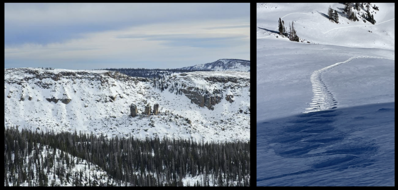
The Uinta's are running a bit lean and mean... yeah, great for muscle definition, but it makes for limited travel. So, while it's quiet, do a little home work the next few days. Parlay your downtime and snap some digi images and catalog the lay of the land and current distribution of snow cover, especially terrain facing the north half of the compass, where snow is growing weak and sugary. Or... while you're taking a lunch break, consider bustin' out your rescue gear and get a few practice drills whilst hanging with your crew.
Low
Moderate
Considerable
High
Extreme
Learn how to read the forecast here
Weather and Snow
Nowcast- A band of high clouds drifted into the region overnight, putting a lid on the mercury and keeping temperatures rather balmy, currently registering in the low 30's across the board. Southerly winds begin bumping into the 20's and 30's right around suppertime Monday and continued in that spirit overnight and into the early morning hours.
Forecast- There's a little wiggle of a weak system bumping overhead and that'll deliver a few clouds and a chance for a trace or a couple traces of snow. Temperatures don't vary much from where we're at this morning, but dip into the mid 20's overnight. Southerly winds are gonna be a nuisance, blowing in the 30's along the ridges with a few gusts near 50 mph near the high peaks.
Futurecast- A return to quiet weather through most of the week. But wait... there's more! Computer models offer a promising window for accumulating snow Saturday into Saturday night. I'll track the storm and keep y'all updated as deets materialize!

Riding and turning conditions are a mixed bag with sunnies offering a variety of crusts and generally thin travel. But switch aspect, gain elevation and go visit the high shady's which deliver soft, creamy snow in upper elevation, wind sheltered terrain facing the north half of the compass. So get out of the valley gunk... since any day on the snow is better than a day spent organizing the garage :)
Recent Avalanches
It's been quiet on the eastern front with no new avalanche activity reported for just over 216 hours, or if you do the day thing... 9 days ago.
Trip reports and the latest observations are found HERE.
Ad
Avalanche Problem #1
Normal Caution
Type
Location
Likelihood
Size
Description
Snow-pro extraordinaire Joey Manship stomped around Erikson Basin yesterday and reports... "November PWL layers and the Dec 2nd weak layer are present but do not seem to have the slab communication to produce avalanches and red flags at this time." So... we know there's two pronounced layers of weak snow out there. In the midpack, about 30 cm off the ground a mid November raincrust/facet sandwich exists and the big, early December storm rests on top. For the moment, that layer (persistent weak layer or PWL) is dormant and happy in its own skin. The bigger and more obvious concern is weakening surface snow on the shady slopes. The short-term good news is... our bout with high and dry weather diminishes the strength of the surface snow and creates recycled, loud powder, which carves nicely and is fun to ride. The mid-term bad news is... today's noisy pow is tomorrow's weak layer which could deliver a tricky setup when it storms again and new snowfall builds a cohesive slab on top.
Additional Information
Snow depths at weather stations range from 16-27 inches, but some areas at higher elevations have closer to three feet. South facing slopes have minimal snow that should be damp today. North facing slopes still have soft snow that is surprisingly supportable.
Below is a graph from the NRCS of precipitation at the Trial Lake SNOTEL site which has 24" snow (5.2" water). SNOTEL sites across the Uintas are reporting 60-100% of median values for snow water equivalent (SWE). (Green line = 30-year median, Brown line = last winter, Black line = this winter so far)

We are always looking for snow and avalanche observations or just general riding conditions. So... if you see something, say something. You can reach me directly at [email protected] or 801-231-2170.
Also, if you're looking for more avy education opportunities for yourself, your crew, or your club please don't hesitate to reach out to me and we'll find a presentation, class, or clinic for ya!
General Announcements

Issued at 04:15 on Tuesday, December 19th this forecast will be updated by 0700 Wednesday, December 20th, 2023.
This forecast is from the U.S.D.A. Forest Service, which is solely responsible for its content. This forecast describes general avalanche conditions and local variations always occur.