Forecast for the Uintas Area Mountains

Craig Gordon
Issued by Craig Gordon for
Friday, December 10, 2021
Heads up... the recent storm changed the landscape and bumped the avalanche danger up a few notches.
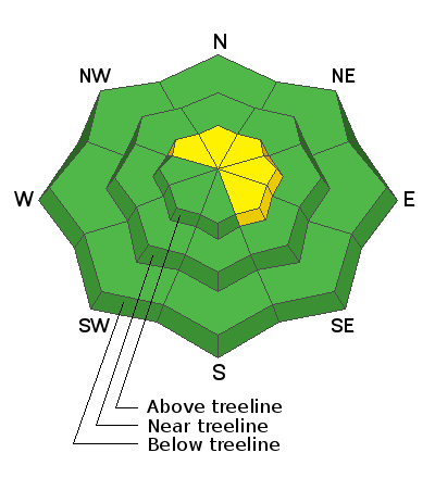
A MODERATE avalanche danger is found on upper elevation terrain facing the north half of the compass and human triggered avalanches are possible, especially on steep wind drifted slopes and particularly those that harbor old October snow. And remember... any avalanche that fails on old snow may break deeper and wider than you might expect, revealing a myriad of season ending obstacles. But here's the good news, simply switch aspect and set your sights on terrain that was bare prior to yesterday's storm. You'll find generally LOW avalanche danger on slopes facing the south half of the compass.
Low
Moderate
Considerable
High
Extreme
Learn how to read the forecast here
Special Announcements
It's Avalanche Week and there's a ton of great events going on throughout the state. Click HERE to find something near you.
But wait... there's more! Get free batteries for your transceiver and a chance to win 1 of 10 Black Diamond Rescue Kits, 1 of 3 Mammut Barryvox transceivers, or 1 of 3 BCA Tracker transceivers. Stop at a participating shop, fill out our survey and get a free set of batteries. Don't need batteries, but still want a chance to win? Simply fill out the survey to be registered. Promotion runs through December 19. Stop at a participating shop
Don't need batteries, but still want a chance to win? Simply fill out the survey to be registered.
Weather and Snow
NOWCAST-
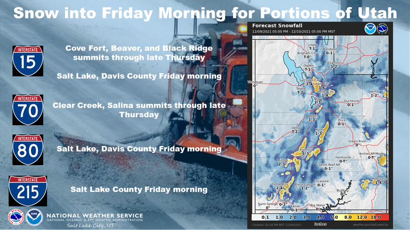
And then it snowed... in fact, it dumped! The storm lit up over the Uinta's delivering a solid 12" of snow with an 1" of water near the trailheads and closer to 16" in the high country. West and southwest winds were well behaved throughout the storm, generally blowing in the mid and upper 20's and temperatures cratered in the the single digits overnight. Riding and turning options went from zero to hero in just 24 hours, but with total snow depths hovering right around 24" it's still thin out there. Road rides and rock free, low angle meadows are the ticket.
FORECAST-
Look for mostly cloudy skies and scattered snow showers as one last shot of snow slides through our area this morning. It's gonna be cold with highs only creeping into the teens and low 20's. West and northwest winds bump into the 20's and 30's as the day progresses.
FUTURECAST-
High pressure builds this weekend and we'll see clearing skies with temperatures rebounding into the 20's. The next significant storm is expected Tuesday night and Wednesday.
Looking for real-time temps, snow, or wind?
Click HERE and then on the "western Uinta" tab for western Uinta specific, weather station network.
As the seasons change, we're interested in what you're seeing. Go here to fill out an observation.
Recent Avalanches
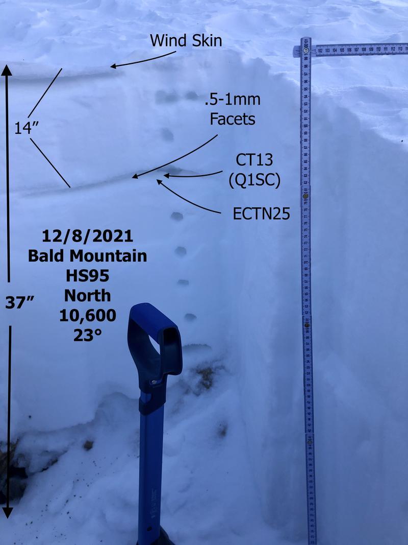
JG submitted the pit profile above from his travels Wednesday near Bald Mountain. His take on the state of snow structure along with a stellar observation is found HERE.
Observations, trip reports, and avalanches found here.
Ad
Avalanche Problem #1
Wind Drifted Snow
Type
Location
Likelihood
Size
Description
Our main man Ted Scroggin visited Double Hill Wednesday and his video above along with this observation HERE, brilliantly explain what current conditions look like in that zone.
The recent storm delivered a good thump to the snowpack and I suspect steep, northerly terrain that held weak, old October snow came to life and produced small, natural avalanches. Steep, shady slopes that didn't avalanche wait for a trigger like us to roll along and tip the scales. So, this is exactly the type of terrain we want to avoid. And given the current "strong snow on top of weak snow" structure, I bet you can trigger avalanches from a distance or from adjacent slopes.
Now here's where it gets complex... there's a fresh blanket of snow coating our mountains and everything's gonna look white. In fact, it'll be more difficult to determine what slopes held early season snow. But remember... terrain that faces the south half of the compass was bare prior to yesterday's storm. And while there's plenty of gear wrecking rocks and stumps to slam into, there's no old snow and avalanche issues are straight-forward.
And remember- a few of our high mountain passes dump us off in avalanche terrain. I think about early season roadside attractions like Wolf Creek Bowl near Highway 35 and Wolf Creek Pass. Easy grab... right? However, just 'cause you can see it from the road doesn't means it's good to go.
Additional Information
Your observations are important, so please let me know what you're seeing... click HERE and contribute to this amazing community based program
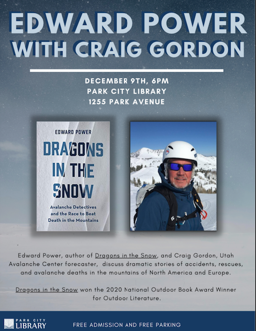
Big thanks to everyone who turned out for last nights Dragons in the Snow book reading and presentation. It was great to see so many familiar faces and old friends and make the connection with new friends as well... what an amazing community we have and I am grateful you shared your evening with Ed and I :)
General Announcements
The information in this forecast expires 24 hours after the day and time posted, but will be updated by 07:00 Saturday December 11th.
Before it gets too crazy, now is the time to book an avalanche awareness presentation for your group, club, or posse. You can reach me directly at 801-231-2170 or [email protected]
This forecast is from the U.S.D.A. Forest Service, which is solely responsible for its content. This forecast describes general avalanche conditions and local variations always occur.