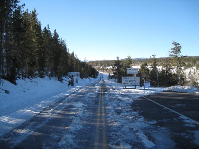
Seasonal closures are in place for the Mirror Lake Highway and currently, there's no winter maintenance or plowing.
If you missed the 13th Annual Utah Snow and Avalanche Workshop, the recordings are available for purchase from the UAC Store.
Click
here for more details.
Looking for ways to navigate the winter ?
Nowcast-
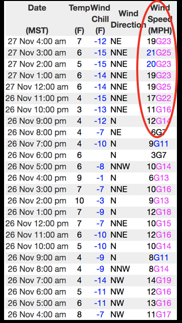
In the wake of yesterdays storm, skies cleared overnight and temperatures crashed into the single digits where they sit early this morning. Northeast winds bumped into the 20's as you went for your second helping of Tofurkey and they've blown steadily overnight along the high ridges, where windchill values register in negative territory. Our Thanksgiving storm helped change the landscape slightly, delivering close to 6" of very light density snow, but with overall snow depths just below two feet, it's still pretty thin out there.
Forecast-
Look for mostly sunny skies with temperatures climbing into the low 20's. Northerly winds relax as the day wares on.
Futurecast-
Clouds slide through the area late Saturday as a weak, moisture starved system clips northern Utah. Another cold front swings through the region Monday night and that may produce a couple inches of snow. Looking into the weather forecast crystal ball, there's no big storms in sight.
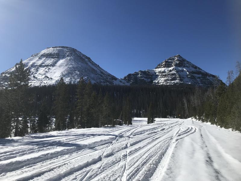
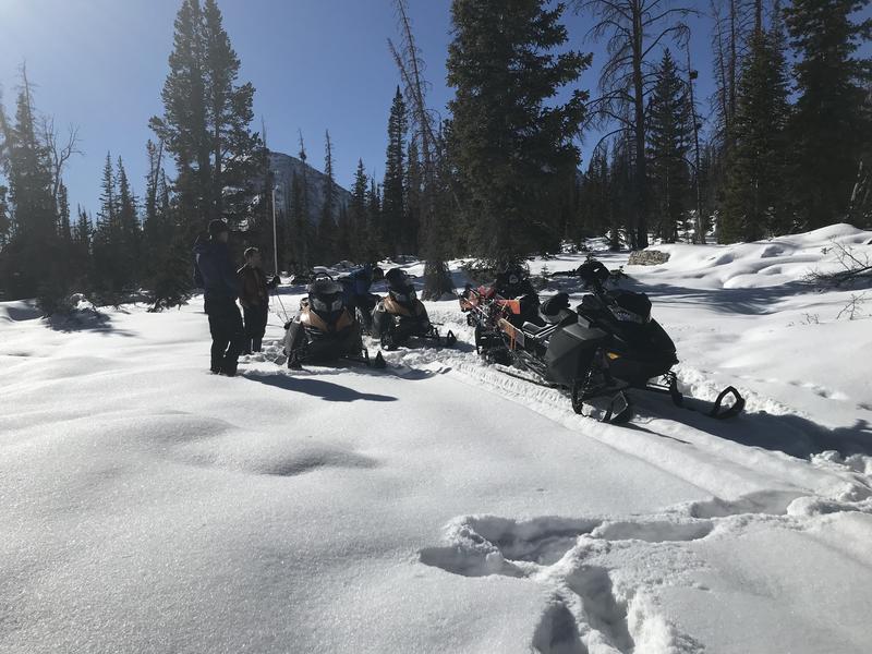
Bald Mountain and Reids Peak looking regal, yet still super boney. With only two feet of snow on the ground and four feet of rock poking through, the snowpack is thin and travel limited to grassy slopes and road rides.
Looking for real-time temps, snow, or wind?
Click
here and then on the "western Uinta" tab for western Uinta specific, weather station network.
No new avalanche activity to report.
To view trip reports and recent avalanche activity, simply click
here.