Forecast for the Uintas Area Mountains

Craig Gordon
Issued by Craig Gordon for
Wednesday, November 21, 2018
As the storm gets going expect the avalanche danger to rise from Moderate to Considerable, especially on mid and upper elevation terrain facing the north half of the compass and particularly on slopes with pre-existing early season snow. In terrain with these characteristics, human triggered avalanches will become likely by days end.
Low
Moderate
Considerable
High
Extreme
Learn how to read the forecast here
Special Announcements
A change in the weather is on tap and I'm expecting a good shot of snow, water, and wind beginning Thursday. Of course this means avalanche conditions will change rapidly through the weekend. Read on to the details below to get a handle on the type of avalanche dragon you can expect to encounter if you're headed to the mountains.
Weather and Snow
Active weather begins on Thursday. Winds start ramping up tonight in advance of a weakening trough that crosses the area tomorrow. This is the warm up band and we'll see periods of light to moderate snow... 3"-6" expected by late in the day with a break scheduled for Friday. The main event is still on tap for Friday night and Saturday. Click HERE for a great viddy synopsis created by our good friends and partners at the National Weather Service.
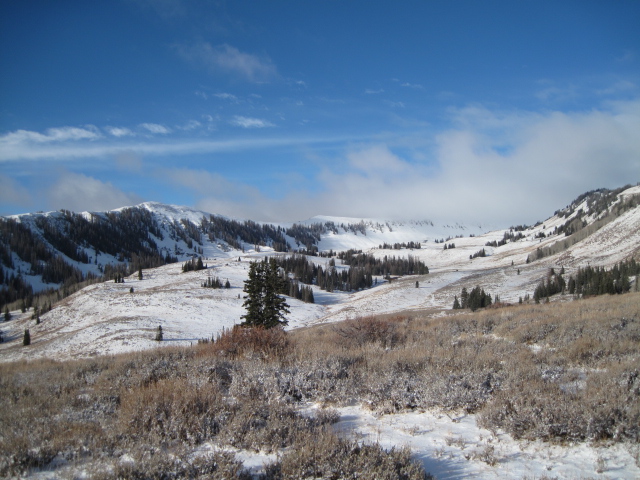
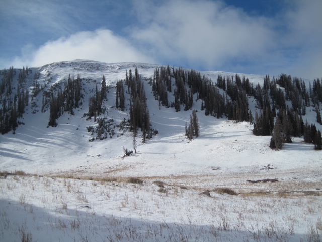
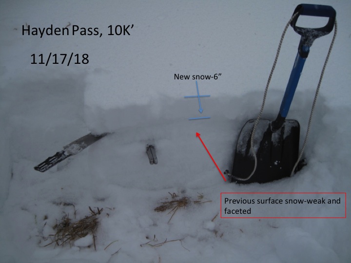
Our main man Ted Scroggin has been out and about, stomping around Bald Mountain Pass and in Whitney Basin since early November. He reports a thin, yet layered snowpack with about 18" of snow on the ground on upper elevation, north facing slopes.
This is exactly the type of terrain that's gonna be sketchy as the holiday storm evolves.
Wanna avoid avalanche danger this weekend? Of course you do and it's easy. Simply avoid any mid or upper slope that has pre-existing, early season snow Your exit strategy is to swing around to souuth facing terrain where you can ride without the worry of avalanches breaking to weak snow near the ground.
Recent Avalanches
No recent avalanche activity to report
Ad
Avalanche Problem #1
Persistent Weak Layer
Type
Location
Likelihood
Size
Description
Our shallow snowpack is in its infancy and it's got issues. The bullseye terrain is mid and upper elevation slopes facing the north half of the compass where the snowpack is weak and sugary. And now for the first time this winter, these slopes will experience their first big stability test. Quite frankly, I don't think this setup is much of a match for the strong winds, copuled with a good dose of water and snow forecast for the next couple of days. We'll have to see how the storm plays out, but I suspect that as the new storm snow stacks up, avalanches will begin breaking into weak snow near the ground, revealing a myraid of hidden obstacles that could easily ruin your day or end your season. Remember- just 'cause you can see your rig parked on Bald Mountain Pass or near Wolf Creek, doesn't mean the terrain you're choosing to ride is good to go.
General Announcements
I will update this forecast by 7:00 AM on Thursday November 22nd.
If you're getting out and about and see or trigger an avalanche, please let me know. You can submit an observation by clicking here. Or if you need to reach me call or text 801-231-2170 or send me an email [email protected]