Forecast for the Uintas Area Mountains

Craig Gordon
Issued by Craig Gordon on
Wednesday morning, January 7, 2026

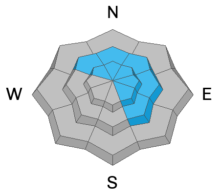
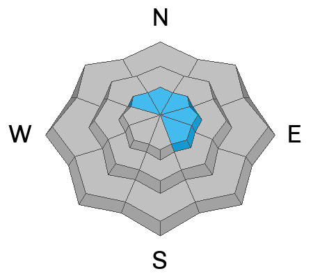
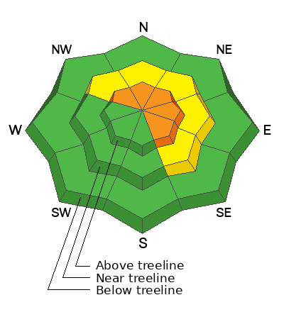
While not widespread, at and above treeline, you'll find pockets of CONSIDERABLE avalanche danger and human triggered avalanches are LIKELY on steep, upper elevation slopes, especially those facing the north half of the compass. Breaking 3-5 feet deep, failing into old snow, and shattering up to a football field wide, these are not to be messed around with avalanche dragons. Remember, once initiated, even a small avalanche can step-down, breaking deeper into the snowpack and triggering a larger slide that gets out of hand in a hurry.

Here's my exit strategy... I'm gonna avoid avalanche terrain altogether by steering my program towards high quality riding on low angle, wind sheltered slopes, with no overhead hazard. Done, done, and done :)
Low
Moderate
Considerable
High
Extreme
Learn how to read the forecast here
Weather and Snow

Nowcast - High pressure is shifting east, while winds blowing 15-25 mph from the southwest near the high peaks invite a few high clouds to drift through the region. There's a warm before the storm on tap, but the mercury hasn't gotten the memo just yet and morning temperatures have a little bite, starting their day in the upper teens and mid 20's F.

Forecast - Look for increasing clouds, temperatures climbing into the low 30's F, and snow developing by early afternoon. Winds blow from the west and southwest, ramping into the 30's and 40's by late afternoon.

Futurecast - A cold front swings through the Uinta's overnight delivering a good shot of low density snow for Thursday. Snow tapers off by about dinnertime and I'm still thinking a foot of snow and inch of water feel like a solid bet before the storm exits the arena. High pressure delivers clearing skies to wrapup the workweek with temperatures warming through the weekend.

Travel Conditions - Since the turn of the New Year, travel conditions have dramatically improved across the range with supportable snow depths registering from 3'-5'. It's still a little lean at lower elevations, but the Christmas Eve raincrust keeps us off the ground and last weekends storm is helping put to bed any lingering rocks, stumps, and bumps.

Riding and turning conditions are five star and the weekend storm delivered the kind of snow that makes the rest of our nations license plate mottos envious... not for potatoes, gardens, or evergreens... though Virginia you're running a close second and yes we're lovers too, but for the Greatest Snow on Earth.

Recent Avalanches

Yesterday, we noted a picturesque natural storm slab avalanche perhaps triggered by a small cornice fall. Occurring near the Chalk Creek ridgeline, this slide broke just over a foot deep and failed on a mist crust that formed at the turn of the New Year.

More trip reports and additional avalanche observations are just a click away on the button below.

Avalanche Problem #1
Persistent Weak Layer
Type
Location
Likelihood
Size
Description

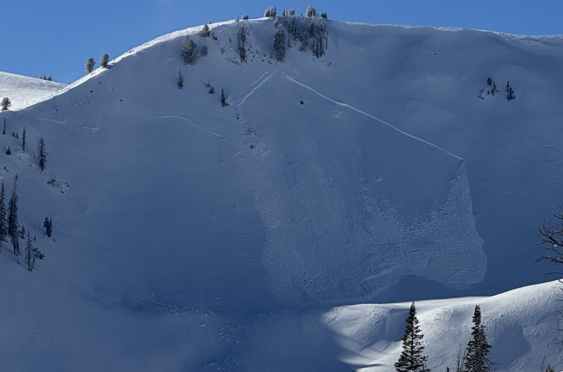
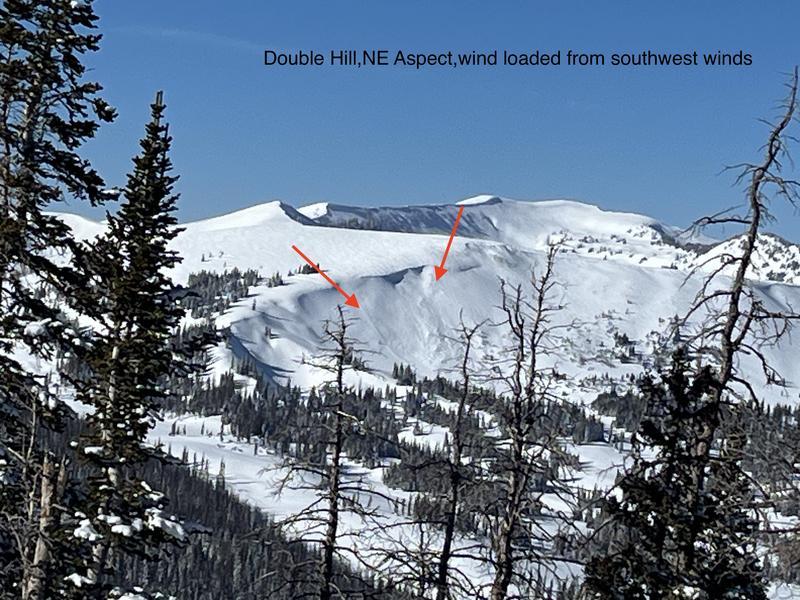
Ted was in the Gold Hill zone yesterday and noted this large, natural slide on Double Hill. It's a couple days old, but mirrors exactly the kind of snow structure and terrain where we could still trigger a deep, scary avalanche today.

The weekend storm was a solid wallop to our snowpack... good snow, water, and wind. And while a few slopes throughout the range avalanched naturally, many more teeter in the balance just waiting for a trigger like us to roll along and knock the legs out from underneath. Personally, I'm moving with caution and intent by slowing down, gathering facts, and reminding myself even though we're into January, our snowpack is in it's infancy and barely comfortable in its own skin. Since i know persistent slabs are tricky, unmanageable avalanche dragons, instead of trying to outsmart the snowpack, I'm gonna use avalanche avoidance as my go-to tool. Steep, rocky slopes with a shallow snowpack is primetime suspect terrain I plan to steer clear of.

Here's the mind-warp... we can put 100 tracks on a slope without triggering a slide, but all the 101st rider needs to do is find a shallow spot in the snowpack, like around a bush or a rock, collapse the weak layer (whumpf), and now we're staring down the barrel of a dangerous avalanche.

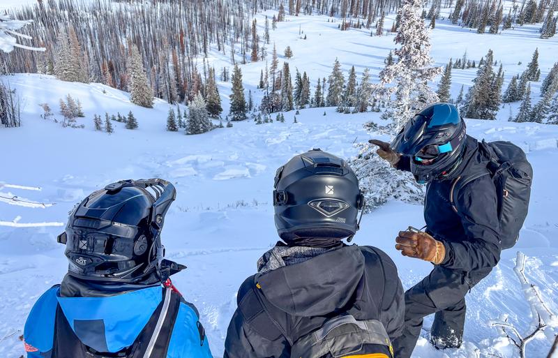
Above, Chad and Al discuss the set-up they see out in the Mirror Lake Corridor near Reids Peak where a strong, dense slab sits above weak, early season, faceted snow that continues to show signs of life.

Avalanche Problem #2
Wind Drifted Snow
Type
Location
Likelihood
Size
Description

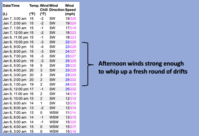
24 hour data dump from Windy Peak (10,662') illustrating yesterday's midday bump in wind velocity near the high peaks.

There's enough low density surface snow available to blow around and team up with increasing ridgetops winds, and that combo easily whips up a fresh round of drifts reactive to our additional weight. This avalanche dragon is straight-forward and I'm looking for and avoiding fat, rounded pillows of snow, especially on the leeward side of ridges, chutes, gully walls, and cut banks. In addition, I'm gonna steer clear of hard, dense drifts, especially if they sound hollow like a drum.

And finally, cornices are getting meaty, will be touchy today, and are gonna pack a punch. Give 'em plenty of room, and remember, a cornice tumbling down on the slope below can easily trigger a larger avalanche that gets quickly out of hand.

Additional Information

There is no better time to take any avalanche course than now! Whether you sled, ski, board or snow angel, we have a class for you. Reach out to us to get into an avalanche course that fits you best, or get your riding crew together and lets set-up a private day on snow!

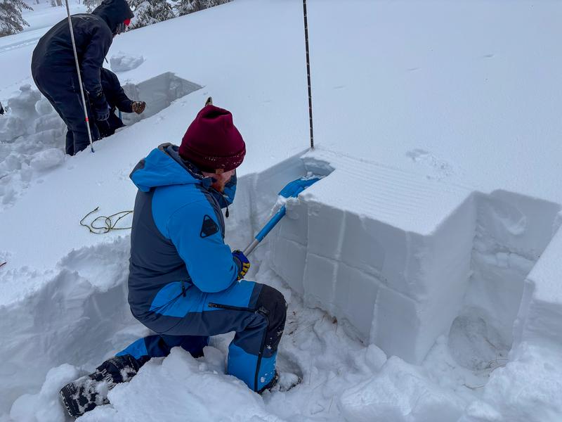
Students in a Sled Backcountry 101 course working on their pit craftsmanship and learning how to properly perform an ECT test and how to communicate those results.

There is no better way to learn about avalanches than investigating avalanches! Students from a recent course take a look at an old human triggered avalanches and try to put the pieces together to understand what happened.

General Announcements

We have some upcoming classes and events that we'd be stoked to see you at -- Please reach out with any questions and check out below for more details!

We are always looking for snow and avalanche observations or just general riding conditions. Reach out to us with questions, concerns, or if you see anything in your travels! Contact us directly through the info below:

This forecast is from the U.S.D.A. Forest Service, which is solely responsible for its content. This forecast describes general avalanche conditions, and local variations always occur. This forecast was issued on Wednesday, January 7th at 0400 AM and expires 24 hours after it was issued. We'll update this information by 07:00 AM tomorrow.