Forecast for the Uintas Area Mountains

Issued by Craig Gordon on
Wednesday morning, January 5, 2022
Wednesday morning, January 5, 2022
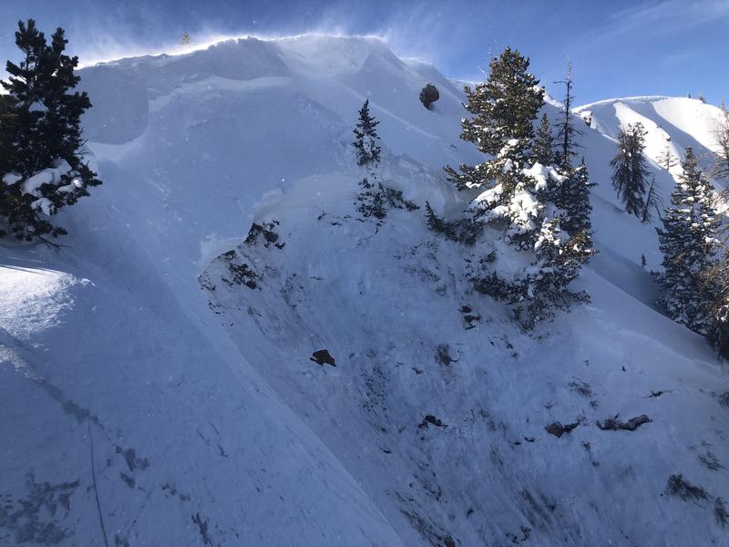
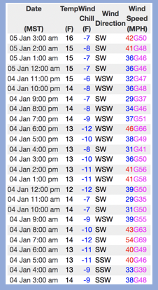
HEADS UP... AVALANCHE DANGER WILL RAMP UP AS TODAY'S STORM MATERIALIZES
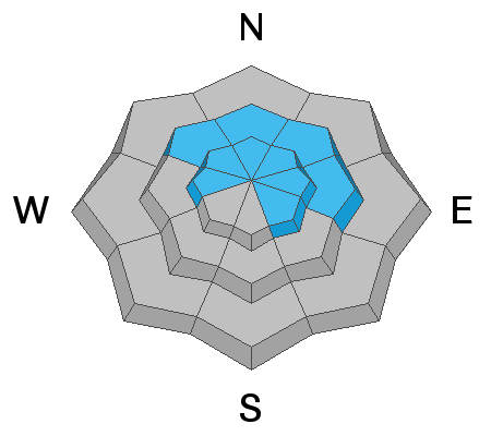
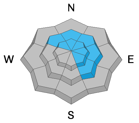
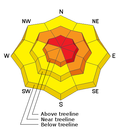
For today- Near and above treeline, especially in the wind zone, the avalanche danger is HIGH. Triggering a deep, dangerous avalanche is VERY LIKELY, particularly on steep, wind drifted slopes facing the north half of the compass.
As the storm evolves look for CONSIDERABLE avalanche danger developing below treeline where human triggered avalanches are LIKELY on steep, shady slopes.
Lower elevation terrain near the trailheads will get in on the act and you'll find MODERATE avalanche danger on steep wind drifted slopes where human triggered avalanches are possible.
What's your exit strategy? There's no shortage of low angle, rolling terrain where you can steer clear of the avalanche dragon and still have a blast. Practice your riding technique and rip deep trenches in a big open meadow today, or head to low angle, sunny slopes that didn't have old October snow for some fun with limited avalanche danger. But remember- let's give the steep, shady slopes some time to get comfortable in their new winter coats.
Low
Moderate
Considerable
High
Extreme
Learn how to read the forecast here