Are you snowpack curious... wondering how the Persistent Weak Layer went from Zero to Hero? Well then, you came to the right place! Please join me 6:00 Monday, January 23rd in Park City at the Kimball Junction Library for a State of the Snowpack prezo. It's gonna be informative, educational, and quite possibly entertaining :)
Nowcast- A shot of cold air slid through the region overnight, delivering a trace of snow and temperatures hovering right around zero. Toss in some northwest winds blowing 15-25 mph and you've got windchill registering right around -15 degrees... ouch. But as skies begin to clear you'll forget about the diesel gelling, toe numbing cold... yup the riding is amazing, especially in mid elevation, wind sheltered terrain.
Forecast- High pressure briefly visits northern Utah, delivering partly cloudy skies, as northwest winds blow 15-25 mph along the high peaks. Temperatures are gonna be cold with highs barely clawing their way into the low 20's while overnight lows crater into negative territory.
Futurecast- Another weak storm clips the northern half of the state and we can expect increasing clouds and buzz-killing northerly winds ramping into the 50's overnight and into Sunday. We might be able to squeeze 2"-4" of snow out of this mostly dry system, but then we're left with very cold temperatures barely reaching into the teens for Monday.
Colossal water numbers and Herculean snowpack depths are helping the pack turn the corner. This strongly aligns with reasoning to pull the plug on our problem child, the Persistent Weak Layer, which has plagued us since late November... whew!
Also, I'm super stoked to see Trevor Katz great ob and insight from the south half of the range near
Tut Creek. Nice work man... thanks for the beta!
Huge thanks for all the great obs streaming in from the eastern front. Detailed trip reports and recent obs are found
HERE.
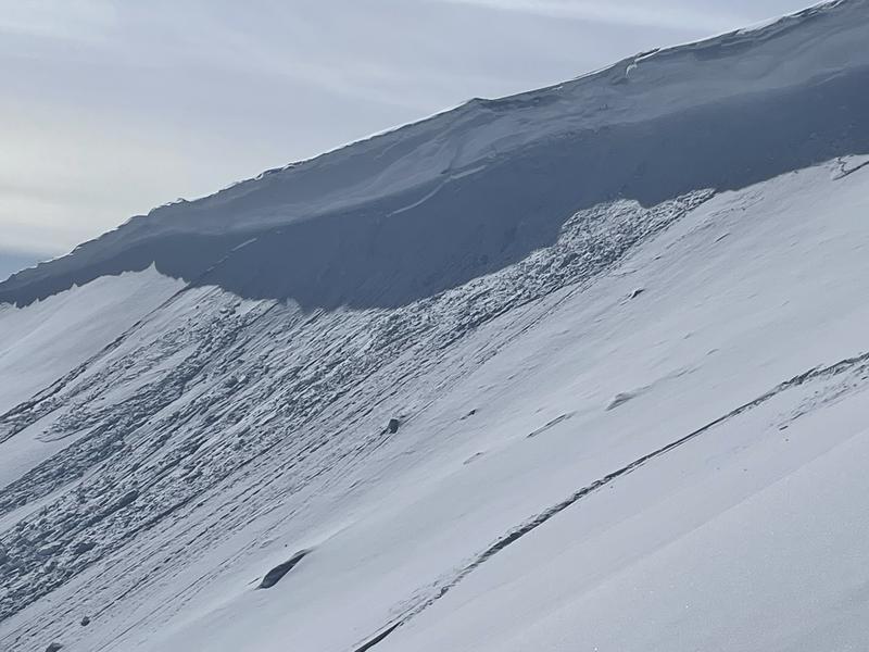
Snow-Pro, mentor to countless avalanche professionals, all around amazing person, and always keen to rally... Bill Nalli, has a keen eye for all things avalanche and spotted a rather significant, week old slide in Upper Moffit Basin
. Deets are found
HERE.Other than a shallow wind drift or two, no other significant avy activity to report. But a slew of Uinta avy obs are found
HERE.