Forecast for the Uintas Area Mountains

Craig Gordon
Issued by Craig Gordon for
Thursday, January 19, 2023
About as straight-forward as it gets-
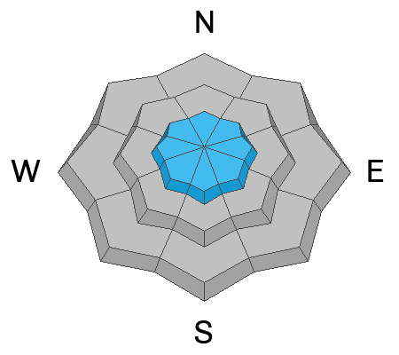
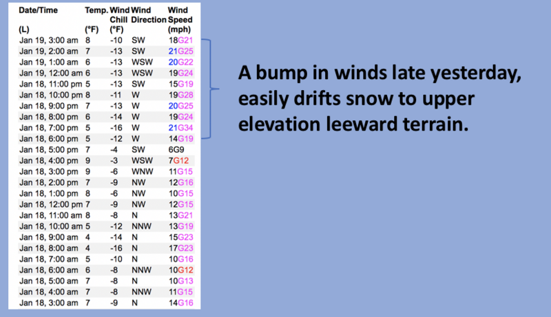
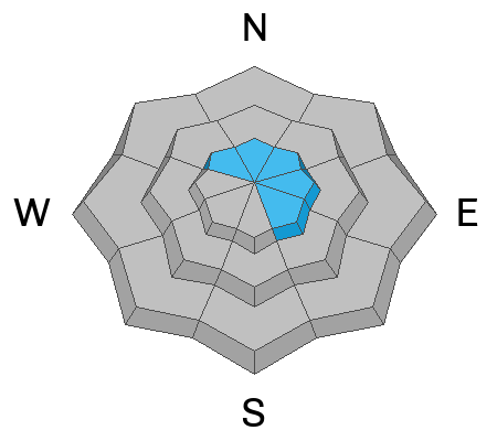
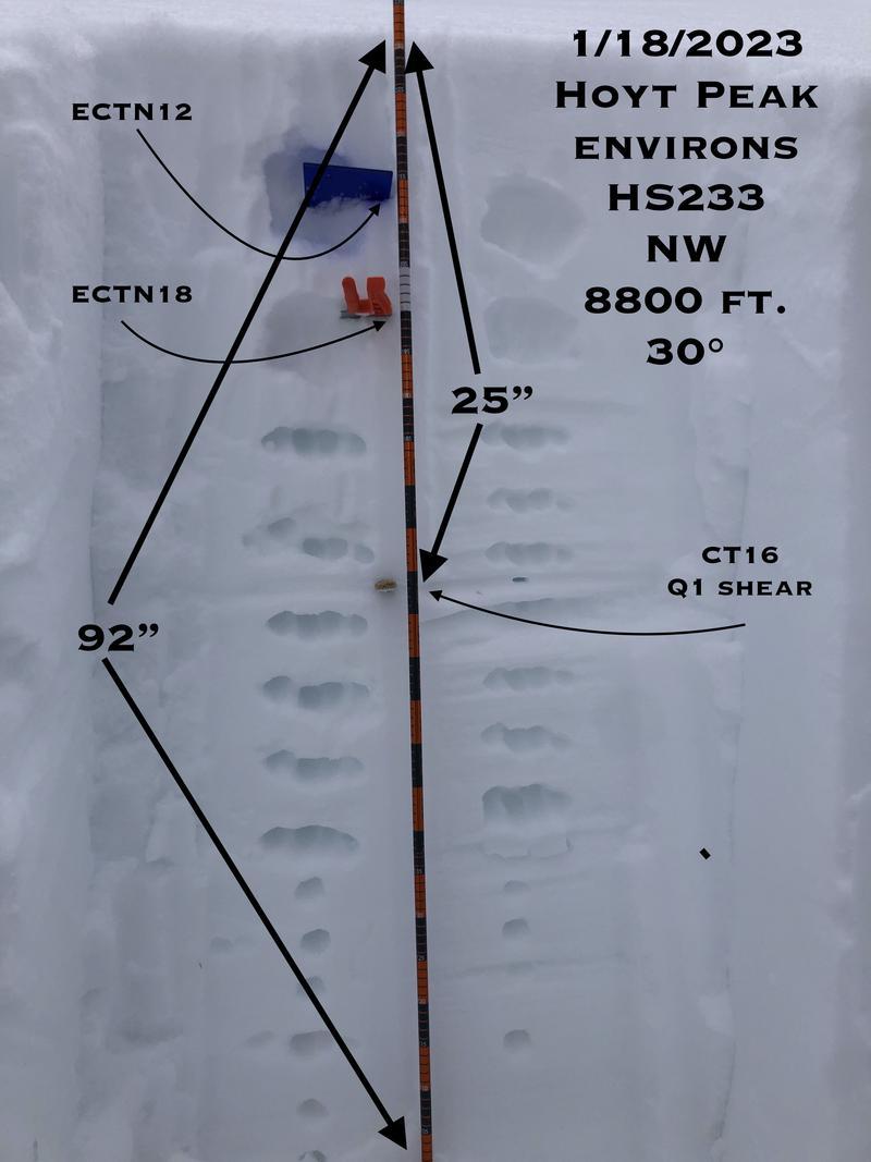
MODERATE avalanche danger is found on upper elevation leeward slopes, especially in the wind zone at and above treeline. Fresh wind drifts reactive to our additional weight are POSSIBLE. While, more the exception than the rule, a rogue avalanche breaking to weak layers now buried deep in our snowpack remains POSSIBLE. The danger is most pronounced in steep, rocky terrain facing the north half of the compass.
Generally LOW avalanche danger is found on all mid and lower elevation slopes.

Low
Moderate
Considerable
High
Extreme
Learn how to read the forecast here
Special Announcements
Are you snowpack curious... wondering how it went from Zero to Hero? Well then, you came to the right place! Please join me 6:00 next Monday, January 23rd at the Kimball Junction Library for a State of the Snowpack prezo. It's gonna be informative, educational, and quite possibly entertaining :)
Weather and Snow
Nowcast- Skies cleared overnight and temperatures crashed into the single digits, with some low laying terrain cratering into negative territory. Southwest winds blow in the mid 20's adding a bite to the air near the high peaks. Yesterday's east and northeast winds damaged our alpine terrain, but sheltered slopes harbor excellent riding conditions.
Forecast- A storm dives into central and southern Utah and we'll just see clouds and a few snow showers develop late in the day. Southwest winds bump into the 30's while temperatures climb into the mid 20's.
Futurecast- Scattered snow showers linger over the region for Friday and weak high pressure visits for the weekend. Another cold brush-by clips the northern mountains late Sunday and Monday.

Mark describes the current snowpack setup in the viddy above
In addition, our main man Ted Scroggin, has an excellent observation and offers his usual keen insight from a recent Gold Hill stomp around.
Huge thanks for all the great obs streaming in from the eastern front. Detailed trip reports and recent obs are found HERE.
Recent Avalanches
Other than a shallow wind drift or two, no significant avy activity to report. But a slew of Uinta avy obs are found HERE.
Ad
Avalanche Problem #1
Wind Drifted Snow
Type
Location
Likelihood
Size
Description
24 hour data dump from Windy Peak(10,662') shows recent run of winds.
There's no shortage of snow available to blow around and recent winds have no problem whipping up a fresh round of shallow drifts sensitive to our additional weight. Found on upper elevation leeward slopes and manageable in size, this is an easy avalanche dragon to avoid... lose a little elevation, you lose the wind and you lose the problem.

Avalanche Problem #2
Persistent Weak Layer
Type
Location
Likelihood
Size
Description
JG's beautiful pit profile from the Hoyt environs illustrates a deep snowpack, happy in its own skin. JG knows how the Uinta snowpack works and his PWL mindset has shifted... "With 7 to 8 feet of snow on the ground we weren't very concerned about the deeply buried PWL created during the November dry spell so we directed our attention to the upper 63cms (25"storm snow) since that is where we were finding instabilities in Column Tests."
So... can I trigger a deep, dangerous avalanche that breaks to the midpack November facets? Yeah... but I've really gotta hunt this one out and all the planets have to align to ruin my day. Likely suspects include steep, rocky, upper elevation terrain where the snowpack is lean or slopes that avalanched earlier this season and are therefore slightly more thin and fragile. I'm stepping out cautiously, but with intent, gathering as much snowpack intel as I can along the way.
Additional Information
Weather stations-
And... rime events have severely crippled the Uinta weather station network. I'm working to get it back up and running and this real-time winter info is found HERE (click weather stations, and then on the Western Uinta tab)
Observations-
Your observations are important, so please let me know what you're seeing... click HERE and contribute to this amazing community-based program
General Announcements
Issued at 03:13 on Thursday January 19th, this forecast expires 24 hours after the date and time posted, but will be updated by 07:00 Friday January 20th, 2023.
Before it gets too crazy, now is the time to book an avalanche awareness presentation for your group, club, or posse. You can reach Craig directly at 801-231-2170 or [email protected].

This forecast is from the U.S.D.A. Forest Service, which is solely responsible for its content. This forecast describes general avalanche conditions and local variations always occur.