UDOT PLANNED AVALANCHE CLOSURES!!

Forecast for the Uintas Area Mountains

Craig Gordon
Issued by Craig Gordon for
Monday, January 14, 2019
At mid and upper elevations, near and above treeline, the avalanche danger is MODERATE. Human triggered avalanches are POSSIBLE on steep slopes, especially those with an easterly component to their aspect.
Any avalanche that breaks into deeper buried weak layers near the ground will result in a deep, scary, and dangerous avalanche.
If you're looking for LOW avalanche danger, simply head to lower elevation terrain or big open meadows with no steep terrain above or connected to where you're traveling.
Low
Moderate
Considerable
High
Extreme
Learn how to read the forecast here
Weather and Snow
Skies are partly cloudy, temperatures in the teens, and there's hardly a whisper of wind even along the highest ridges. Riding and turning conditions are straight-forward... low elevation terrain and sunny aspects took on heat the past few days and are crusted, but there's still plenty of cold, shallow snow on wind sheltered, shady slopes.
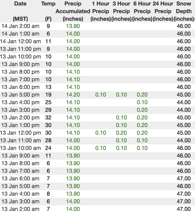
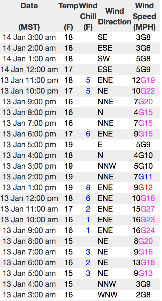
Above is hourly data from Trial Lake (9,945') along with recent wind data from Windy Peak (10,662'). To view more regional weather stations click here.
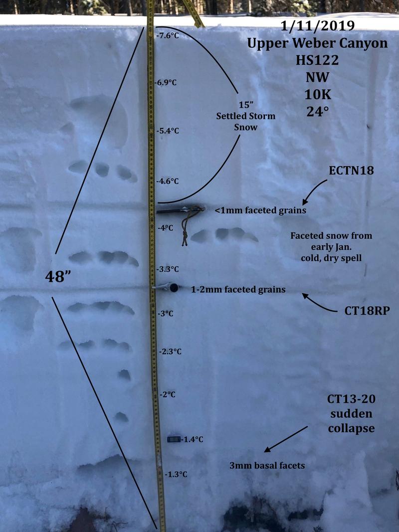
A beautifully detailed pit submitted by JG who was in Weber Canyon Friday, reveals some bad juju near our faceted layers of snow. More on his travels here.
Recent Avalanches
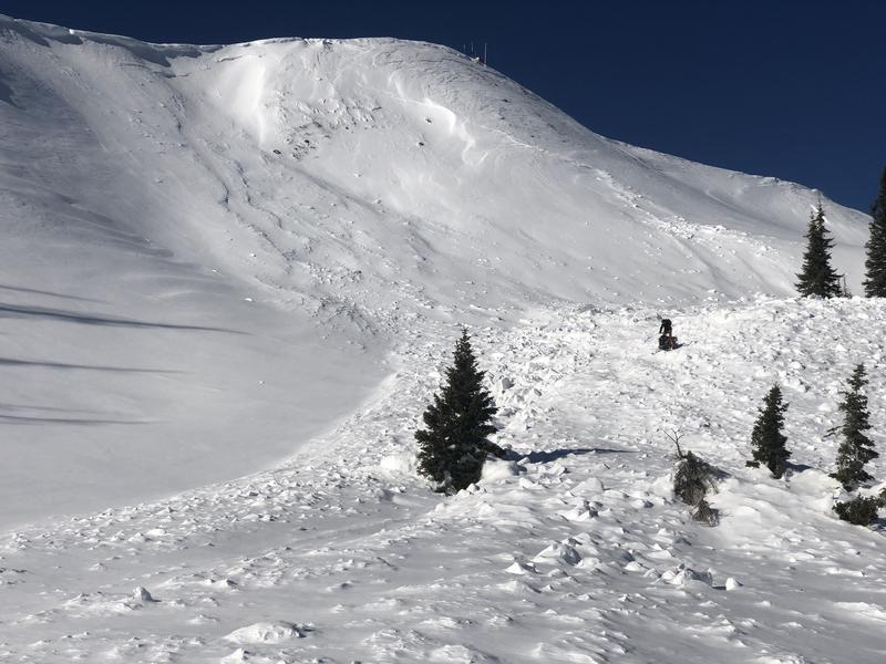
Andy and Bo stomped around the south half of the range, noting a widespread, midweek avy cycle. The viddy above clearly illustrates a weak, midpack layer that lit up with last weeks big storm. With more snow, water, and wind slated for this week, it's a layer to to keep and eye on, especially as it gets buried deeper in our pack.
Check out their well documented and very detailed trip report here. Solid work men!
Ad
Avalanche Problem #1
Persistent Weak Layer
Type
Location
Likelihood
Size
Description
You'd think by now our persistent weak layer issues would be done... and in much of our terrain it is. And while it's been a week since the snowpack received a big thump of water, snow, and wind, it was exactly that combo that brought dormant, persistent weak layers back to life, particularly in terrain where the snowpack is thin and weak. Now here's the problem- "persistent weak layers" in the snowpack are a headache because all we need to do is find one weakness, maybe around a bush or rock that we can't see buried underneath the snow, collapse the pack, and now we've triggered a deep, dangerous avalanche. Another wild card to add to the deck is the possibility of triggering an avalanche low on the slope or from an adjacent slope.
So you're asking, "how do we manage an unmanageable avalanche dragon is the snowpack?" Well we simply avoid it and the usual suspects come to mind- steep, rocky terrain and slopes that have already avalanched this year. In addition, periphery terrain where the pack has remained shallow all season should be considered guilty until proven otherwise.
Chad was in a weak snow zone Saturday. His viddy clearly shows the setup.
Avalanche Problem #2
Wind Drifted Snow
Type
Location
Likelihood
Size
Description
A bump in the winds Saturday night may have found enough loose snow to blow around and form a fresh drift or two along the leeward side of upper elevation ridges, but I don't these these are gonna be particularly widespread. However, the Uintas are a big place, so look for and avoid any fat, rounded piece of snow especially if it sounds hollow like a drum.
Additional Information
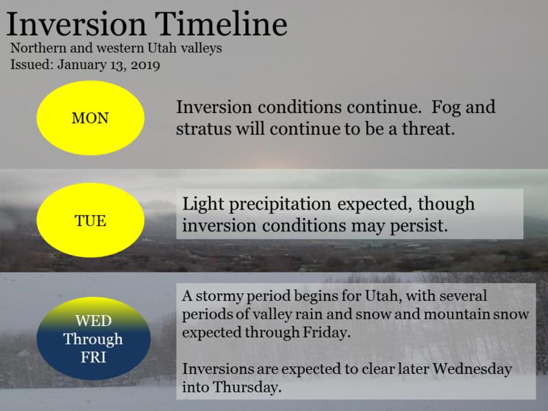
One more sunny day is on tap before high pressure begins breaking down, allowing a series of weak storms to slide through the region beginning tomorrow. Look for increasing clouds late in the day with high temperatures in the 30's and winds bump into the mid 20's and 30's by about dinnertime. A small shot of snow develops for Tuesday with another on Wednesday. A colder, wetter system appears to develop for late in the week. I should have a better handle on that storm in the next day or two and will keep y'all posted.
General Announcements
The information in this advisory expires 24 hours after the date and time posted, but will be updated by 7:00 AM Tuesday January 15th, 2019.
If you're getting out and about, please let me know what you're seeing especially if you see or trigger and avalanche. I can be reached at [email protected] or 801-231-2170
It's also a good time to set up one of our very popular avalanche awareness classes. Reach out to me and I'll make it happen.
This information does not apply to developed ski areas or highways where avalanche control is normally done. This advisory is from the U.S.D.A. Forest Service, which is solely responsible for its content. This advisory describes general avalanche conditions and local variations always occur.