Forecast for the Skyline Area Mountains

Brett Kobernik
Issued by Brett Kobernik for
Thursday, March 7, 2019
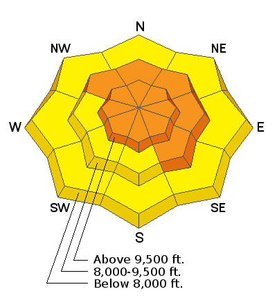
DENSE SNOW AND STRONG WIND ARE INCREASING THE AVALANCHE DANGER. The danger is CONSIDERABLE today. Human triggered avalanches are likely especially in areas with fresh drifts of wind blown snow. You will want to let the snow from the current series of storms settle before getting into any serious terrain.
Low
Moderate
Considerable
High
Extreme
Learn how to read the forecast here
Weather and Snow
About 6 inches of dense snow fell in the last 24 hours. The rain/snow level was around 7000 feet. The southwest wind was as strong as I've seen it on the Skyline with gusts to near 100mph on Monument Peak. I recorded a gust of 40mph at my weather station in the canyon bottom of Spring City Canyon.
We should see periods of snow today adding another 2 to 4 inches with another round on Friday of about the same or a little more snow. Saturday looks cloudy but perhaps no snow and cooler temperatures. More periods of snow will start again Sunday and continue into next week.
Ad
Additional Information
This forecast is from the U.S. Forest Service, which is solely responsible for its content. This forecast describes general avalanche conditions and local variations always occur.