UDOT PLANNED AVALANCHE CLOSURES!!

Forecast for the Skyline Area Mountains

Brett Kobernik
Issued by Brett Kobernik for
Tuesday, March 5, 2019
There was no huge change in conditions since Monday. The avalanche danger is MODERATE today. Continue to watch for fresh drifts of wind blown snow along the upper ridges. Also, monitor the snow surface and watch for areas to become damp today. Move off steep slopes when they do become wet and sloppy.
Low
Moderate
Considerable
High
Extreme
Learn how to read the forecast here
Weather and Snow
We'll see partly cloudy skies today with mild temperatures. Another storm rolls through tonight bringing a good shot of snow and then another impulse on Friday. It's possible we could see one to two feet of snow.
Ad
Avalanche Problem #1
Wind Drifted Snow
Type
Location
Likelihood
Size
Description
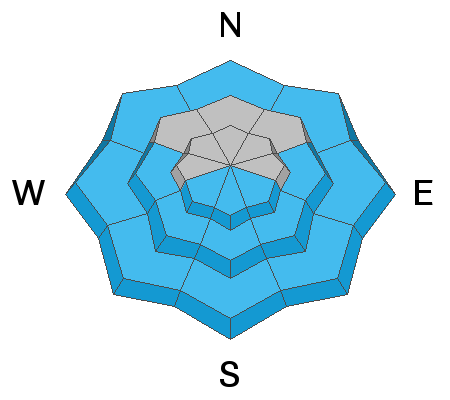
West wind was moderate in speed on Monday along the ridges and I did notice some snow getting transported. Cracking out a fresh wind drift today is the most likely avalanche problem you'll encounter. Watch for these fresh drifts on the more east facing steep slopes especially along the ridges.
Avalanche Problem #2
Wet Snow
Type
Location
Likelihood
Size
Description
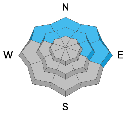
It'll be a little warmer today with possibly more sun in the mountains so the chance for wet avalanches may be greater today than Monday. Watch for "pinwheels" or "rollerballs" on the snow surface indicating the snow is becoming damp and it's time to start moving off of these steep slopes.
Avalanche Problem #3
Persistent Weak Layer
Type
Location
Likelihood
Size
Description
Shallow areas are still holding very weak sugar snow near the ground that could fail under the new snow load. This is more of an issue in the mid and lower elevation terrain. What's a little tricky is that this season we have enough snow to travel into lower elevation terrain and we don't usually think so much about avalanches in these areas. Avoid steep slopes anywhere you find unsupportable snow like in the video below.
Additional Information
This forecast is from the U.S. Forest Service, which is solely responsible for its content. This forecast describes general avalanche conditions and local variations always occur.