Forecast for the Skyline Area Mountains

Brett Kobernik
Issued by Brett Kobernik for
Friday, March 24, 2023
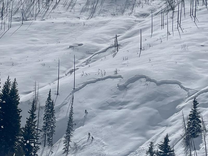
There is a CONSIDERABLE avalanche danger rating in the upper elevation steep terrain.
New snow and strong wind is expected today creating unstable conditions especially in the upper elevations.
Continue to avoid any steep slopes with recent deposits of wind drifted snow.
Low
Moderate
Considerable
High
Extreme
Learn how to read the forecast here
Weather and Snow
Current Conditions: Wow, it was again really deep on Thursday. I did fieldwork around Miller Flat and upper Huntington Canyon where there's been 32 inches of new snow since Sunday. The sun poked through here and there making the snow damp on the sunnier slopes. It did settle and consolidate a bit but it'll still be deep today. Temperatures got into the mid 20s on Thursday and dropped into the teens overnight. The wind continued to slow during the day on Thursday and has been pretty light from the southwest. There was a trace of new snow yesterday evening.

Mountain Weather: We're going to have another round of snow and wind today. I'm thinking we should see 4 to 8 inches of new snow by Saturday morning. The wind will shift around and be from the northwest with strong speeds by this afternoon. It looks like we'll see partly cloudy skies through the weekend with another chance for minor snowfall on Sunday. We get a break for a few days next week and then another storm is shaping up for Wednesday night. The weather pattern continues to look active into early April.
Recent Avalanches
There was some natural avalanche activity during the storm Wednesday evening. A period of very intense snowfall coupled with fairly strong wind created fresh drifts and slabs that released. The photo below shows avalanches in the Camp Chutes of Huntington Canyon. It appears that these only involved the most recent storm layer of snow. I also was able to get a glimpse into the higher terrain and spotted some activity along the ridges there as well.
Ad
Avalanche Problem #1
Wind Drifted Snow
Type
Location
Likelihood
Size
Description
The biggest threat today is going to be fresh wind drifts and wind slabs. Another round of snow with wind will again create fresh drifts and slabs. These are always the most sensitive while they are forming and directly afterward. Natural avalanches are possible later today. You'll again want to avoid being on any steep terrain where the wind has deposited snow, especially in the upper elevations.
General Announcements
This forecast is from the U.S.D.A. Forest Service, which is solely responsible for its content. This forecast describes general avalanche conditions and local variations always occur.