Forecast for the Skyline Area Mountains

Brett Kobernik
Issued by Brett Kobernik for
Friday, March 1, 2019
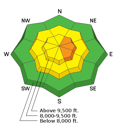
The overall avalanche danger is MODERATE today. You're biggest concern is where the new snow has been drifted into deeper slabs that may be sensitive to people. This will mainly be on the more east facing terrain along the upper ridges. These avalanches probably won't be all that large but may be enough to knock you around and possibly bury you.
Low
Moderate
Considerable
High
Extreme
Learn how to read the forecast here
Weather and Snow
Thursday: 3 to 5 inches of snow fell during a quick little storm Thursday night. The rain/snow level is in the 7000 foot range or perhaps a bit higher. Temperatures are in the mid 20s at most higher elevation stations and west northwest wind is in the moderate speed with stronger ridgetop gusts.
Today: We'll see mostly cloudy skies with the chance for light snowfall which won't add up to a whole lot more. It looks like it'll be a little breezy in the higher terrain today.
Extended: An active weather pattern will bring periods of snow for the next 10 days. The next significant period will be Saturday where we could see 5 to 10 inches.
Ad
Additional Information
This forecast is from the U.S. Forest Service, which is solely responsible for its content. This forecast describes general avalanche conditions and local variations always occur.