Forecast for the Skyline Area Mountains

Brett Kobernik
Issued by Brett Kobernik for
Thursday, February 9, 2023
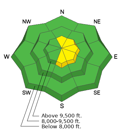
A MODERATE danger rating exists in upper elevation north through east through south terrain where recent deposits of wind drifted snow are present.
Avoid cornices and steep slopes below cornices. These are the most likely places to trigger a slide today.
If you avoid areas with wind drifted snow, the avalanche danger is LOW.
Low
Moderate
Considerable
High
Extreme
Learn how to read the forecast here
Weather and Snow
Current Conditions: The wind from the northwest has dramatically slowed overnight and is calm to light in speed. Temperatures have plummeted down to around 0˚F.
Mountain Weather: We'll have sunny skies, high temperatures around 20˚F, and light northwest wind becoming more southerly late in the day. Friday looks similar with warmer temperatures. We'll see some clouds on Saturday. The next chance for snow looks to be around mid week.
Recent Avalanches
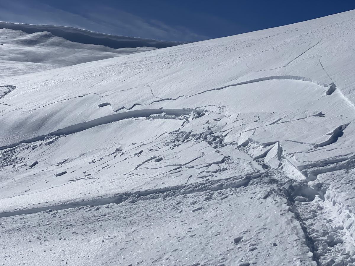
Wind slabs formed on Wednesday. These were sensitive to snowmobiles, but most didn't pose that much threat. There were undoubtedly larger slabs out there that could've knocked a person around. Likely places would be underneath cornices, like in the photo below, where you can see the wind drifting snow off the cornice and depositing it on the slope below. Photo: Cade Beck/Snow Big Deal
Ad
Avalanche Problem #1
Wind Drifted Snow
Type
Location
Likelihood
Size
Description
Yesterday's strong wind drifted snow and formed some sensitive drifts and slabs of snow. These are always the most sensitive as they form and will be more stubborn today. However, they are still likely to crack out on people. Give them a day or so to settle and stabilize before getting onto slopes where they are present.
The most likely places to find these are on steep slopes right below the ridges and peaks. Underneath cornices are also suspect areas. They'll be most predominantly on the east half of the compass.
General Announcements
This forecast is from the U.S.D.A. Forest Service, which is solely responsible for its content. This forecast describes general avalanche conditions and local variations always occur.