Forecast for the Skyline Area Mountains

Brett Kobernik
Issued by Brett Kobernik for
Tuesday, February 28, 2023
The avalanche danger rating is CONSIDERABLE today on the Skyline.
New snow and STRONG WIND have created dangerous avalanche conditions.
Human triggered avalanches are likely on steep slopes where the wind has drifted snow. Avoid any steep slopes where the snow feels stiff or you see pillows or drifts of snow.
Low
Moderate
Considerable
High
Extreme
Learn how to read the forecast here
Weather and Snow
Current Conditions: The southern and central Skyline picked up about 6 inches of new snow overnight. The northern end was favored by the storm and there is a solid foot as of 6am in the Fairview/Huntington Canyon zone. THE WIND IS HOWLING along the higher terrain with gusts to 80mph!! This is as strong as we ever see. I can't say for sure but from instrumentation and cameras, the wind doesn't look near as bad down in the canyon bottoms. Temperatures were in the mid 20s on Monday and have dropped into the low teens this morning.

Mountain Weather: We'll see snowfall this morning with a few more inches possible. We could see a quick window of partial clearing mid-day. Wind from the west will continue to be strong over the higher terrain. It should slow late in the day or this evening. Temperatures will be in the mid teens. We'll have another round of snow on Wednesday with 6 to 8 inches possible. The wind will thankfully be not near as strong.
Ad
Avalanche Problem #1
Wind Drifted Snow
Type
Location
Likelihood
Size
Description
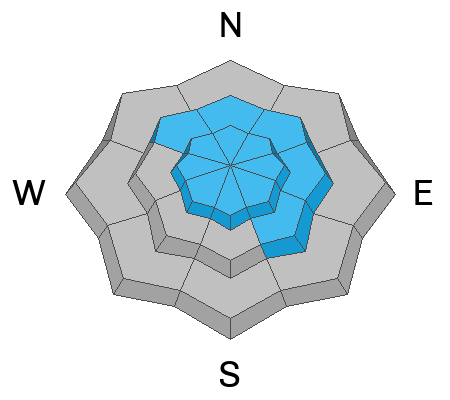
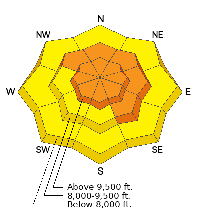
The wind drifted snow is your biggest concern today. All the new low density snow is getting blown around and drifted in the higher terrain. There is enough new wind drifted snow that we could see some larger avalanches. These drifts will be the most sensitive today as they are forming. The wind is from the south and west so it will be primarily drifting and loading snow onto the north and east facing slopes. However, watch for crossloaded drifts and slabs of snow on slopes that face any direction in the higher terrain.
The good news is that the new snow should be well behaved in areas where it hasn't been drifted. More good news is that all the drifts and slabs that are forming should stabilize within a few days.
General Announcements
This forecast is from the U.S.D.A. Forest Service, which is solely responsible for its content. This forecast describes general avalanche conditions and local variations always occur.