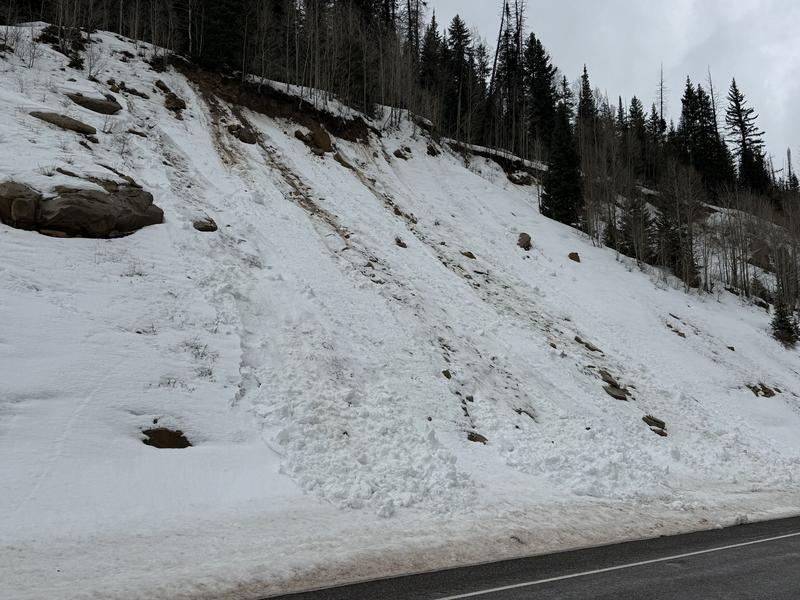
General Conditions: Unbelievable. The winter just gets stranger and stranger. Yesterday's warm-up made for some truly horrible travel conditions. It also rained up to 9500 feet. Below that, the snowpack became wet and soggy. It was punchy and unsupportable, making for difficult snowmachine travel. The track was trenching deep into sloppy wet snow as well as the skis. It was like a late afternoon in May. Above 9500', there was about an inch of dense new snow. It was more like paste. Most weather stations actually lost snow depths over the last 24 hours. Temperatures have been in the mid-30s for two days now. Wind from the west has been steady in the moderate speed range over the last 24 hours.
I was out with Logan Addis on Wednesday and he wrote about what we were finding. DETAILS HERE.
Mountain Weather: The big picture is that we slid back into the pattern we were in during January, where the long wave trough is over the eastern United States, leaving us battling a ridge of high pressure out west. We should see the skies clear out today. Temperatures will be in the mid-30s to around 40°F. Wind from the west will be moderate in speed. It'll feel a little breezy along the ridges. Warm temperatures remain in place through the weekend with periods of clouds. There's a slight chance for snow/rain on Sunday.
Warm temperatures and rain was producing some minor avalanche activity in the mid elevations on Wednesday. These were gouging deep into the facets as they traveled downhill.