Forecast for the Skyline Area Mountains

Brett Kobernik
Issued by Brett Kobernik for
Sunday, February 26, 2023
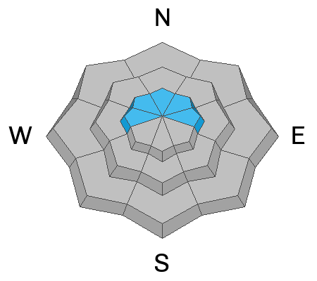
Overall the avalanche danger rating is mostly LOW today. There is a "pockety" MODERATE danger rating in the higher terrain.
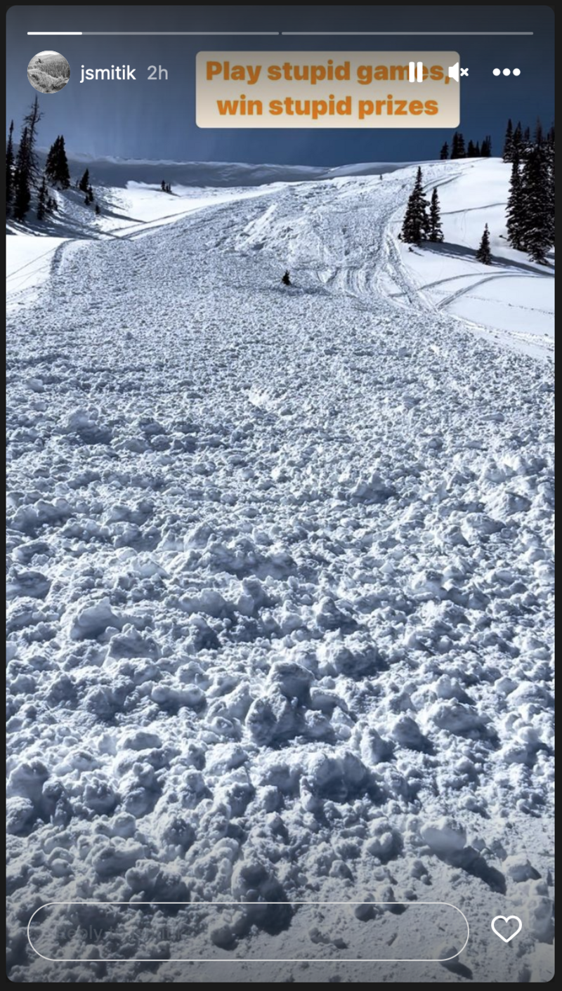
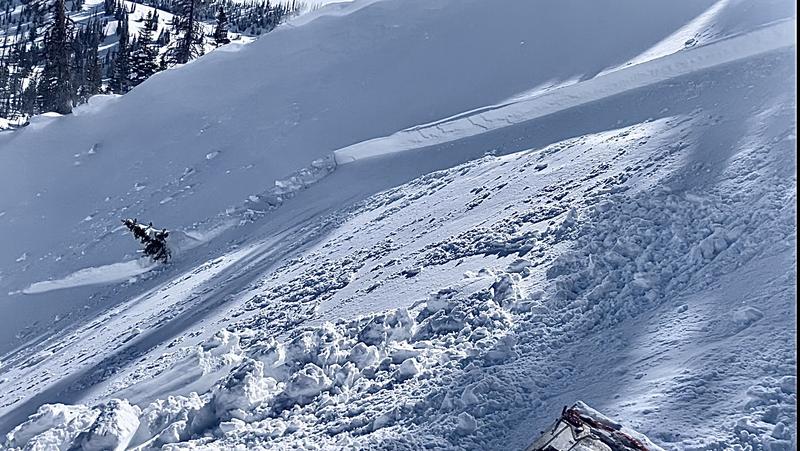
There are scattered areas where a person could trigger an avalanche in the higher terrain.
The most likely places are on northerly facing terrain right under the ridges on very steep slopes where wind has drifted snow.
Low
Moderate
Considerable
High
Extreme
Learn how to read the forecast here
Weather and Snow
Current Conditions: South and southeast wind on Saturday produced some odd drifting patterns. The wind wasn't all that strong in most places but there were higher speeds in some locations where I wouldn't have expected. Overall, riding conditions remained quite good. Temperatures got into the mid 30s on Saturday and dropped to around 20˚ overnight. There was a trace of new snow overnight.

Mountain Weather: We may see some light snowfall today but it won't add up to much. Southeast wind will shift around and blow from the west southwest at light to moderate speeds. Temperatures will remain in the low to mid 20s. We could see some light snowfall on Monday then a better storm moves in Monday night. Another impulse moves through on Wednesday. We could see a foot of snow or more between now and then.
Recent Avalanches
There are a couple of recent avalanches that are noteworthy. The first is a snowmobile triggered avalanche in Lake Canyon that occurred on Saturday. It was on a very steep northeast facing slope that was wind loaded. The rider triggered the avalanche while on the steep wind loaded slope. It released just under the ridgeline. In the photo below, if you look closely you can see plumes of snow coming off the cornice which indicates the slope was getting loaded at the time of the avalanche.
The second noteworthy avalanche released naturally in Pleasant Creek sometime late Friday night. It was also on a very steep northeast facing slope just below the ridgeline where the wind was drifting and loading snow onto the slope.
Ad
Avalanche Problem #1
Wind Drifted Snow
Type
Location
Likelihood
Size
Description
There's been just enough southerly wind to cause some concerns with fresh drifts and slabs. If you are getting into the higher terrain and very steep slopes, be aware that you could trigger an avalanche. The places where one might release are quite scattered and most slopes will stay in place. The wind has been from the south so north facing slopes are more suspect. Pockets right under the higher ridges are where you could find trouble.
General Announcements
This forecast is from the U.S.D.A. Forest Service, which is solely responsible for its content. This forecast describes general avalanche conditions and local variations always occur.