Forecast for the Skyline Area Mountains

Brett Kobernik
Issued by Brett Kobernik on
Thursday morning, February 19, 2026

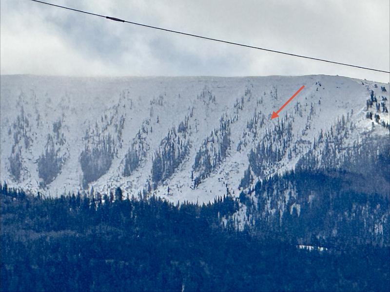
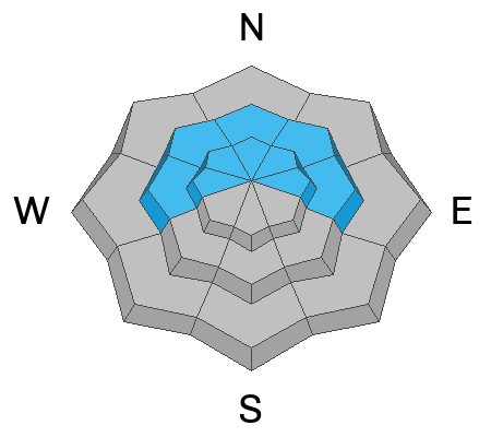
The overall avalanche danger is HIGH on the Manti Skyline today. Human-triggered avalanches are certain. To stay safe, the only thing you can do is avoid being on or below steep slopes.
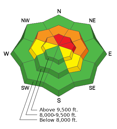
Low
Moderate
Considerable
High
Extreme
Learn how to read the forecast here
Avalanche Warning

Thursday, 2/19/26 at 6:00 AM MST through 6:00 AM MST Friday, 2/20/26

What: The avalanche danger for the warning area is HIGH today.

Where: The mountains of northern, central, southwestern, and southeastern Utah, including the Abajo Range, as well as southeastern Idaho.

Impacts: Recent heavy snow combined with strong wind is creating widespread areas of unstable snow. Both human-triggered and natural avalanches are likely.

What to do: Avoid all avalanche terrain. Stay off of and out from under slopes steeper than 30°. Carry and know how to use avalanche rescue equipment. Find safer riding conditions on slopes less than 30° with no steep slopes above you.

Weather and Snow

General Conditions: It's starting to stack up now. I'm pleased to report that snowfall exceeded my expectations on Wednesday. We picked up 10 to 12" of new snow in the last 24 hours, bringing totals since Monday up to 18". Riding conditions are getting good. Moderate to strong wind from the west continued on Wednesday. It is now slowing down. The cold front moved through midday Wednesday and temperatures have been dropping since then, bottoming out at 0°F this morning.

Mountain Weather: We have a break this morning in the clouds but they will fill back in. We could see a few snowflakes fall, with no accumulation expected. Wind will be light to moderate in speed from the southwest. Temperatures will get into the teens. We'll see one more round of snow starting late today and lasting into Friday, which could bring a few more inches of accumulation. Things clear out for the weekend and temperatures start to rebound Sunday.
Recent Avalanches

The little glimpses I've been seeing suggest we most likely went through some sort of natural avalanche cycle. I spotted a fairly large avalanche Thursday morning in the Little Horseshoe. It was about 300 feet wide and deep enough that I could see the fracture line through a scope from 8 miles away. MORE DETAILS HERE. It is almost guaranteed that other slopes released naturally over the last couple of days.

Avalanche Problem #1
Persistent Weak Layer
Type
Location
Likelihood
Size
Description

Now things are real. We've picked up enough new snow to make the avalanche size scary. It is nothing to mess with. The old weak facets are widespread in the mid and upper elevations on the north half of the compass. Including last week's storm, we now have about two feet of snow that has been added on top of the old facets. The wind has drifted in snow much deeper on many slopes. Sizeable natural avalanches have been spotted. I've experienced cracking and collapsing every day that I've been out. It's all there folks. Don't mess with it. Stick to slopes less than 30° in steepness and make sure there are no steep slopes above you. Avalanches can be triggered from a distance right now.

General Announcements
This forecast is from the U.S.D.A. Forest Service, which is solely responsible for its content. This forecast describes general avalanche conditions and local variations always occur.